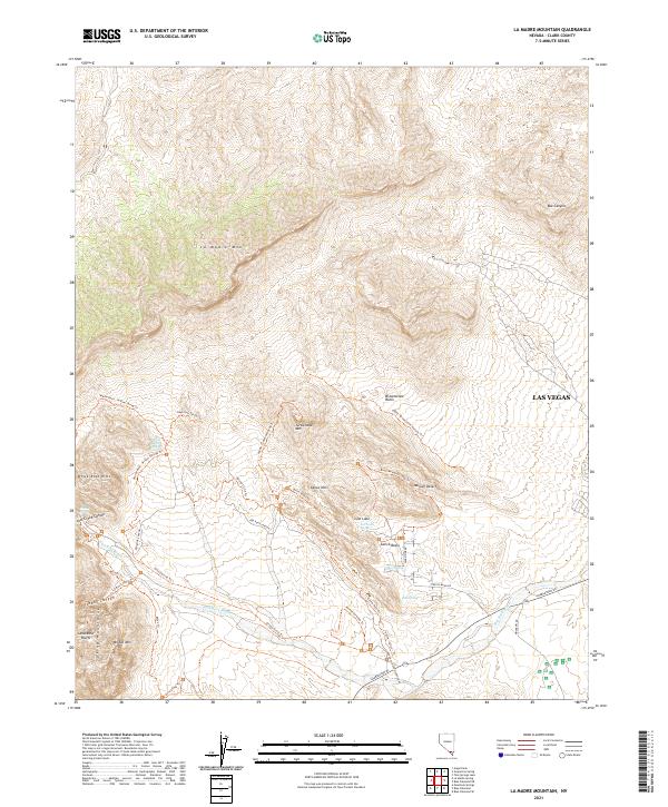
2021 Map of La Madre Mountain
USGS Topo · Published 2021About this map
The Springs Mountains and the massive La Madre Mtn define this transition from the high desert peaks to the western edge of Las Vegas. This map documents a high-traffic recreational landscape within the Mojave Desert, anchored by the Red Rock Canyon corridor. It reveals an intricate network of pathways including the Keystone Thrust Trl and the Grand Circle Trl, which navigate between the striking geological formations of the Calico Hills and the Sandstone Bluffs. Water sources such as White Rock Spring, Ash Creek Spring, and Calico Spring are noted along the drainages of Red Rock Wash. From the Red Rock Visitor Center along Charleston Bl to the steep relief of Bridge Mtn, the map details how this protected area serves as a rugged gateway just miles from urban Nevada.
Find a feature on this map
47 named features on this map. Tap any name to fly to it.
Don’t see what you’re looking for? This feature index may not catch every label — zoom into the map to look around manually.
Map Details
Editions of this 2021 La Madre Mountain Map
This is the sole edition of this map. No revisions or reprints were ever made.
Other maps of this area

1907 · Las Vegas
USGS Topo · 1:250,000

1908 · Las Vegas
USGS Topo · 1:250,000

1952 · Corn Creek Springs
USGS Topo · 1:62,500

1952 · Blue Diamond
USGS Topo · 1:62,500

1954 · Las Vegas
USGS Topo · 1:250,000

1957 · Las Vegas
USGS Topo · 1:250,000

1957 · Charleston Peak
USGS Topo · 1:62,500

1957 · Mountain Springs
USGS Topo · 1:62,500

1959 · Las Vegas
USGS Topo · 1:250,000

1962 · Las Vegas
USGS Topo · 1:250,000