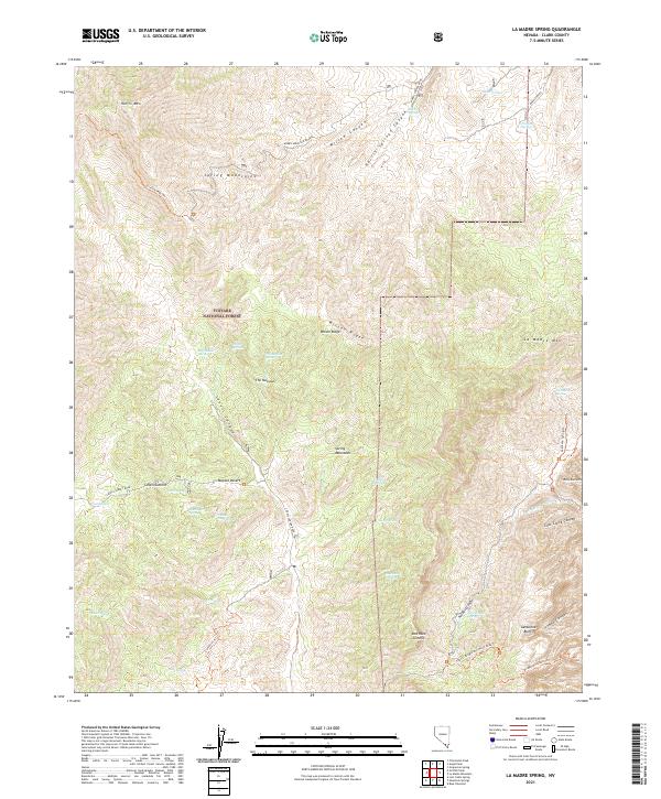
2021 Map of La Madre Spring
USGS Topo · Published 2021About this map
The Spring Mountains dominate this high-desert landscape, where the Toiyabe National Forest provides a backdrop for a complex network of seasonal water sources and trails. This 2021 survey illustrates the transition from the arid floor of the Mojave Desert into the steep drainages of Lovell Canyon and Willow Canyon. The geography is defined by prominent peaks like Harris Mtn and La Madre Mtn, connected by remote corridors such as Harris Mountain Road.
Find a feature on this map
51 named features on this map. Tap any name to fly to it.
Don’t see what you’re looking for? This feature index may not catch every label — zoom into the map to look around manually.
Map Details
Editions of this 2021 La Madre Spring Map
This is the sole edition of this map. No revisions or reprints were ever made.
Other maps of this area

1907 · Las Vegas
USGS Topo · 1:250,000

1908 · Las Vegas
USGS Topo · 1:250,000

1952 · Corn Creek Springs
USGS Topo · 1:62,500

1952 · Blue Diamond
USGS Topo · 1:62,500

1954 · Las Vegas
USGS Topo · 1:250,000

1957 · Las Vegas
USGS Topo · 1:250,000

1957 · Charleston Peak
USGS Topo · 1:62,500

1957 · Mountain Springs
USGS Topo · 1:62,500

1959 · Las Vegas
USGS Topo · 1:250,000

1962 · Las Vegas
USGS Topo · 1:250,000