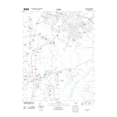
2011 Map of La Plata
USGS Topo · Published 2011About this map
The town of La Plata serves as a southern anchor for this corridor of Charles County, appearing here amidst a landscape of rapidly expanding residential neighborhoods and established crossroads. Historically significant sites for genealogists include Sacred Heart Cemetery and Mount Rest Cemetery near the town center, as well as the Saint Pauls Piney Cemetery further north. The map documents the northern growth of Waldorf and Saint Charles, where suburban development is woven into the natural drainage basins of Old Womans Run and the expansive Zekiah Swamp Run. Between these centers, older named locations such as Beantown and White Plains persist alongside newer tracts like Bannister and Huntington. This period of the early 21st century reflects a transition from rural Maryland tobacco country into a sophisticated suburban network, connected by historical routes like Rosewick Rd.
Find a feature on this map
83 named features on this map. Tap any name to fly to it.
Don’t see what you’re looking for? This feature index may not catch every label — zoom into the map to look around manually.
Map Details
Editions of this 2011 La Plata Map
This is the sole edition of this map. No revisions or reprints were ever made.
Other maps of this area

1889 · Fredericksburg
USGS Topo · 1:125,000

1890 · Mt. Vernon
USGS Topo · 1:125,000

1891 · Mt. Vernon
USGS Topo · 1:125,000

1892 · Fredericksburg
USGS Topo · 1:125,000

1892 · Brandywine
USGS Topo · 1:62,500

1894 · Wicomico
USGS Topo · 1:62,500

1894 · Fredericksburg
USGS Topo · 1:125,000

1894 · Mt. Vernon
USGS Topo · 1:125,000

1895 · Wicomico
USGS Topo · 1:62,500

1895 · Brandywine
USGS Topo · 1:62,500