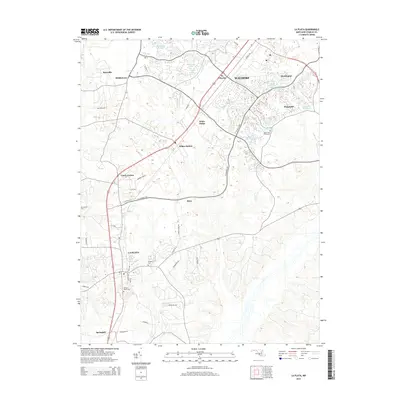
2014 Map of La Plata
USGS Topo · Published 2014About this map
La Plata serves as a primary hub in this portion of Charles County, showcasing a landscape of established residential streets like Kent Ave and Oak Ave. The town is anchored by significant community landmarks, including Mt Rest Cem and Sacred Heart Cem, which offer essential points of interest for genealogical research. To the north, the corridor toward Waldorf reveals a pattern of suburban growth, with several named residential developments such as Wakefield and Huntington emerging alongside local water bodies like Wakefield Lake and Lambeth Hill Lake.
Find a feature on this map
45 named features on this map. Tap any name to fly to it.
Don’t see what you’re looking for? This feature index may not catch every label — zoom into the map to look around manually.
Map Details
Editions of this 2014 La Plata Map
This is the sole edition of this map. No revisions or reprints were ever made.
Other maps of this area

1889 · Fredericksburg
USGS Topo · 1:125,000

1890 · Mt. Vernon
USGS Topo · 1:125,000

1891 · Mt. Vernon
USGS Topo · 1:125,000

1892 · Fredericksburg
USGS Topo · 1:125,000

1892 · Brandywine
USGS Topo · 1:62,500

1894 · Wicomico
USGS Topo · 1:62,500

1894 · Fredericksburg
USGS Topo · 1:125,000

1894 · Mt. Vernon
USGS Topo · 1:125,000

1895 · Wicomico
USGS Topo · 1:62,500

1895 · Brandywine
USGS Topo · 1:62,500