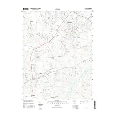
2016 Map of La Plata
USGS Topo · Published 2016About this map
La Plata serves as a central hub on this contemporary record of Charles County, where urban development meets the significant natural hydrology of the region. The landscape is defined by the transition from the densely settled corridors of Waldorf and Saint Charles down toward the expansive Zekiah Swamp. This area preserves several traditional burial sites, including Sacred Heart Cem and Mount Rest Cem, which remain as historical anchors amidst modern residential growth. To the east, the sprawling Zekiah Swamp Run and Jordan Swamp dominate the lowlands, illustrating the persistent environmental character of the Maryland coastal plain. The map also captures smaller communities like White Plains, Brice, and Springhill, connected by a network of established roads and contemporary developments such as those surrounding Post Office Lake and Wakefield Lake.
Find a feature on this map
186 named features on this map. Tap any name to fly to it.
Don’t see what you’re looking for? This feature index may not catch every label — zoom into the map to look around manually.
Map Details
Editions of this 2016 La Plata Map
This is the sole edition of this map. No revisions or reprints were ever made.
Other maps of this area

1889 · Fredericksburg
USGS Topo · 1:125,000

1890 · Mt. Vernon
USGS Topo · 1:125,000

1891 · Mt. Vernon
USGS Topo · 1:125,000

1892 · Fredericksburg
USGS Topo · 1:125,000

1892 · Brandywine
USGS Topo · 1:62,500

1894 · Wicomico
USGS Topo · 1:62,500

1894 · Fredericksburg
USGS Topo · 1:125,000

1894 · Mt. Vernon
USGS Topo · 1:125,000

1895 · Wicomico
USGS Topo · 1:62,500

1895 · Brandywine
USGS Topo · 1:62,500