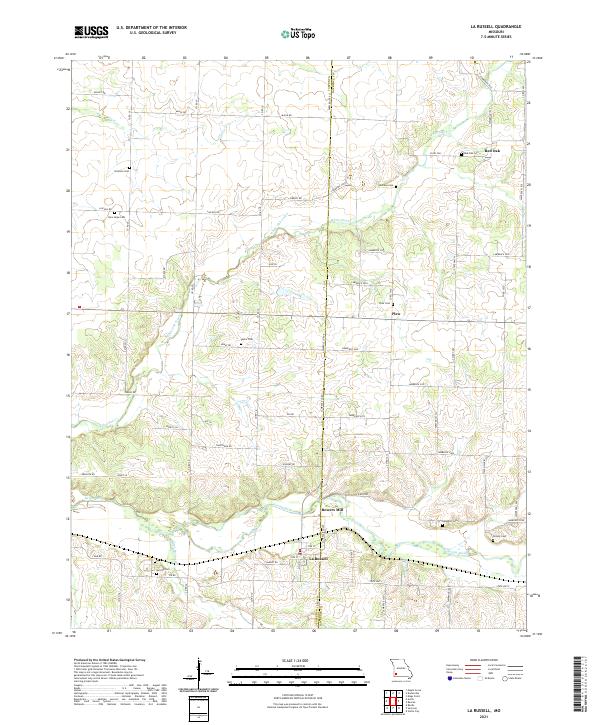
2021 Map of La Russell
USGS Topo · Published 2021About this map
La Russell and Bowers Mill sit along the winding course of the Spring River near the border of Jasper Co and Lawrence Co. This rural landscape is defined by its small crossroads settlements and numerous family and community burial grounds, reflecting generations of Missouri farm life. To the north, the small cluster of Red Oak remains a notable landmark along with Plew, while the terrain is drained by several branches including White Oak Creek and Dry Fork. The map provides a contemporary record of the local road network, showing how modern corridors like State HWY YY connect these longstanding hamlets. Genealogists will find the density of named burial sites particularly useful, ranging from Stemons Cem in the northwest to Gillock Cem near the eastern margin.
Find a feature on this map
69 named features on this map. Tap any name to fly to it.
Don’t see what you’re looking for? This feature index may not catch every label — zoom into the map to look around manually.
Map Details
Editions of this 2021 La Russell Map
This is the sole edition of this map. No revisions or reprints were ever made.
Other maps of this area

1886 · Greenfield
USGS Topo · 1:125,000

1886 · Carthage
USGS Topo · 1:125,000

1888 · Greenfield
USGS Topo · 1:125,000

1894 · Carthage
USGS Topo · 1:125,000

1921 · Stotts City
USGS Topo · 1:62,500

1921 · Sarcoxie
USGS Topo · 1:62,500

1947 · Joplin
USGS Topo · 1:250,000

1949 · Joplin
USGS Topo · 1:250,000

1954 · Springfield
USGS Topo · 1:250,000

1954 · Joplin
USGS Topo · 1:250,000