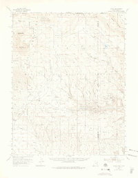
1974 Map of La Sal
USGS Topo · Published 1975About this map
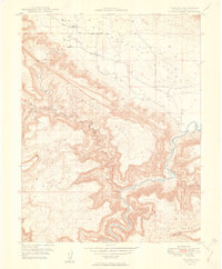
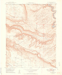
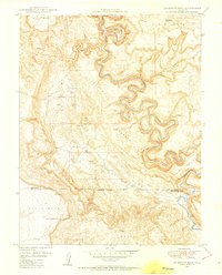
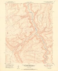
Old La Sal and the La Sal Guard Sta anchor the high-altitude landscape of the Manti-La Sal National Forest, where the topography transitions from the dramatic peaks of Mt Peale and Mt Mellenthin down to the complex canyon systems of Dark Canyon and Trinity Canyon. The map records a significant mid-century mining landscape along the Utah-Colorado border, particularly focused on uranium and vanadium extraction. Numerous operations such as the Vanadium Queen Mine, Uranium Girl Mine, and Gray Dawn Mine are clustered near Lion Creek and Wray Mesa Mine. This density of named claims suggests a period of intense prospecting and development in the eastern portion of the quadrangle. Water management is evident through a network of high-country reservoirs and springs, including Buckeye Res and Blue Lake, supporting both the local ranching at Pine Lodge Ranch and the industrial needs of the surrounding mines.
Find a feature on this map
80 named features on this map. Tap any name to fly to it.
Don’t see what you’re looking for? This feature index may not catch every label — zoom into the map to look around manually.
Map Details
Editions of this 1974 La Sal Map
This is the sole edition of this map. No revisions or reprints were ever made.
Other maps of this area

1885 · La Sal
USGS Topo · 1:250,000

1916 · Paradox Valley
USGS Topo · 1:125,000

1922 · Paradox Valley
USGS Topo · 1:125,000

1948 · Roc Creek
USGS Topo · 1:24,000

1948 · Paradox
USGS Topo · 1:24,000
1949 · Paradox
USGS Topo · 1:24,000
1949 · Roc Creek
USGS Topo · 1:24,000

1949 · Juanita Arch
USGS Topo · 1:24,000
1949 · Anderson Mesa
USGS Topo · 1:24,000
1950 · Juanita Arch
USGS Topo · 1:24,000