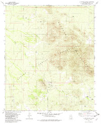
1979 Map of La Tortuga Butte
USGS Topo · Published 1982About this map
The Roskruge Mountains dominate this landscape within the Papago Indian Reservation during the late 1970s. The terrain is defined by its arid water management features, including several named tanks and wells such as Indio Tank, White Tank, and La Tortuga Well, which were essential for sustaining life and livestock in this environment. The presence of Graves near the base of La Tortuga Butte offers a quiet, grounded connection to the people who once traversed these slopes.
Find a feature on this map
20 named features on this map. Tap any name to fly to it.
Don’t see what you’re looking for? This feature index may not catch every label — zoom into the map to look around manually.
Map Details
Editions of this 1979 La Tortuga Butte Map
2 editions found
Other maps of this area

1934 · Tucson Mountains
USGS Topo · 1:125,000

1934 · Silver Bell
USGS Topo · 1:125,000

1938 · San Vicente
USGS Topo · 1:62,500

1941 · San Vicente
USGS Topo · 1:62,500

1941 · Cocoraque Butte
USGS Topo · 1:62,500

1942 · San Vicente
USGS Topo · 1:62,500

1943 · Cocoraque Butte
USGS Topo · 1:62,500

1948 · San Vicente
USGS Topo · 1:62,500

1956 · Tucson
USGS Topo · 1:250,000

1958 · Tucson
USGS Topo · 1:250,000