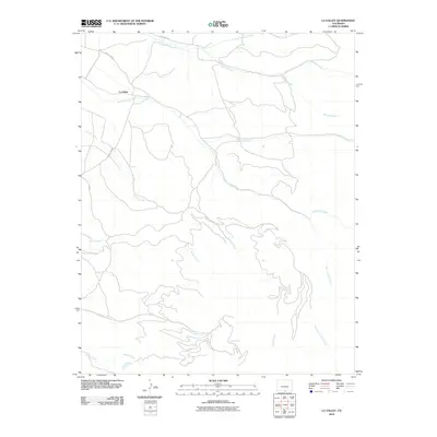
2010 Map of La Valley
USGS Topo · Published 2010About this map
La Valley serves as the primary settlement node in this drainage-rich landscape of southern Costilla County. The terrain is defined by a dense network of watercourses flowing toward the southwest, including Vallejos Creek, San Francisco Creek, and Alamosito Creek. The presence of the Sanchez Canal in the northwest corner highlights the importance of water management and irrigation to the local agriculture in this high-altitude environment. Local transport is facilitated by a grid of rural routes such as County Rd 36 and County Rd 33, which connect the scattered homesteads and grazing lands to the larger valley floor. From the northern reaches of North Vallejos Creek to the southern waters of Willow Creek, the map illustrates a landscape where life is closely tied to the seasonal flows of the Sangre de Cristo foothills.
Find a feature on this map
20 named features on this map. Tap any name to fly to it.
Don’t see what you’re looking for? This feature index may not catch every label — zoom into the map to look around manually.
Map Details
Editions of this 2010 La Valley Map
This is the sole edition of this map. No revisions or reprints were ever made.
Other maps of this area

1954 · Raton
USGS Topo · 1:250,000

1954 · Trinidad
USGS Topo · 1:250,000

1955 · Trinidad
USGS Topo · 1:250,000

1958 · Raton
USGS Topo · 1:250,000

1958 · Trinidad
USGS Topo · 1:250,000

1959 · Trinidad
USGS Topo · 1:250,000

1962 · Ash Mountain
USGS Topo · 1:62,500

1963 · Amalia
USGS Topo · 1:24,000

1963 · Big Costilla Peak
USGS Topo · 1:24,000

1967 · San Luis
USGS Topo · 1:24,000