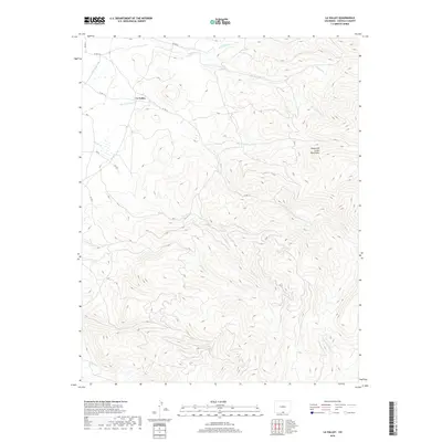
2019 Map of La Valley
USGS Topo · Published 2019About this map
La Valley sits at the base of the Sangre de Cristo Mountains, where the high desert terrain of the San Luis Valley meets the steep rise of the southern Colorado Rockies. This 2019 survey captures a landscape defined by water management and high-altitude drainage. The Sanchez Canal and San Francisco Cr are central to the valley's irrigation, while a network of seasonal and perennial streams like Vallejos Cr, Torcido Cr, and Alamosito Cr carve deep into the mountain slopes. The settlement pattern is sparse, concentrated primarily along the lower reaches of the foothills near established county roads like Co RD J 2. This map details the transition from the relatively flat agricultural lands of the basin to the timbered ridges and canyons of the W Fork Costilla Cr drainage system.
Find a feature on this map
22 named features on this map. Tap any name to fly to it.
Don’t see what you’re looking for? This feature index may not catch every label — zoom into the map to look around manually.
Map Details
Editions of this 2019 La Valley Map
This is the sole edition of this map. No revisions or reprints were ever made.
Other maps of this area

1954 · Raton
USGS Topo · 1:250,000

1954 · Trinidad
USGS Topo · 1:250,000

1955 · Trinidad
USGS Topo · 1:250,000

1958 · Raton
USGS Topo · 1:250,000

1958 · Trinidad
USGS Topo · 1:250,000

1959 · Trinidad
USGS Topo · 1:250,000

1962 · Ash Mountain
USGS Topo · 1:62,500

1963 · Amalia
USGS Topo · 1:24,000

1963 · Big Costilla Peak
USGS Topo · 1:24,000

1967 · San Luis
USGS Topo · 1:24,000