2024 Map of Labadieville
USGS Topo · Published 2024About this map
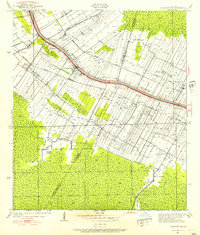
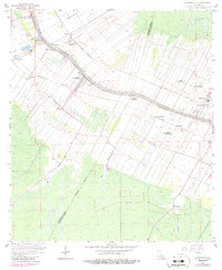
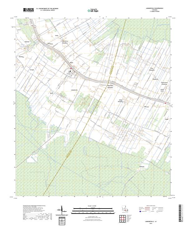
Bayou Lafourche serves as the central artery for this section of Assumption Parish, where long, narrow land tracts extend perpendicularly from the water in a traditional French arpent surveying pattern. This enduring division of the landscape is punctuated by numerous historical estate sites, including Cedar Grove Plantation, Saint Rose Plantation, and White Plantation, reflecting the region’s deep ties to the sugar industry and river-based commerce. The settlement of Labadieville sits at the heart of this network, anchored by the Saint Philomena Cem and surrounded by smaller communities such as Chula, Freetown, and Leche. To the south, the cultivated fields give way to the wetlands of the Lowlands and the winding course of Bayou Boudreaux, while the north features the industrial presence of the Supreme Sugar Pond near Supreme.
Find a feature on this map
89 named features on this map. Tap any name to fly to it.
Don’t see what you’re looking for? This feature index may not catch every label — zoom into the map to look around manually.
Map Details
Editions of this 2024 Labadieville Map
This is the sole edition of this map. No revisions or reprints were ever made.
Historical Maps of Laurel Grove Plantation Through Time
3 maps found