
1938 Map of Lac Du Flambeau
USGS Topo · Published 1959About this map
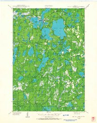
Lac du Flambeau stands as a central hub in this Wisconsin lake country, where the Chicago and Northwestern railroad tracks cross the water-rich landscape of the Flambeau and Minocqua regions. The map illustrates a dense network of glacial lakes including the large Fence Lake and Indian Lake, alongside smaller bodies like Crawling Stone Lake and Flambeau Lake. Beyond the main settlement, the rural infrastructure of the 1930s is visible in features like the Marlands Sch and the Flambeau Fire Tower located near Marlands. Large tracts of protected land are defined by the boundaries of the Northern Highland State Forest and the Chequamegon National Forest. The presence of the Mishonagon Swamp and numerous named bogs indicates the wet, low-lying nature of the terrain between the Vilas, Oneida, and Iron County lines.
Find a feature on this map
102 named features on this map. Tap any name to fly to it.
Don’t see what you’re looking for? This feature index may not catch every label — zoom into the map to look around manually.
Map Details
Editions of this 1938 Lac Du Flambeau Map
2 editions found
Other maps of this area

1938 · Minocqua
USGS Topo · 1:48,000

1939 · Trout Lake
USGS Topo · 1:48,000

1939 · Lac Du Flambeau
USGS Topo · 1:48,000

1939 · Mc Cord
USGS Topo · 1:48,000

1939 · Winchester
USGS Topo · 1:48,000

1939 · Cassian
USGS Topo · 1:48,000

1940 · Mercer
USGS Topo · 1:48,000

1941 · Pike Lake
USGS Topo · 1:48,000

1941 · Brantwood
USGS Topo · 1:48,000

1942 · Pike Lake
USGS Topo · 1:48,000