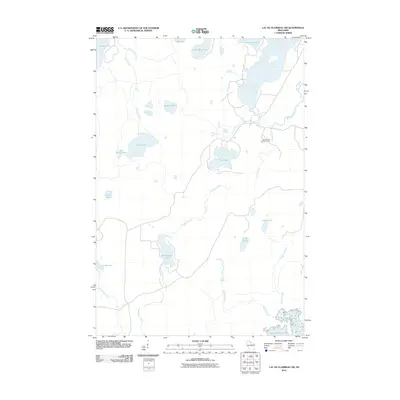
2010 Map of Lac du Flambeau SW
USGS Topo · Published 2010About this map
Willow Reservoir and its complex shoreline dominate the southeastern corner of this Northwoods landscape, where a dense network of water bodies and streams dictates the local geography. The presence of the Squirrel Hill Lookout Tower near Yukon Creek indicates the importance of fire observation over these vast wooded tracts. This area is defined by its extensive drainage systems, with the Squirrel River and McGrass Creek weaving between numerous named lakes such as Stone Lake, Pine Lake, and Swamsauger Lake. The map reveals a region primarily shaped by its natural hydrography rather than dense urban settlement, reflecting the persistent character of northern Wisconsin's lake country. Navigable waterways like Langley Creek and Buckskin Creek connect these isolated basins, providing a clear record of the area's aquatic connectivity before more modern development altered such drainage patterns.
Find a feature on this map
24 named features on this map. Tap any name to fly to it.
Don’t see what you’re looking for? This feature index may not catch every label — zoom into the map to look around manually.
Map Details
Editions of this 2010 Lac du Flambeau SW Map
This is the sole edition of this map. No revisions or reprints were ever made.
Other maps of this area

1938 · Lac Du Flambeau
USGS Topo · 1:48,000

1939 · Lac Du Flambeau
USGS Topo · 1:48,000

1939 · Mc Cord
USGS Topo · 1:48,000

1941 · Pike Lake
USGS Topo · 1:48,000

1941 · Brantwood
USGS Topo · 1:48,000

1942 · Pike Lake
USGS Topo · 1:48,000

1943 · Brantwood
USGS Topo · 1:48,000

1946 · Lac Du Flambeau
USGS Topo · 1:48,000

1947 · Mc Cord
USGS Topo · 1:48,000

1950 · Pike Lake
USGS Topo · 1:48,000