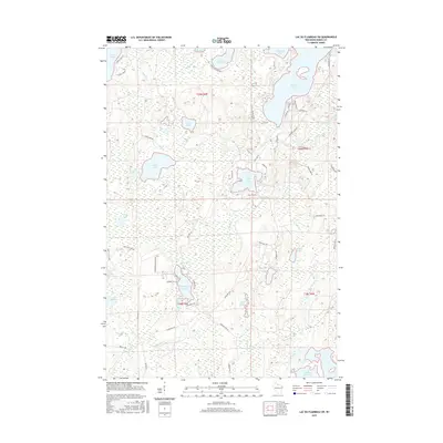
2015 Map of Lac du Flambeau SW
USGS Topo · Published 2015About this map
Squirrel Lake and the northern reaches of the Willow Reservoir define the hydrography of this Northwoods landscape. The drainage patterns are intricate, with Swamsauger Creek and Spring Creek connecting a dense network of glacial water bodies like Stone Lake, Pine Lake, and Great Bass Lake. The terrain is marked by a complex system of fire lanes and forest roads, including the Kennedy Fire Lane and Moran Fire Lane, which provide access to the wetlands and springs that dominate the central sections. Notable landmarks like Camp Fifteen Springs and Swamsauger Lake offer specific points of interest for researchers studying the environmental history and land-use patterns of the region. The presence of numbered water bodies, such as Lake Sixteen, alongside family-named roads like Manhardt Road and Frautshi Road, reflects the area's development through both public land management and private recreational use.
Find a feature on this map
58 named features on this map. Tap any name to fly to it.
Don’t see what you’re looking for? This feature index may not catch every label — zoom into the map to look around manually.
Map Details
Editions of this 2015 Lac du Flambeau SW Map
This is the sole edition of this map. No revisions or reprints were ever made.
Other maps of this area

1938 · Lac Du Flambeau
USGS Topo · 1:48,000

1939 · Lac Du Flambeau
USGS Topo · 1:48,000

1939 · Mc Cord
USGS Topo · 1:48,000

1941 · Pike Lake
USGS Topo · 1:48,000

1941 · Brantwood
USGS Topo · 1:48,000

1942 · Pike Lake
USGS Topo · 1:48,000

1943 · Brantwood
USGS Topo · 1:48,000

1946 · Lac Du Flambeau
USGS Topo · 1:48,000

1947 · Mc Cord
USGS Topo · 1:48,000

1950 · Pike Lake
USGS Topo · 1:48,000