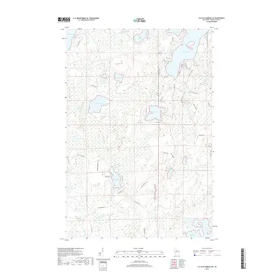
2018 Map of Lac du Flambeau SW
USGS Topo · Published 2018About this map
Willow Reservoir anchors the southeastern corner of this Northwoods landscape, where a dense network of water bodies and fire lanes defines the geography of Oneida County. The map captures a transition between large recreational lakes and significant wetland drainage systems, including the headwaters of the Squirrel River and Swamsauger Cr. Notable for its many family-named roads and remote access points, the area features prominent landmarks like Stone Lake and the isolated Camp Fifteen Springs. The presence of several named fire lanes, such as Kennedy Fire Ln and Moran Fire Ln, suggests a managed forest environment where logging history and fire protection are integral to the land's layout. Collectors and local historians can trace the specific shorelines of Swamsauger Lake and Squirrel Lake as they appeared in 2018.
Find a feature on this map
57 named features on this map. Tap any name to fly to it.
Don’t see what you’re looking for? This feature index may not catch every label — zoom into the map to look around manually.
Map Details
Editions of this 2018 Lac du Flambeau SW Map
This is the sole edition of this map. No revisions or reprints were ever made.
Other maps of this area

1938 · Lac Du Flambeau
USGS Topo · 1:48,000

1939 · Lac Du Flambeau
USGS Topo · 1:48,000

1939 · Mc Cord
USGS Topo · 1:48,000

1941 · Pike Lake
USGS Topo · 1:48,000

1941 · Brantwood
USGS Topo · 1:48,000

1942 · Pike Lake
USGS Topo · 1:48,000

1943 · Brantwood
USGS Topo · 1:48,000

1946 · Lac Du Flambeau
USGS Topo · 1:48,000

1947 · Mc Cord
USGS Topo · 1:48,000

1950 · Pike Lake
USGS Topo · 1:48,000