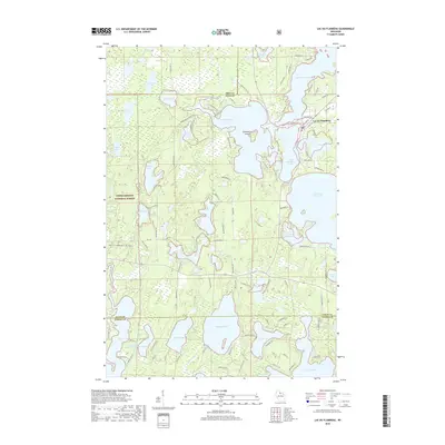
2018 Map of Lac du Flambeau
USGS Topo · Published 2018About this map
Strawberry Island and the Lac du Flambeau settlement anchor this landscape of interconnected waterways and timberlands within the Chequamegon National Forest. The geography is defined by a dense concentration of glacial lakes, including the large Flambeau Lake, Crawling Stone Lake, and Pokegama Lake, which are linked by the Bear River. This map illustrates the intersection of traditional land use and modern conservation, featuring numerous tribal and local roads like Old Pow-Wow Trl and N Indian Village Rd.
Find a feature on this map
108 named features on this map. Tap any name to fly to it.
Don’t see what you’re looking for? This feature index may not catch every label — zoom into the map to look around manually.
Map Details
Editions of this 2018 Lac du Flambeau Map
This is the sole edition of this map. No revisions or reprints were ever made.
Other maps of this area

1938 · Lac Du Flambeau
USGS Topo · 1:48,000

1939 · Lac Du Flambeau
USGS Topo · 1:48,000

1939 · Winchester
USGS Topo · 1:48,000

1940 · Mercer
USGS Topo · 1:48,000

1941 · Pike Lake
USGS Topo · 1:48,000

1942 · Pike Lake
USGS Topo · 1:48,000

1945 · Mercer
USGS Topo · 1:48,000

1946 · Winchester
USGS Topo · 1:48,000

1946 · Lac Du Flambeau
USGS Topo · 1:48,000

1947 · Mercer
USGS Topo · 1:48,000