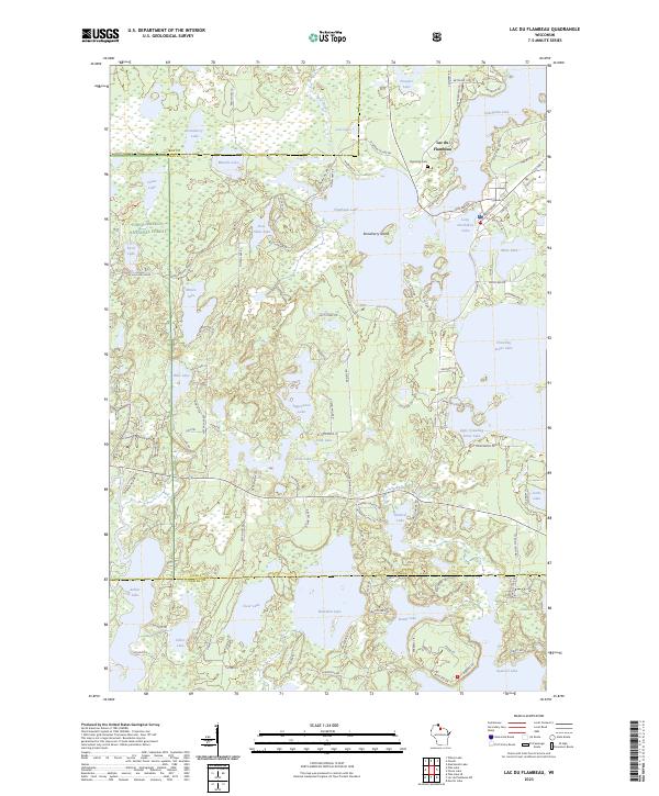
2023 Map of Lac du Flambeau
USGS Topo · Published 2023About this map
Lac du Flambeau serves as the focal point for this lake-dominated landscape, situated where Pokegama Lake and Long Interlaken Lake meet. The geography is defined by a dense network of glacial water bodies, including Flambeau Lake and Crawling Stone Lake, which have shaped the settlement patterns and local transportation routes. Historic transit is marked by paths like the Chequamegon Forest Tr and Indian Hwy 34, reflecting the area's deep connection to both the surrounding timberlands and the tribal territory.
Find a feature on this map
113 named features on this map. Tap any name to fly to it.
Don’t see what you’re looking for? This feature index may not catch every label — zoom into the map to look around manually.
Map Details
Editions of this 2023 Lac du Flambeau Map
This is the sole edition of this map. No revisions or reprints were ever made.
Other maps of this area

1938 · Lac Du Flambeau
USGS Topo · 1:48,000

1939 · Lac Du Flambeau
USGS Topo · 1:48,000

1939 · Winchester
USGS Topo · 1:48,000

1940 · Mercer
USGS Topo · 1:48,000

1941 · Pike Lake
USGS Topo · 1:48,000

1942 · Pike Lake
USGS Topo · 1:48,000

1945 · Mercer
USGS Topo · 1:48,000

1946 · Winchester
USGS Topo · 1:48,000

1946 · Lac Du Flambeau
USGS Topo · 1:48,000

1947 · Mercer
USGS Topo · 1:48,000