
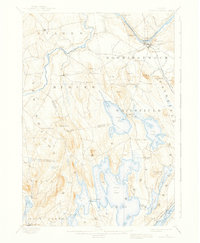
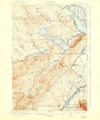
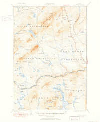
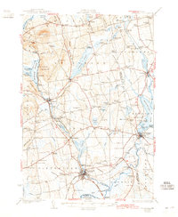
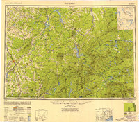
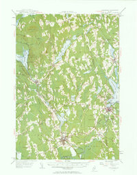
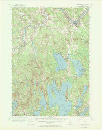
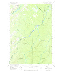
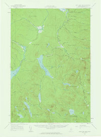
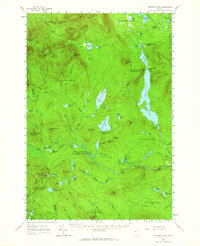
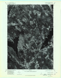
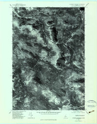
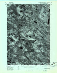
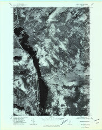
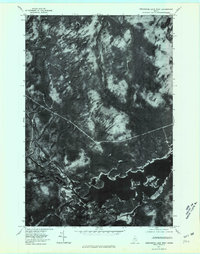
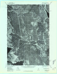
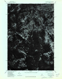
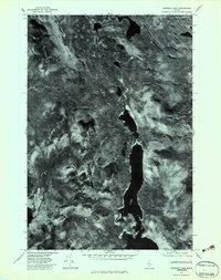
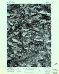
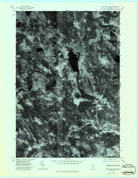
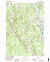
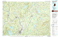
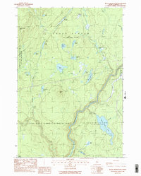
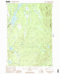
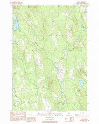
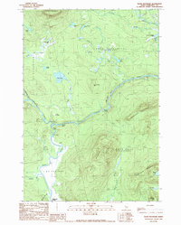
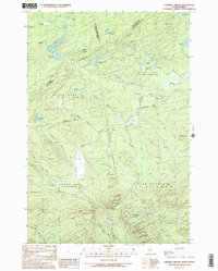
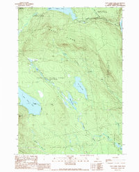
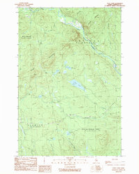
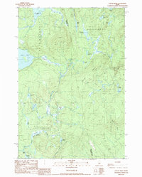
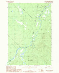
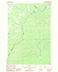
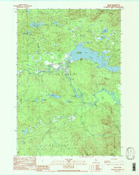
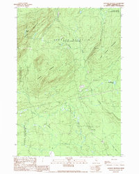
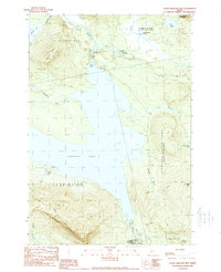
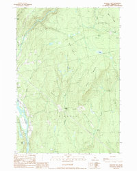
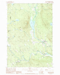
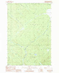
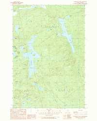
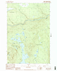
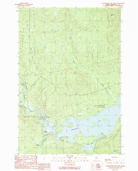
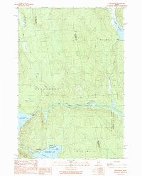
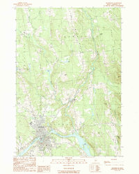
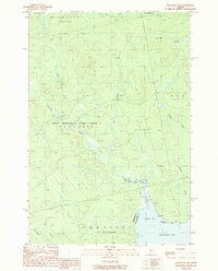
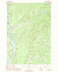
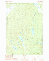
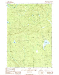
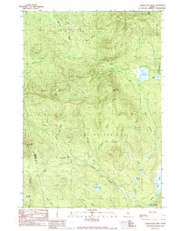
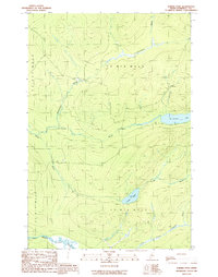
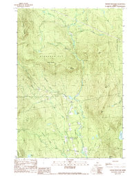
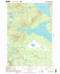
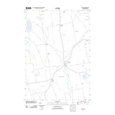
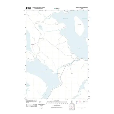
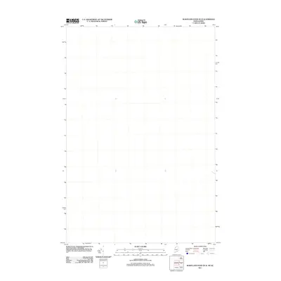
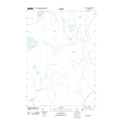
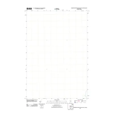
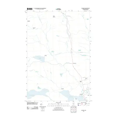
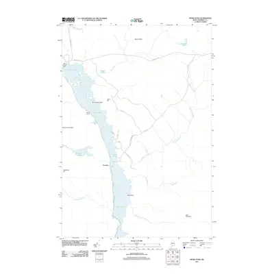
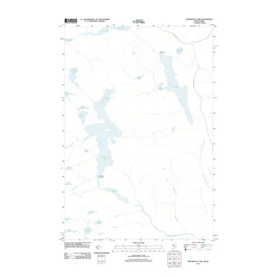
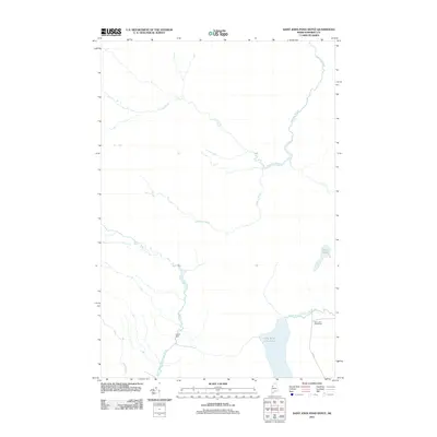
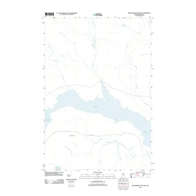
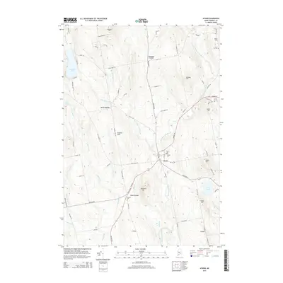
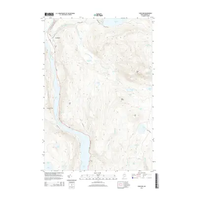
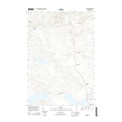
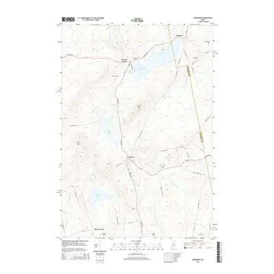
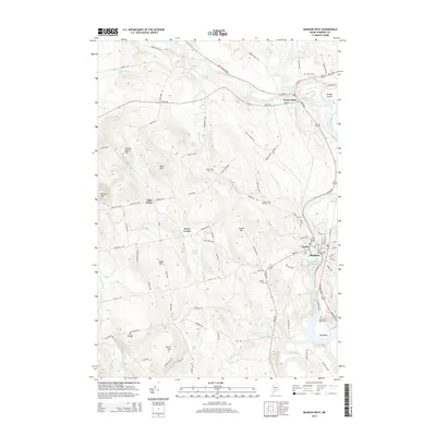
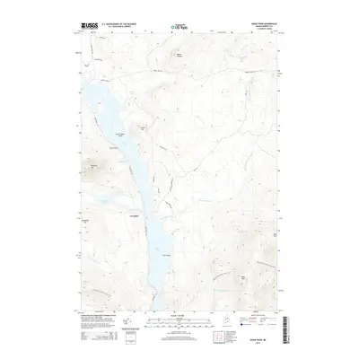
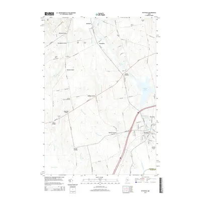
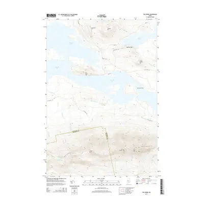
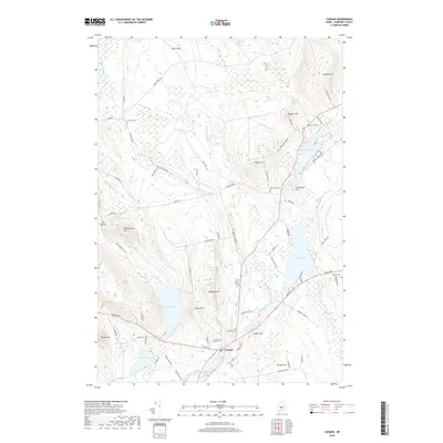
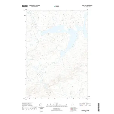
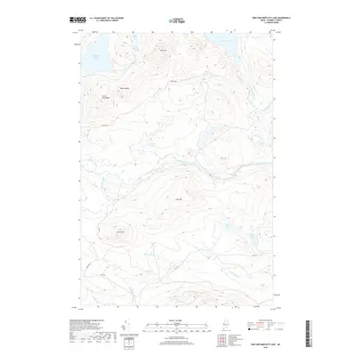
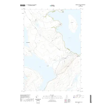
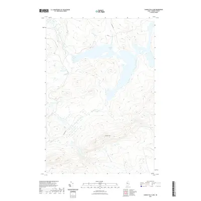
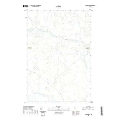
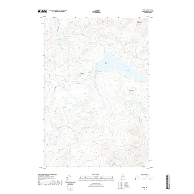
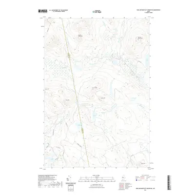
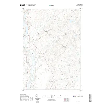
1993 Map of Lac Etchemin
USGS Topo · Published 1993About this map
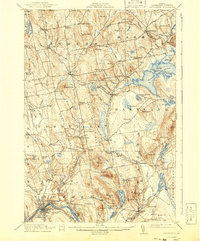
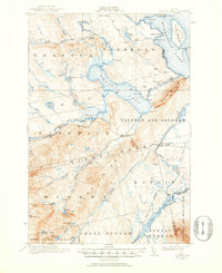
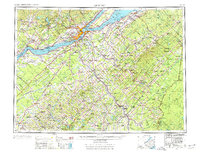
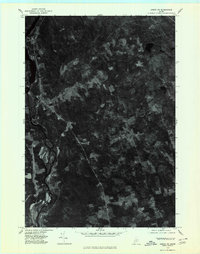
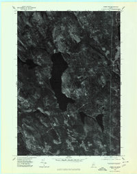
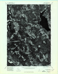
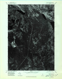
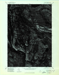
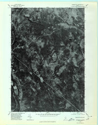
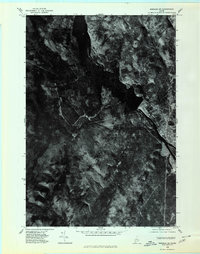
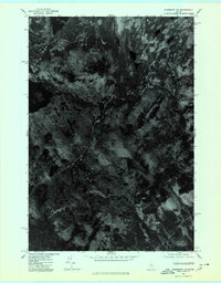
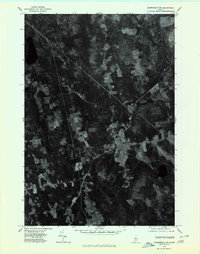
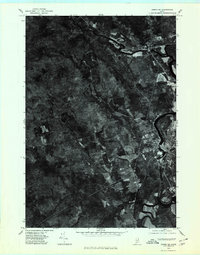
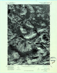
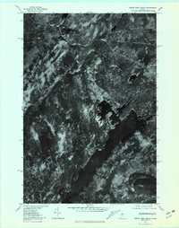
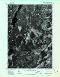
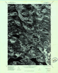
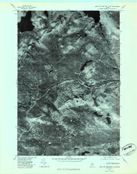
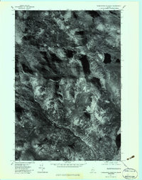
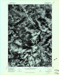
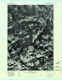
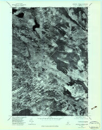
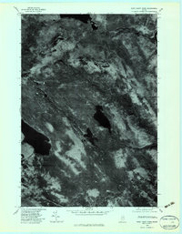
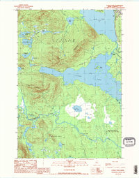
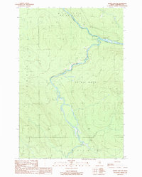
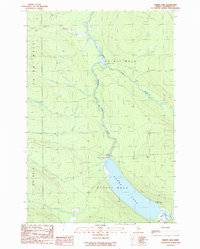
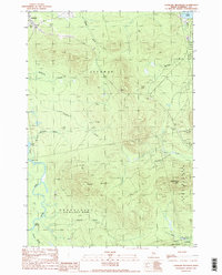
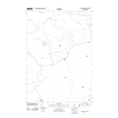
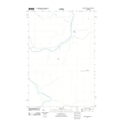
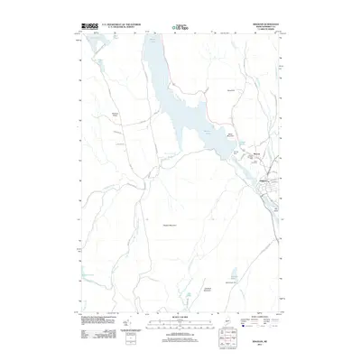
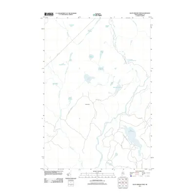
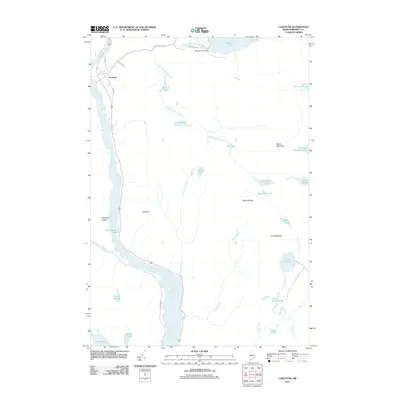
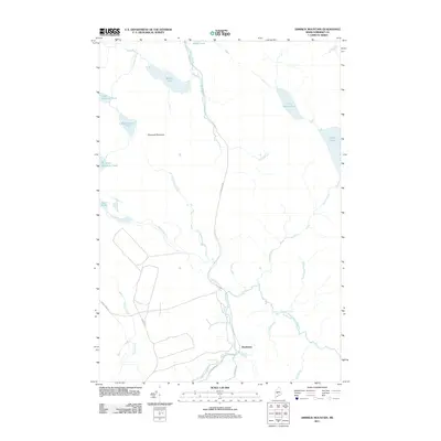
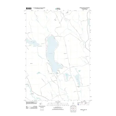
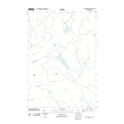
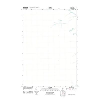
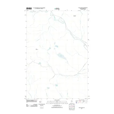
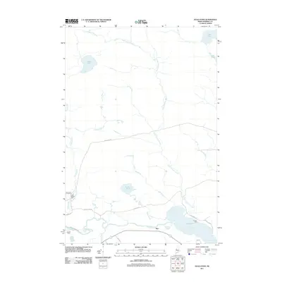
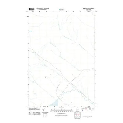
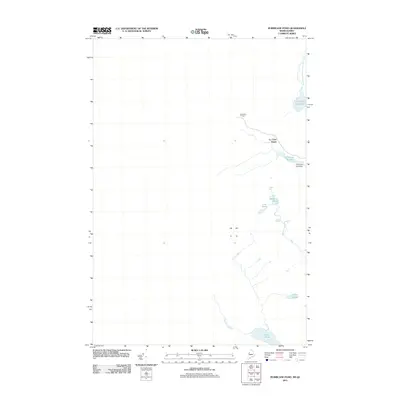
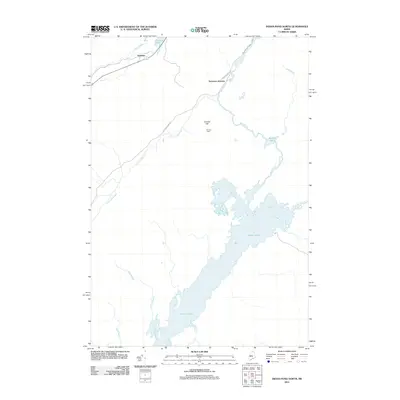
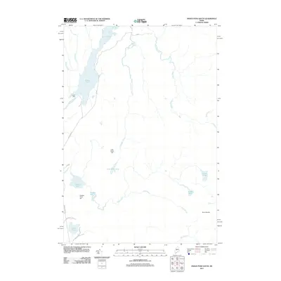
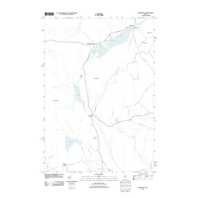
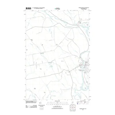
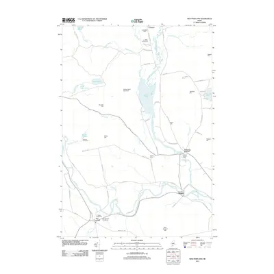
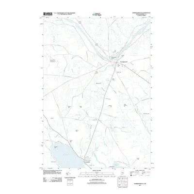
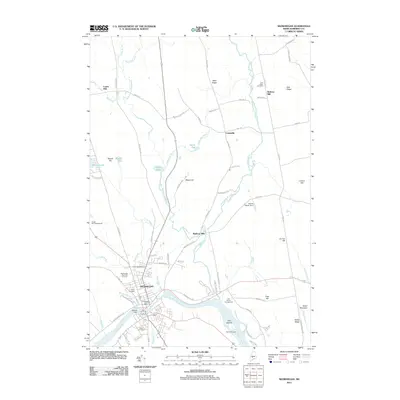
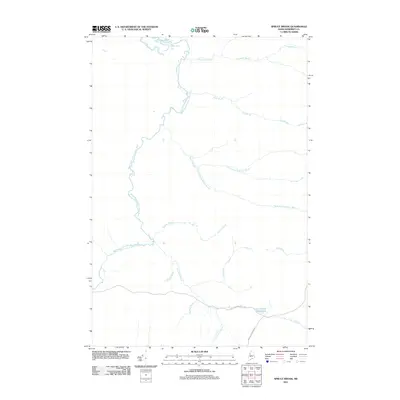
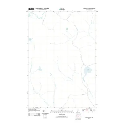
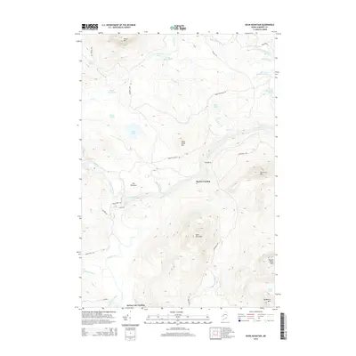
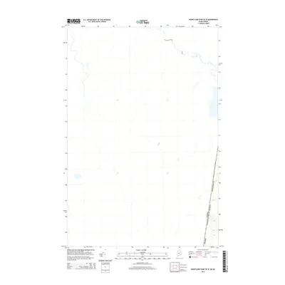
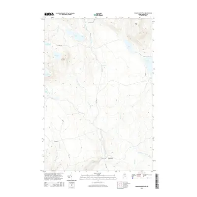
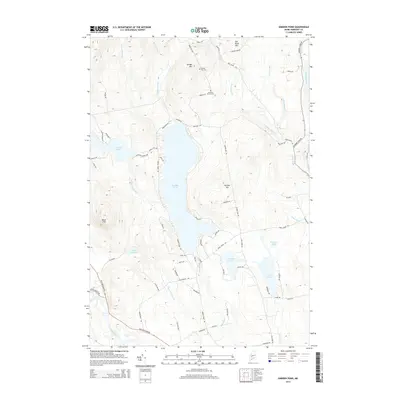
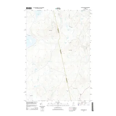
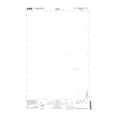
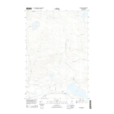
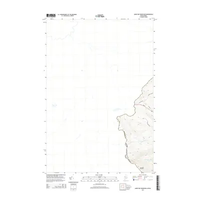
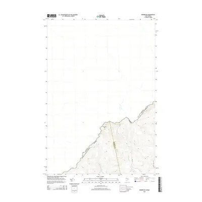
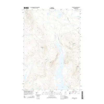
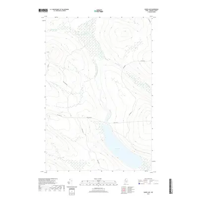
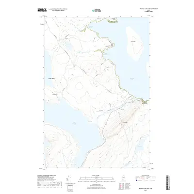
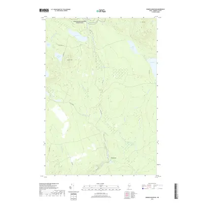
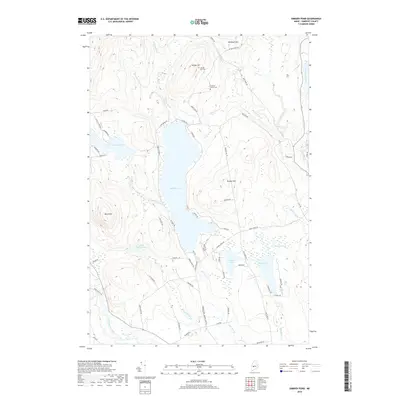
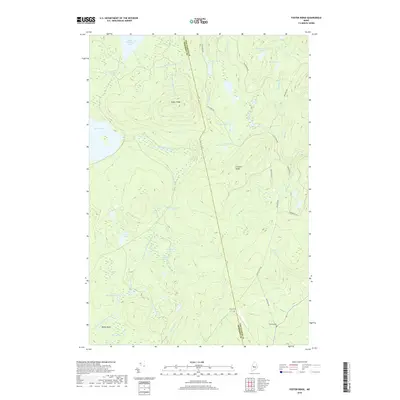
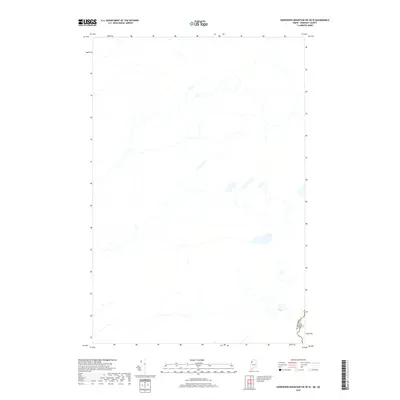
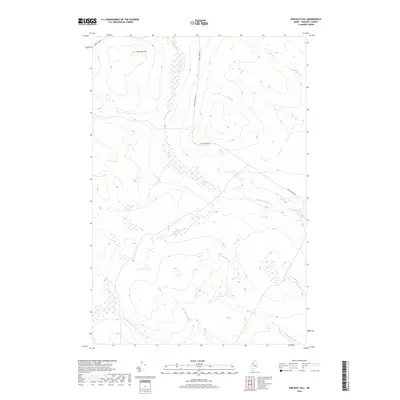
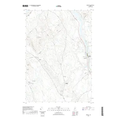
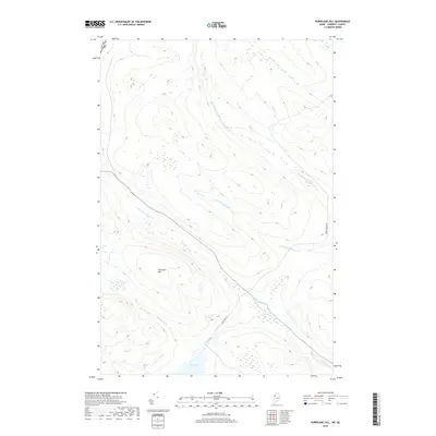
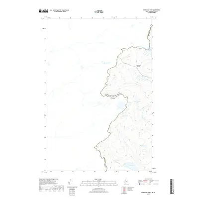
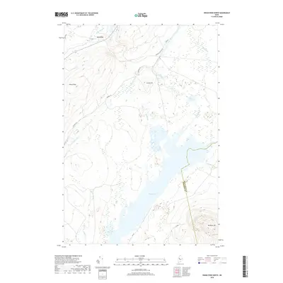
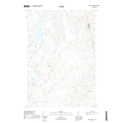
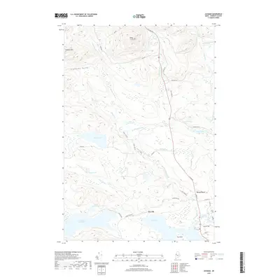
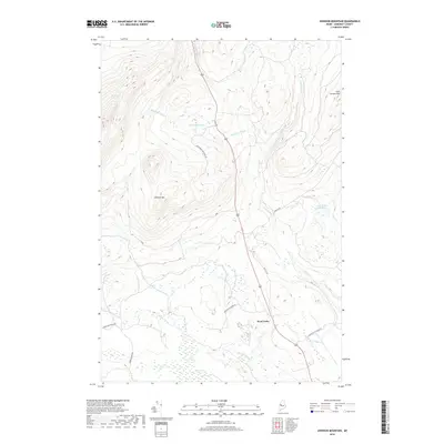
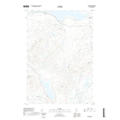
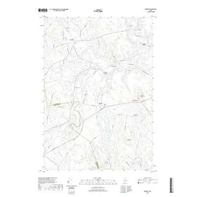
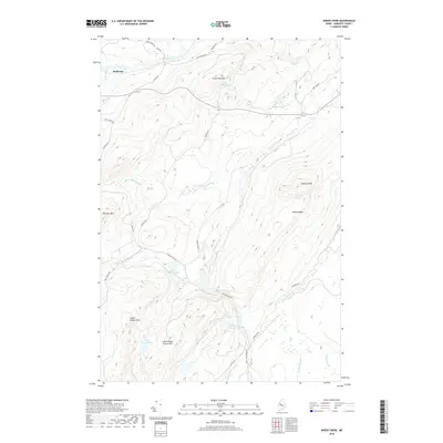
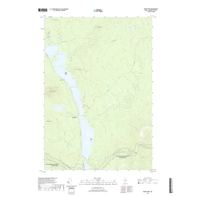
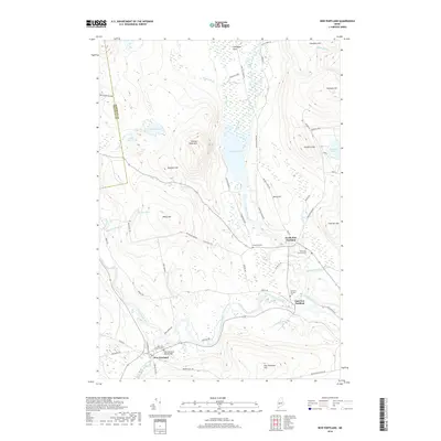
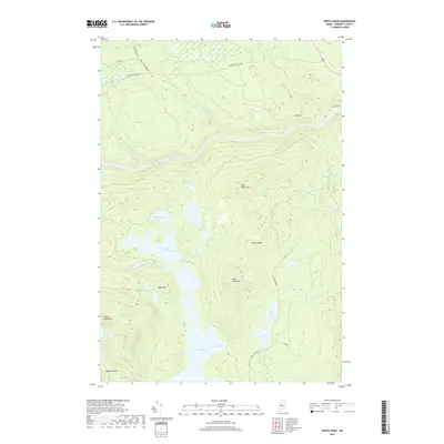
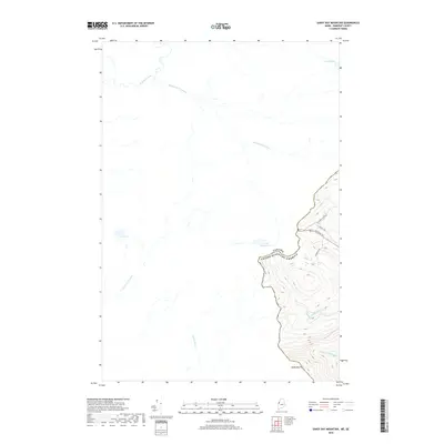
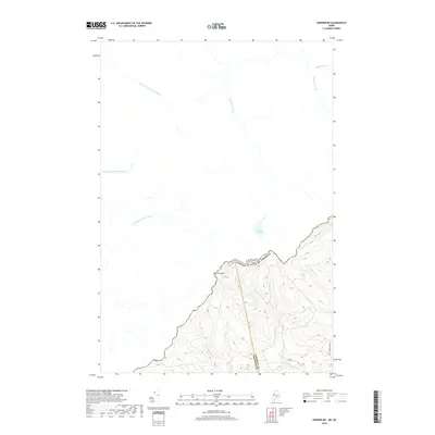
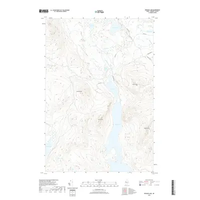
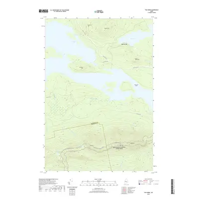
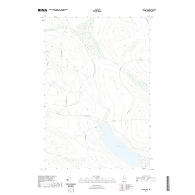
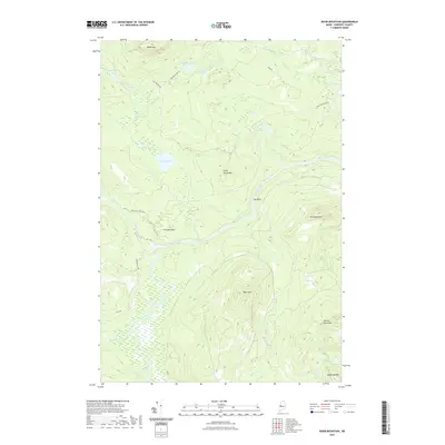
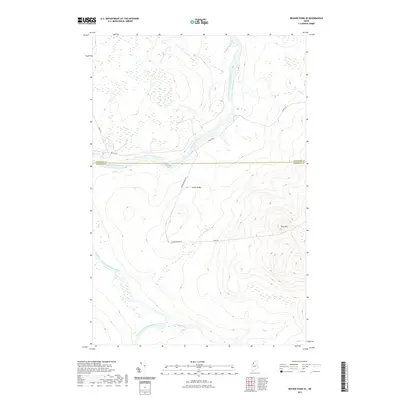
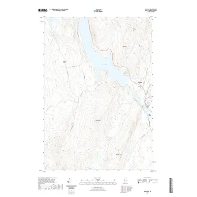
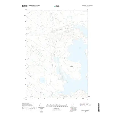
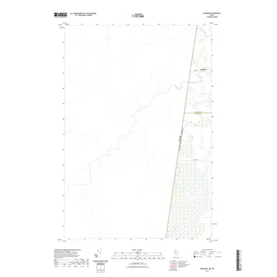
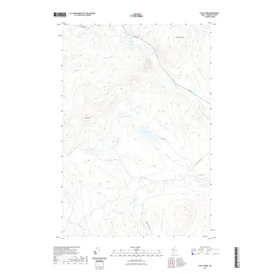
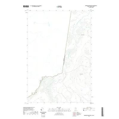
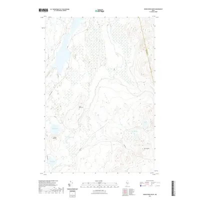
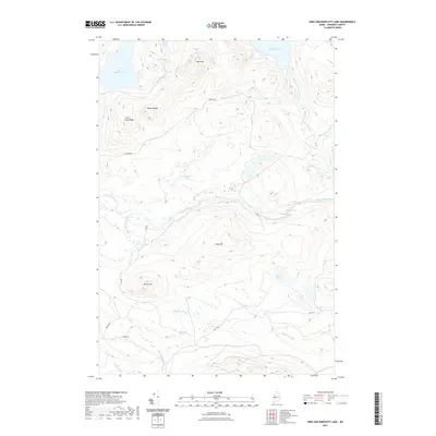
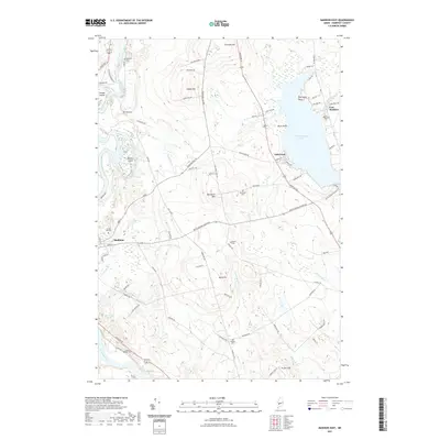
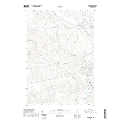
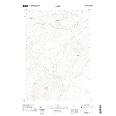
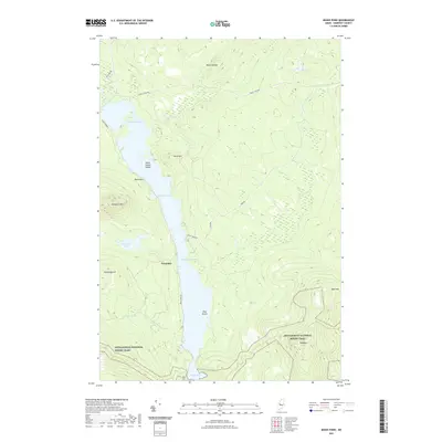
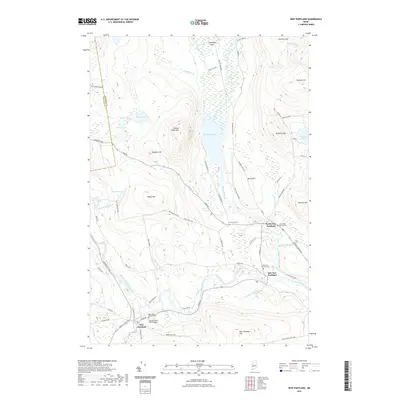
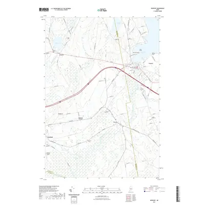
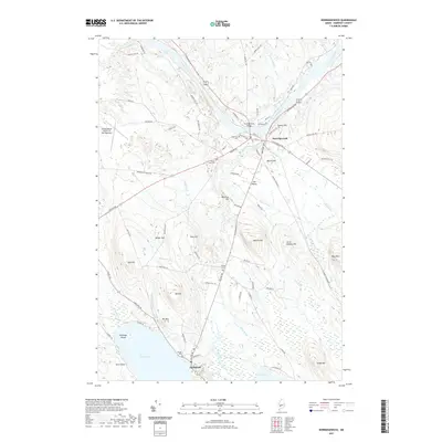
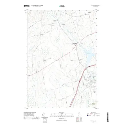
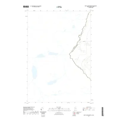
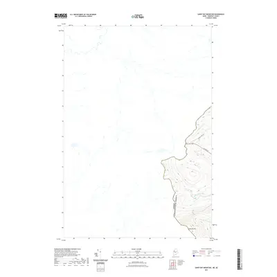
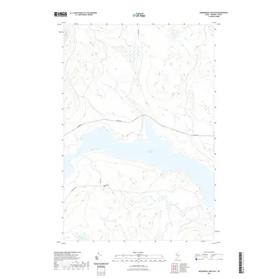
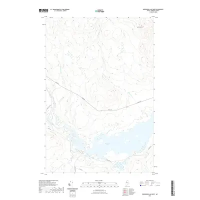
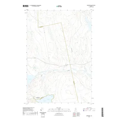
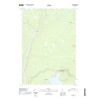
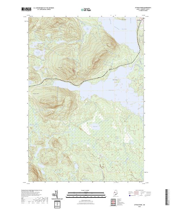
Monts Notre Dame dominate the northwestern portion of this international survey, providing a backdrop for the dense network of settlements along the Riviere Chaudiere. In the early 1990s, the region was characterized by its transnational connections, centered on the Port of Entry that links Maine and Canada. The map illustrates a stark contrast between the industrial and agricultural clusters of the Chaudiere Valley, including Beauceville and Saint-Georges, and the vast, unorganized timberlands of Somerset County to the southeast. Remote water bodies such as Hurricane Pond and Dole Pond serve as headwaters for the complex drainage systems of the Saint John River Southwest Branch and the North Branch of the Penobscot River. This survey captures the borderland at a time when traditional water-based transport routes had long been replaced by a system of primary and secondary roads connecting isolated towns like Saint-Magloire and Sainte-Justine to the larger centers of the Beauce region.
Find a feature on this map
47 named features on this map. Tap any name to fly to it.
Don’t see what you’re looking for? This feature index may not catch every label — zoom into the map to look around manually.
Map Details
Editions of this 1993 Lac Etchemin Map
This is the sole edition of this map. No revisions or reprints were ever made.
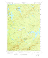
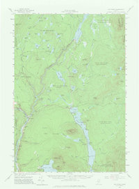
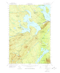
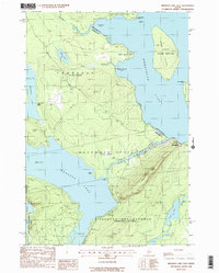
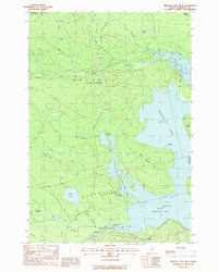
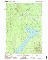
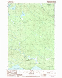
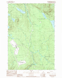
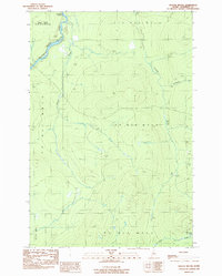
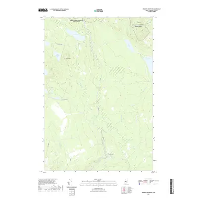
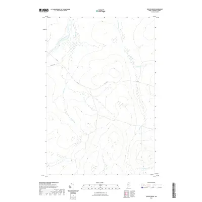
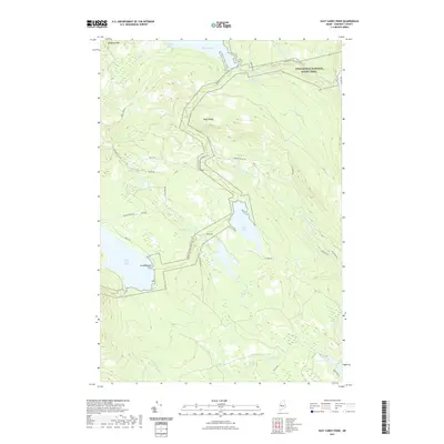
Historical Maps of Somerset County Through Time
635 maps found

1894 Norridgewock
Somerset County, ME
1898 Norridgewock
Somerset County, ME

1903 Bingham
Somerset County, ME
1904 Anson
Somerset County, ME
1905 Bingham
Somerset County, ME

1905 The Forks
Somerset County, ME
1907 The Forks
Somerset County, ME
1913 Skowhegan
Somerset County, ME
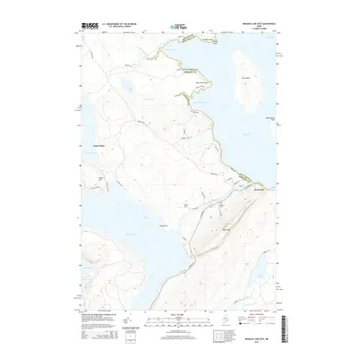
1921 Brassua Lake
Somerset County, ME
1922 Long Pond
Somerset County, ME
1923 Attean
Somerset County, ME
1923 Brassua Lake
Somerset County, ME
1924 Long Pond
Somerset County, ME
1925 Attean
Somerset County, ME
1925 Pierce Pond
Somerset County, ME
1927 Pierce Pond
Somerset County, ME
1927 Sandy Bay
Somerset County, ME

1928 Dead River
Somerset County, ME
1928 Spencer
Somerset County, ME

1930 Pittsfield
Somerset County, ME
1930 Sandy Bay
Somerset County, ME

1931 Dead River
Somerset County, ME
1932 Pittsfield
Somerset County, ME
1932 Spencer
Somerset County, ME

1933 Pittsfield
Somerset County, ME
1943 Norridgewock
Somerset County, ME

1944 Brassua Lake
Somerset County, ME

1944 Dead River
Somerset County, ME

1944 Long Pond
Somerset County, ME

1944 Pierce Pond
Somerset County, ME
1944 Sandy Bay
Somerset County, ME
1949 Jackman
Somerset County, ME

1950 Attean
Somerset County, ME

1950 Dead River
Somerset County, ME

1954 Baker Lake
Somerset County, ME
1954 Seboomook Lake
Somerset County, ME
1954 St. John Pond
Somerset County, ME
1955 Anson
Somerset County, ME
1955 Pittsfield
Somerset County, ME
1955 Skowhegan
Somerset County, ME
1956 Bingham
Somerset County, ME
1956 Little Bigelow Mtn
Somerset County, ME
1956 Norridgewock
Somerset County, ME
1956 Penobscot Lake
Somerset County, ME
1956 The Forks
Somerset County, ME
1957 Brassua Lake
Somerset County, ME
1957 Hardwood Mountain
Somerset County, ME
1957 Norris Brook
Somerset County, ME
1957 St. Zacharie
Somerset County, ME
1958 Pierce Pond
Somerset County, ME
1958 Saint John Pond
Somerset County, ME
1958 Spencer Lake
Somerset County, ME

1962 Baker Lake
Somerset County, ME
1962 Quebec
Somerset County, ME

1963 Jackman
Somerset County, ME

1966 Sherbrooke
Somerset County, ME
1970 Skinner NE
Somerset County, ME
1975 Anson NE
Somerset County, ME
1975 Anson NW
Somerset County, ME
1975 Anson SE
Somerset County, ME
1975 Bingham NE
Somerset County, ME
1975 Bingham NW
Somerset County, ME
1975 Bingham SE
Somerset County, ME
1975 Bingham SW
Somerset County, ME
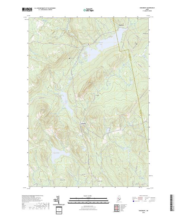
1975 Kingsbury NW
Somerset County, ME
1975 Kingsbury SW
Somerset County, ME
1975 Norridgewock NE
Somerset County, ME
1975 Norridgewock NW
Somerset County, ME
1975 Pittsfield NE
Somerset County, ME
1975 Pittsfield NW
Somerset County, ME
1975 Pittsfield SE
Somerset County, ME
1975 Pittsfield SW
Somerset County, ME
1975 Skowhegan NE
Somerset County, ME
1975 Skowhegan NW
Somerset County, ME
1975 Skowhegan SE
Somerset County, ME
1975 Skowhegan SW
Somerset County, ME
1975 Waterville NW
Somerset County, ME
1976 Anson SW
Somerset County, ME

1976 Sherbrooke
Somerset County, ME
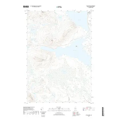
1977 Attean Pond
Somerset County, ME
1977 Basin Mountain
Somerset County, ME
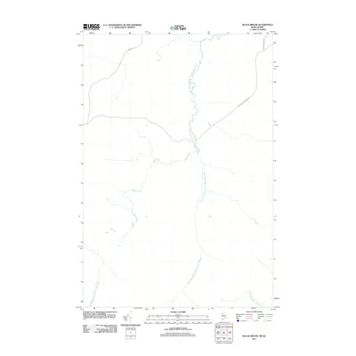
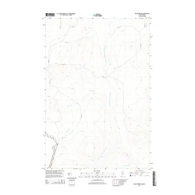
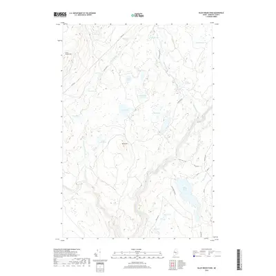
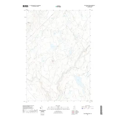
1977 Black Brook Pond
Somerset County, ME
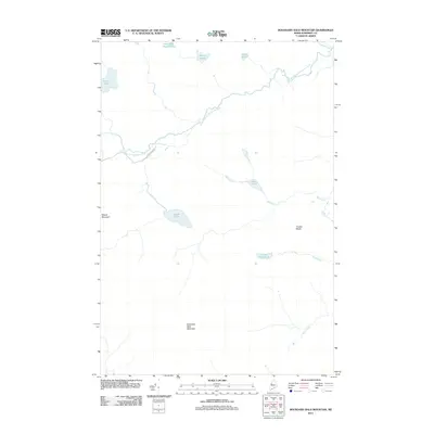
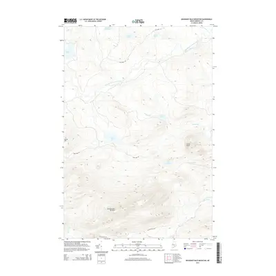
1977 Boundary Bald Mountain
Somerset County, ME
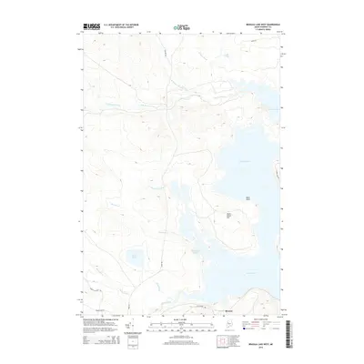
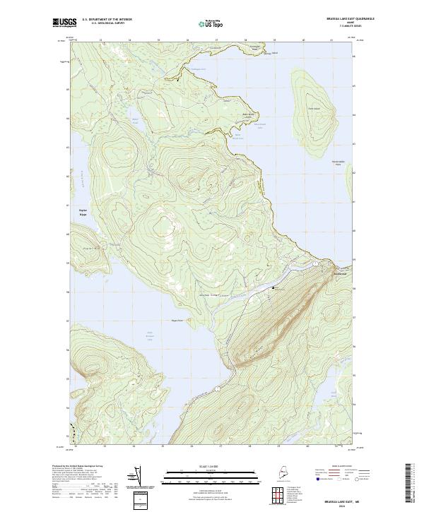
1977 Brassua Lake East
Somerset County, ME
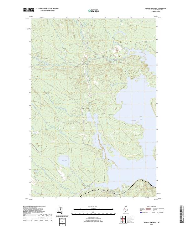
1977 Brassua Lake West
Somerset County, ME
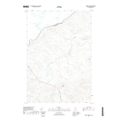
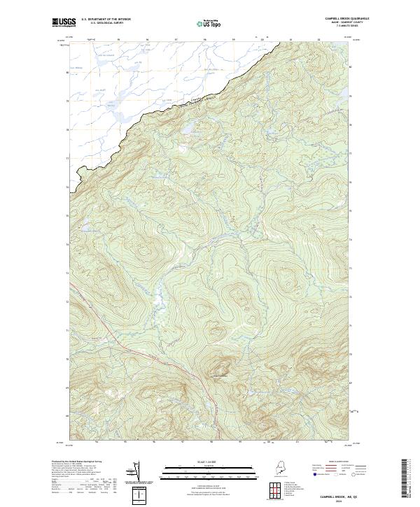
1977 Campbell Brook
Somerset County, ME
1977 Catheart Mountain
Somerset County, ME
1977 Enchanted Pond
Somerset County, ME
1977 Heald Pond
Somerset County, ME
1977 Holeb
Somerset County, ME
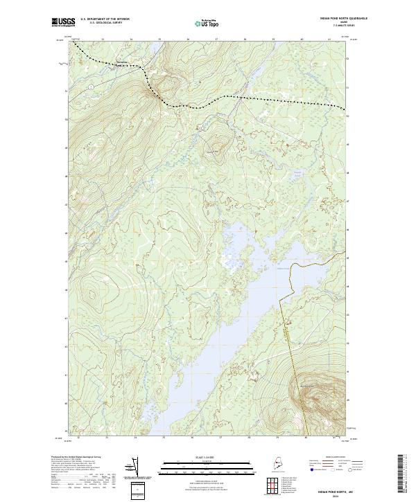
1977 Indian Pond North
Somerset County, ME
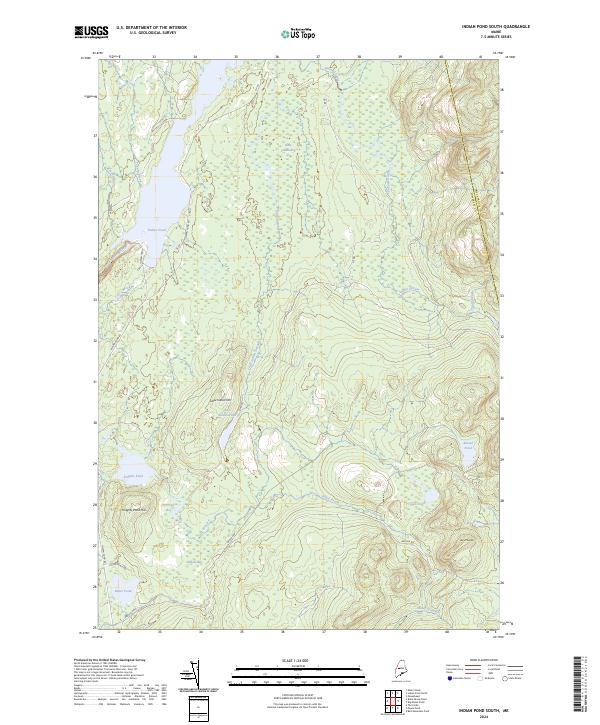
1977 Indian Pond South
Somerset County, ME
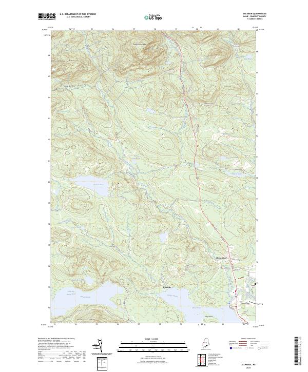
1977 Jackman
Somerset County, ME
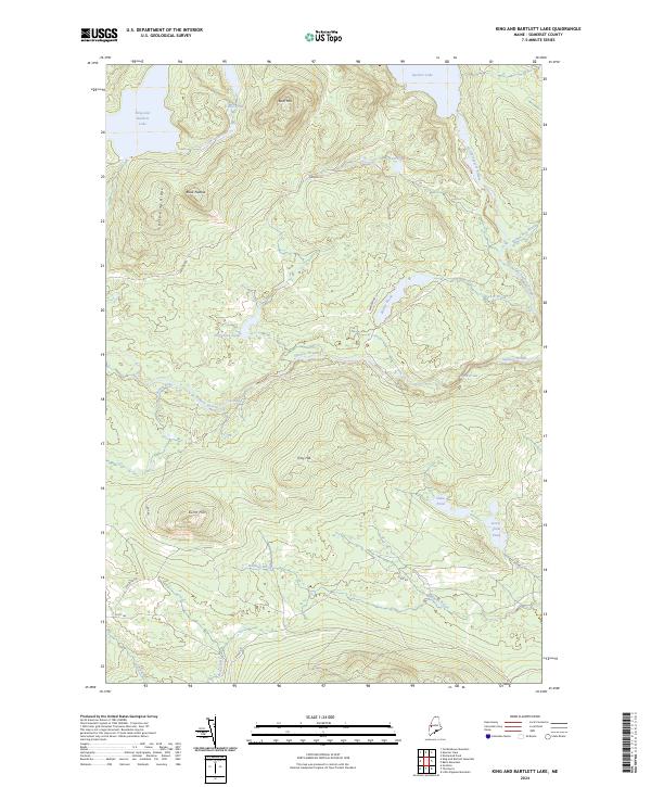
1977 King And Bartlett Lake
Somerset County, ME
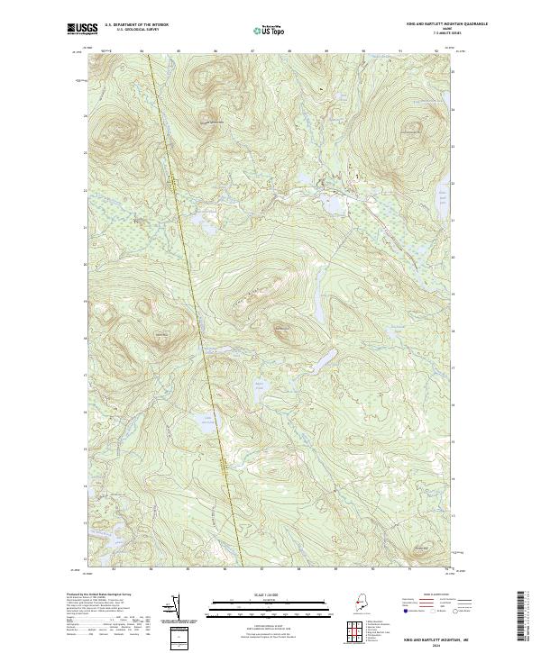
1977 King and Bartlett Mountain
Somerset County, ME
1977 Lac Du Portage
Somerset County, ME
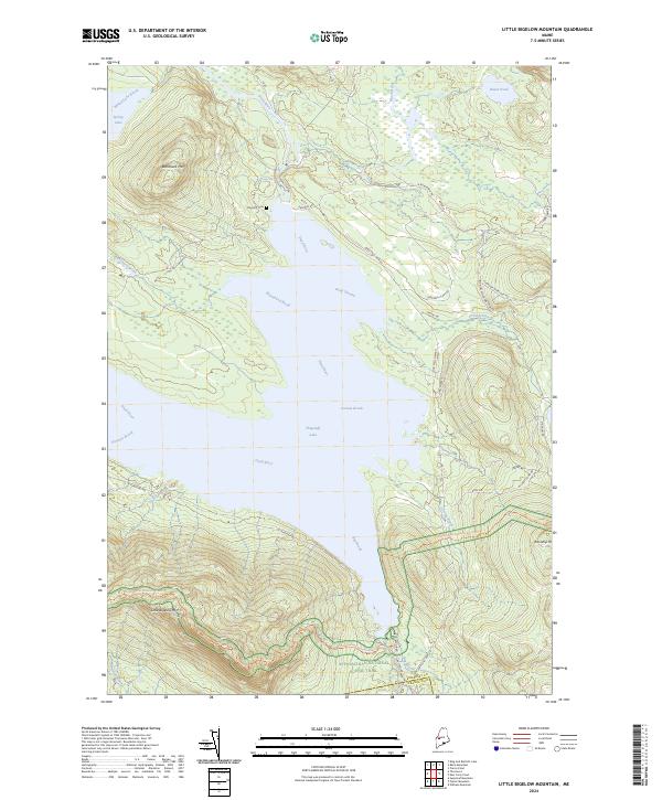
1977 Little Bigelow Mountain
Somerset County, ME
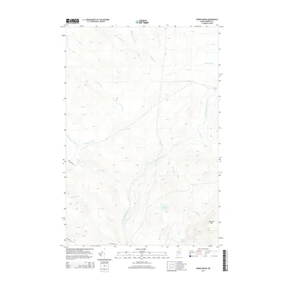
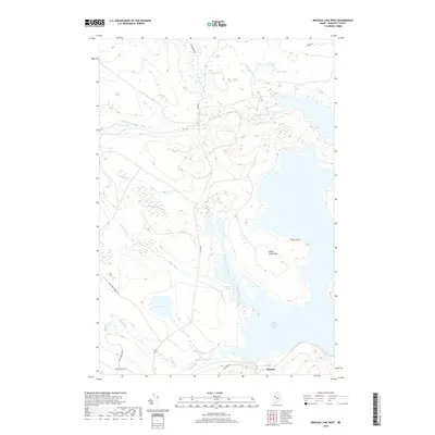
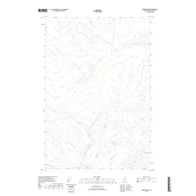
1977 Misery Knob
Somerset County, ME
1977 Moxie Pond
Somerset County, ME
1977 Penobscot Lake
Somerset County, ME
1977 Riviere Monument
Somerset County, ME
1977 Seboomook Lake East
Somerset County, ME
1977 Seboomook Lake West
Somerset County, ME
1977 Seboomook
Somerset County, ME
1977 Socatean Bay
Somerset County, ME
1977 Spencer Lake
Somerset County, ME
1977 Stony Brook
Somerset County, ME
1977 The Forks
Somerset County, ME
1977 The Horns
Somerset County, ME
1977 Tomhegan Pond
Somerset County, ME
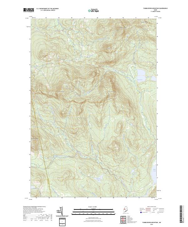
1977 Tumbledown Mountain
Somerset County, ME
1978 Skinner NE
Somerset County, ME
1979 Canada Falls Lake
Somerset County, ME
1979 Churchill Stream
Somerset County, ME
1979 East Carry Pond
Somerset County, ME
1979 Foley Pond
Somerset County, ME
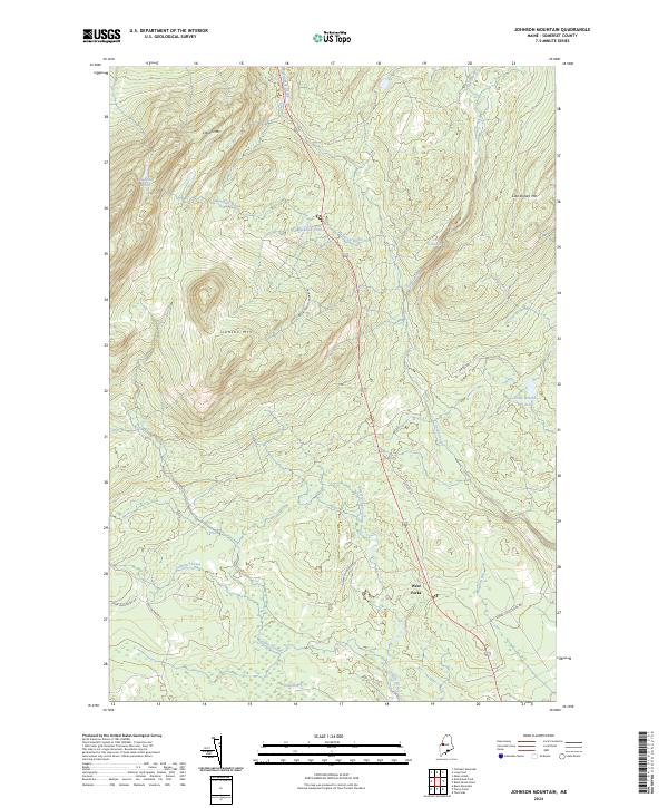
1979 Johnson Mountain
Somerset County, ME
1979 Long Pond
Somerset County, ME
1979 New Portland
Somerset County, ME
1979 Pierce Pond
Somerset County, ME
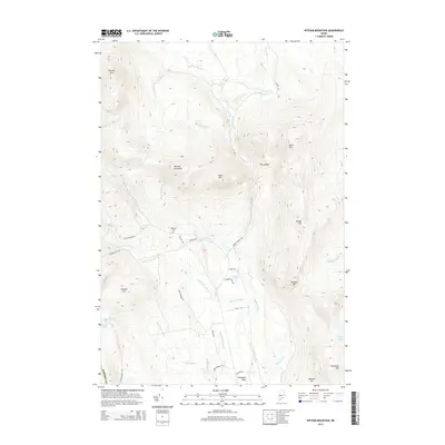
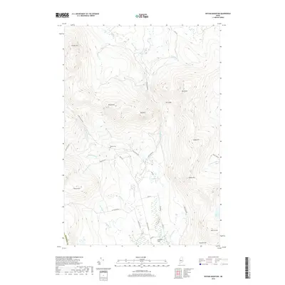
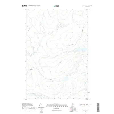
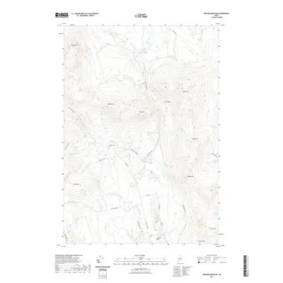
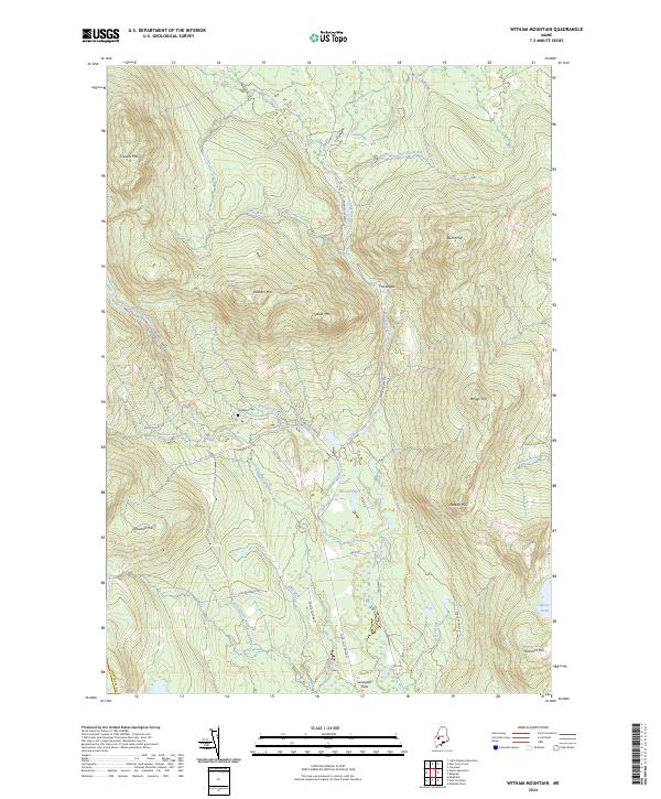
1979 Witham Mountain
Somerset County, ME
1982 Hartland
Somerset County, ME
1982 Hinckley
Somerset County, ME
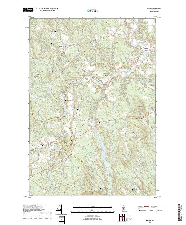
1982 Mercer
Somerset County, ME

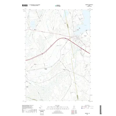
1982 Newport
Somerset County, ME
1982 Norridgewock
Somerset County, ME
1982 Pittsfield
Somerset County, ME
1985 Skowhegan
Somerset County, ME
1986 Beaver Pond SE
Somerset County, ME
1986 Eastman Brook
Somerset County, ME

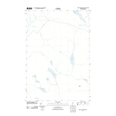
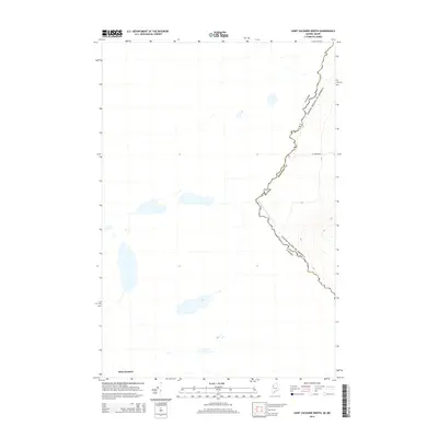
1986 Lac Etchemin
Somerset County, ME

1986 Megantic
Somerset County, ME
1987 Daaquam
Somerset County, ME
1988 Black Brook Pond
Somerset County, ME
1988 Brassua Lake East
Somerset County, ME
1988 Brassua Lake West
Somerset County, ME
1988 Indian Pond North
Somerset County, ME
1988 Indian Pond South
Somerset County, ME
1988 Misery Knob
Somerset County, ME
1988 Moxie Pond
Somerset County, ME
1988 The Forks
Somerset County, ME
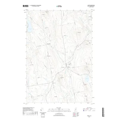
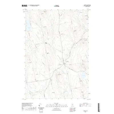
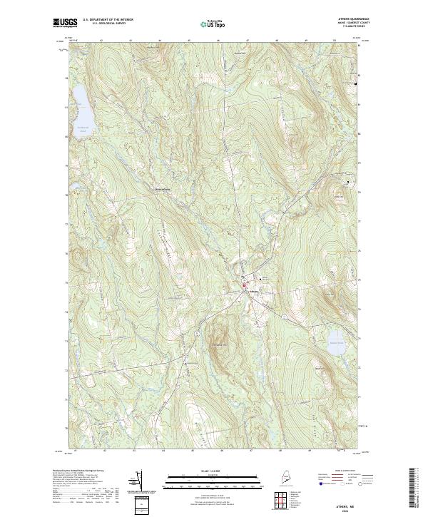
1989 Athens
Somerset County, ME
1989 Attean Pond
Somerset County, ME
1989 Baker Lake NW
Somerset County, ME
1989 Baker Lake
Somerset County, ME
1989 Basin Mountain
Somerset County, ME
1989 Bingham
Somerset County, ME
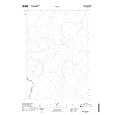
1989 Black Brook
Somerset County, ME
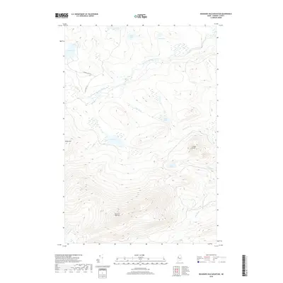
1989 Boundary Bald Mountain
Somerset County, ME
1989 Campbell Brook
Somerset County, ME
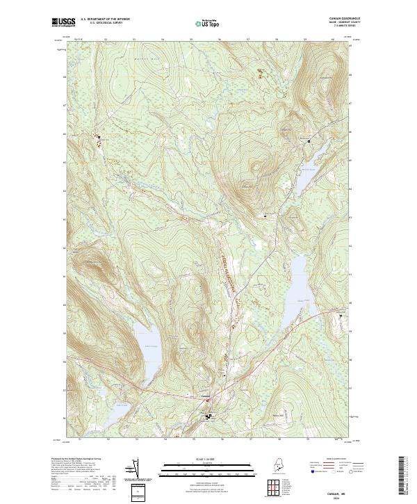
1989 Canaan
Somerset County, ME
1989 Canada Falls Lake
Somerset County, ME
1989 Caratunk
Somerset County, ME
1989 Catheart Mountain
Somerset County, ME
1989 Churchill Stream
Somerset County, ME
1989 Dimmick Mountain
Somerset County, ME
1989 Doucie Brook
Somerset County, ME
1989 East Carry Pond
Somerset County, ME
1989 Embden Pond
Somerset County, ME
1989 Enchanted Pond
Somerset County, ME
1989 Fisher Ponds
Somerset County, ME
1989 Foley Pond
Somerset County, ME
1989 Foster Ridge
Somerset County, ME
1989 Hardwood Mountain SE
Somerset County, ME
1989 Hardwood Mountain
Somerset County, ME
1989 Hardwood Mountain SW
Somerset County, ME
1989 Harmony
Somerset County, ME
1989 Heald Pond
Somerset County, ME
1989 Hinckley Hill
Somerset County, ME
1989 Holeb
Somerset County, ME
1989 Hurricane Hill
Somerset County, ME
1989 Hurricane Pond
Somerset County, ME
1989 Jackman
Somerset County, ME
1989 Johnson Mountain
Somerset County, ME
1989 Kind And Bartlett Lake
Somerset County, ME
1989 Kind and Bartlett Mtn.
Somerset County, ME
1989 Kingsbury
Somerset County, ME
1989 Little Bigelow Mtn
Somerset County, ME
1989 Long Pond
Somerset County, ME
1989 Madison East
Somerset County, ME
1989 Madison West
Somerset County, ME
1989 Mahoney Hill
Somerset County, ME
1989 New Portland
Somerset County, ME
1989 Norris Brook
Somerset County, ME
1989 Penobscot Lake
Somerset County, ME
1989 Pierce Pond
Somerset County, ME
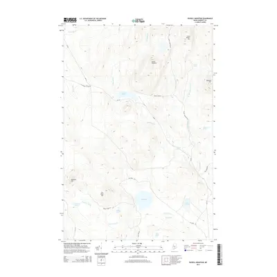
1989 Russell Mountain
Somerset County, ME
1989 Sandy Bay Mountain
Somerset County, ME
1989 Seboomook Lake East
Somerset County, ME
1989 Seboomook Lake West
Somerset County, ME
1989 Seboomook
Somerset County, ME
1989 Skowhegan
Somerset County, ME
1989 Socatean Bay
Somerset County, ME
1989 Solon
Somerset County, ME
1989 Spencer Lake
Somerset County, ME
1989 Spruce Brook
Somerset County, ME
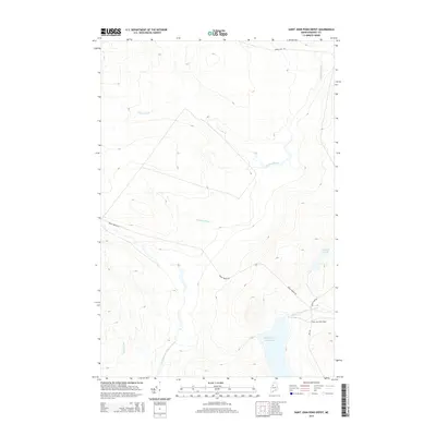
1989 St. John Ponds Depot
Somerset County, ME
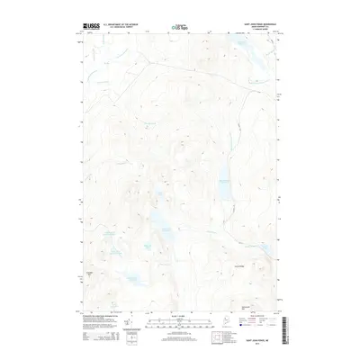
1989 St. John Ponds
Somerset County, ME
1989 Stony Brook
Somerset County, ME
1989 St. Zacharie North
Somerset County, ME
1989 The Horns
Somerset County, ME
1989 Tomhegan Pond
Somerset County, ME
1989 Tumbledown Mtn
Somerset County, ME
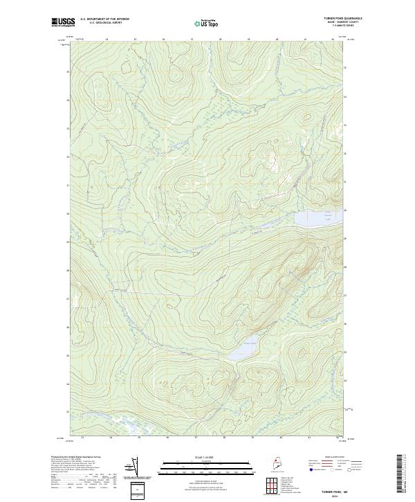
1989 Turner Pond
Somerset County, ME
1989 Witham Mtn
Somerset County, ME
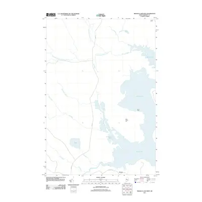
1993 Lac Etchemin
Somerset County, ME

1993 Montmagny
Somerset County, ME

1994 Megantic
Somerset County, ME
1997 Attean Pond
Somerset County, ME
1997 Holeb
Somerset County, ME
1997 Jackman
Somerset County, ME
1997 The Horns
Somerset County, ME
2011 Athens
Somerset County, ME
2011 Attean Pond
Somerset County, ME
2011 Baker Lake NW
Somerset County, ME
2011 Baker Lake
Somerset County, ME
2011 Basin Mountain
Somerset County, ME
2011 Beaver Pond SE
Somerset County, ME
2011 Bingham
Somerset County, ME
2011 Black Brook Pond
Somerset County, ME
2011 Black Brook
Somerset County, ME
2011 Boundary Bald Mountain
Somerset County, ME
2011 Brassua Lake East
Somerset County, ME
2011 Brassua Lake West
Somerset County, ME
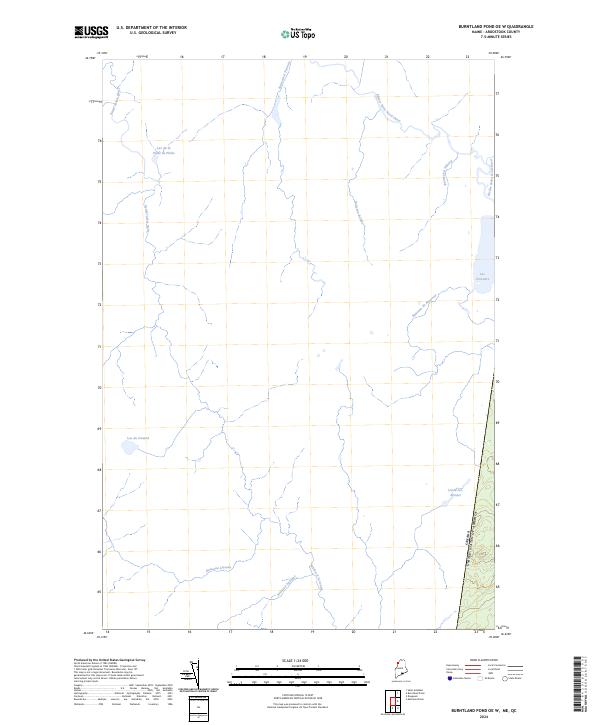
2011 Burntland Pond OE W
Somerset County, ME
2011 Campbell Brook
Somerset County, ME
2011 Canaan
Somerset County, ME
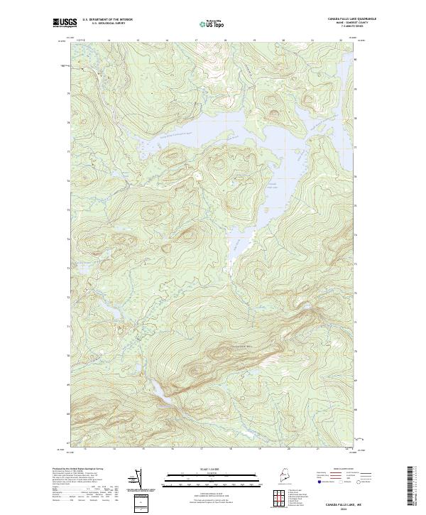
2011 Canada Falls Lake
Somerset County, ME
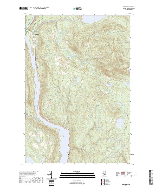
2011 Caratunk
Somerset County, ME
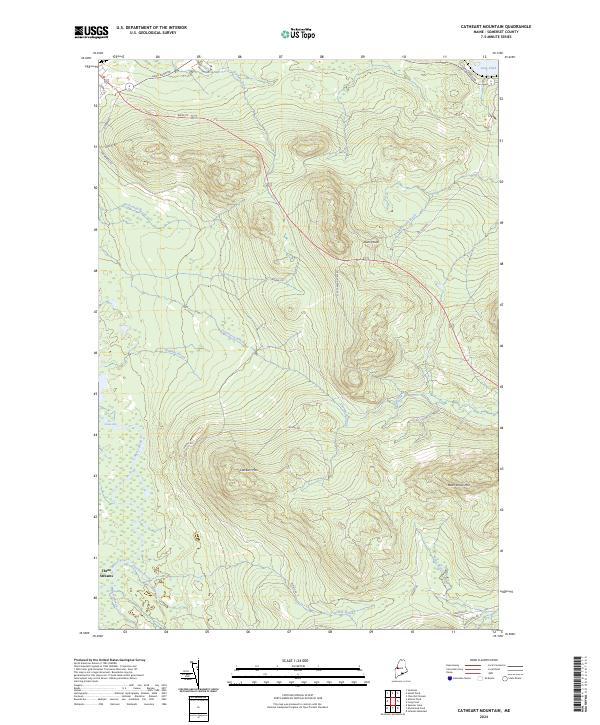
2011 Catheart Mountain
Somerset County, ME
2011 Churchill Stream
Somerset County, ME
2011 Daaquam
Somerset County, ME
2011 Dimmick Mountain
Somerset County, ME
2011 Doucie Brook
Somerset County, ME
2011 East Carry Pond
Somerset County, ME
2011 Eastman Brook
Somerset County, ME
2011 Embden Pond
Somerset County, ME
2011 Enchanted Pond
Somerset County, ME
2011 Fisher Ponds
Somerset County, ME
2011 Foley Pond
Somerset County, ME
2011 Foster Ridge
Somerset County, ME
2011 Hardwood Mountain OE W
Somerset County, ME
2011 Hardwood Mountain SE
Somerset County, ME
2011 Hardwood Mountain
Somerset County, ME
2011 Hardwood Mountain SW OE W
Somerset County, ME
2011 Hardwood Mountain SW
Somerset County, ME
2011 Harmony
Somerset County, ME
2011 Hartland
Somerset County, ME
2011 Heald Pond
Somerset County, ME
2011 Hinckley Hill
Somerset County, ME
2011 Hinckley
Somerset County, ME
2011 Holeb
Somerset County, ME
2011 Hurricane Hill
Somerset County, ME
2011 Hurricane Pond
Somerset County, ME
2011 Indian Pond North
Somerset County, ME
2011 Indian Pond South
Somerset County, ME
2011 Jackman
Somerset County, ME
2011 Johnson Mountain
Somerset County, ME
2011 King And Bartlett Lake
Somerset County, ME
2011 King And Bartlett Mountain
Somerset County, ME
2011 Kingsbury
Somerset County, ME
2011 Little Bigelow Mountain
Somerset County, ME
2011 Long Pond
Somerset County, ME
2011 Madison East
Somerset County, ME
2011 Madison West
Somerset County, ME
2011 Mahoney Hill
Somerset County, ME
2011 Mercer
Somerset County, ME
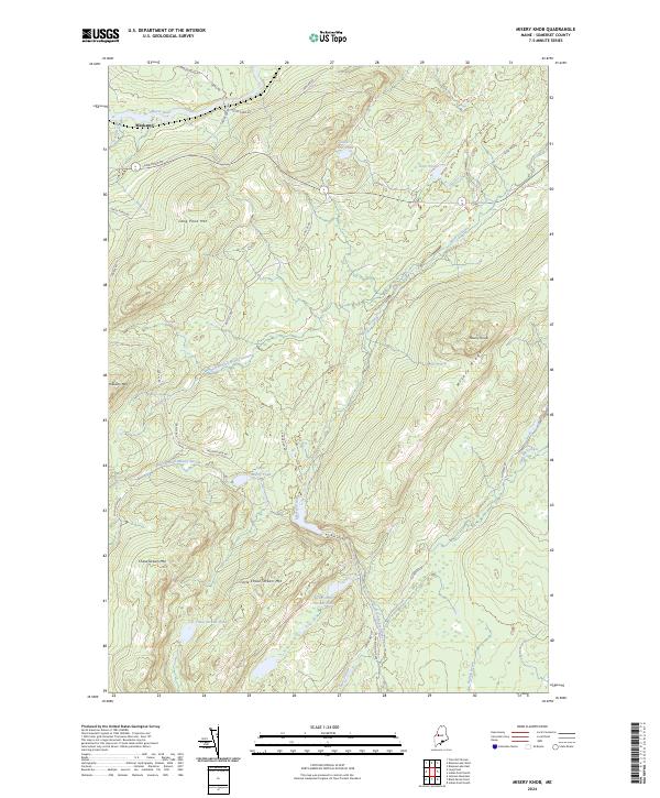
2011 Misery Knob
Somerset County, ME
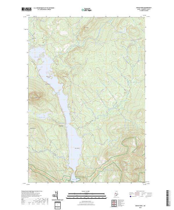
2011 Moxie Pond
Somerset County, ME
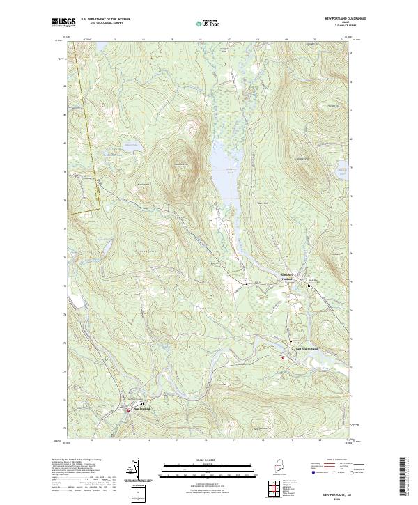
2011 New Portland
Somerset County, ME

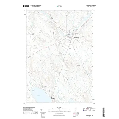
2011 Newport
Somerset County, ME
2011 Norridgewock
Somerset County, ME
2011 Norris Brook
Somerset County, ME
2011 Penobscot Lake
Somerset County, ME
2011 Pierce Pond
Somerset County, ME
2011 Pittsfield
Somerset County, ME
2011 Russell Mountain
Somerset County, ME
2011 Saint John Pond Depot
Somerset County, ME
2011 Saint John Ponds
Somerset County, ME
2011 Saint Zacharie North
Somerset County, ME
2011 Sandy Bay Mountain
Somerset County, ME
2011 Seboomook Lake East
Somerset County, ME
2011 Seboomook Lake West
Somerset County, ME
2011 Seboomook
Somerset County, ME
2011 Skinner NE
Somerset County, ME
2011 Skowhegan
Somerset County, ME
2011 Socatean Bay
Somerset County, ME
2011 Solon
Somerset County, ME
2011 Spencer Lake
Somerset County, ME
2011 Spruce Brook
Somerset County, ME
2011 Stony Brook
Somerset County, ME
2011 The Forks
Somerset County, ME
2011 The Horns
Somerset County, ME
2011 Tomhegan Pond
Somerset County, ME
2011 Tumbledown Mountain
Somerset County, ME
2011 Turner Pond
Somerset County, ME
2011 Witham Mountain
Somerset County, ME
2014 Athens
Somerset County, ME
2014 Attean Pond
Somerset County, ME
2014 Baker Lake NW
Somerset County, ME
2014 Baker Lake
Somerset County, ME
2014 Basin Mountain
Somerset County, ME
2014 Beaver Pond SE
Somerset County, ME
2014 Bingham
Somerset County, ME
2014 Black Brook Pond
Somerset County, ME
2014 Black Brook
Somerset County, ME
2014 Boundary Bald Mountain
Somerset County, ME
2014 Brassua Lake East
Somerset County, ME
2014 Brassua Lake West
Somerset County, ME
2014 Burntland Pond OE W
Somerset County, ME
2014 Campbell Brook
Somerset County, ME
2014 Canaan
Somerset County, ME
2014 Canada Falls Lake
Somerset County, ME
2014 Caratunk
Somerset County, ME
2014 Catheart Mountain
Somerset County, ME
2014 Churchill Stream
Somerset County, ME
2014 Daaquam
Somerset County, ME
2014 Dimmick Mountain
Somerset County, ME
2014 Doucie Brook
Somerset County, ME
2014 East Carry Pond
Somerset County, ME
2014 Eastman Brook
Somerset County, ME
2014 Embden Pond
Somerset County, ME
2014 Enchanted Pond
Somerset County, ME
2014 Fisher Ponds
Somerset County, ME
2014 Foley Pond
Somerset County, ME
2014 Foster Ridge
Somerset County, ME
2014 Hardwood Mountain OE W
Somerset County, ME
2014 Hardwood Mountain SE
Somerset County, ME
2014 Hardwood Mountain
Somerset County, ME
2014 Hardwood Mountain SW OE W
Somerset County, ME
2014 Hardwood Mountain SW
Somerset County, ME
2014 Harmony
Somerset County, ME
2014 Hartland
Somerset County, ME
2014 Heald Pond
Somerset County, ME
2014 Hinckley Hill
Somerset County, ME
2014 Hinckley
Somerset County, ME
2014 Holeb
Somerset County, ME
2014 Hurricane Hill
Somerset County, ME
2014 Hurricane Pond
Somerset County, ME
2014 Indian Pond North
Somerset County, ME
2014 Indian Pond South
Somerset County, ME
2014 Jackman
Somerset County, ME
2014 Johnson Mountain
Somerset County, ME
2014 King And Bartlett Lake
Somerset County, ME
2014 King And Bartlett Mountain
Somerset County, ME
2014 Kingsbury
Somerset County, ME
2014 Little Bigelow Mountain
Somerset County, ME
2014 Long Pond
Somerset County, ME
2014 Madison East
Somerset County, ME
2014 Madison West
Somerset County, ME
2014 Mahoney Hill
Somerset County, ME
2014 Mercer
Somerset County, ME
2014 Misery Knob
Somerset County, ME
2014 Moxie Pond
Somerset County, ME
2014 New Portland
Somerset County, ME
2014 Newport
Somerset County, ME
2014 Norridgewock
Somerset County, ME
2014 Norris Brook
Somerset County, ME
2014 Penobscot Lake
Somerset County, ME
2014 Pierce Pond
Somerset County, ME
2014 Pittsfield
Somerset County, ME
2014 Russell Mountain
Somerset County, ME
2014 Saint John Pond Depot
Somerset County, ME
2014 Saint John Ponds
Somerset County, ME
2014 Saint Zacharie North
Somerset County, ME
2014 Sandy Bay Mountain
Somerset County, ME
2014 Seboomook Lake East
Somerset County, ME
2014 Seboomook Lake West
Somerset County, ME
2014 Seboomook
Somerset County, ME
2014 Skinner NE
Somerset County, ME
2014 Skowhegan
Somerset County, ME
2014 Socatean Bay
Somerset County, ME
2014 Solon
Somerset County, ME
2014 Spencer Lake
Somerset County, ME
2014 Spruce Brook
Somerset County, ME
2014 Stony Brook
Somerset County, ME
2014 The Forks
Somerset County, ME
2014 The Horns
Somerset County, ME
2014 Tomhegan Pond
Somerset County, ME
2014 Tumbledown Mountain
Somerset County, ME
2014 Turner Pond
Somerset County, ME
2014 Witham Mountain
Somerset County, ME
2018 Athens
Somerset County, ME
2018 Attean Pond
Somerset County, ME
2018 Baker Lake NW
Somerset County, ME
2018 Baker Lake
Somerset County, ME
2018 Basin Mountain
Somerset County, ME
2018 Beaver Pond SE
Somerset County, ME
2018 Bingham
Somerset County, ME
2018 Black Brook Pond
Somerset County, ME
2018 Black Brook
Somerset County, ME
2018 Boundary Bald Mountain
Somerset County, ME
2018 Brassua Lake East
Somerset County, ME
2018 Brassua Lake West
Somerset County, ME
2018 Burntland Pond OE W
Somerset County, ME
2018 Campbell Brook
Somerset County, ME
2018 Canaan
Somerset County, ME
2018 Canada Falls Lake
Somerset County, ME
2018 Caratunk
Somerset County, ME
2018 Catheart Mountain
Somerset County, ME
2018 Churchill Stream
Somerset County, ME
2018 Dimmick Mountain
Somerset County, ME
2018 Doucie Brook
Somerset County, ME
2018 East Carry Pond
Somerset County, ME
2018 Eastman Brook
Somerset County, ME
2018 Embden Pond
Somerset County, ME
2018 Enchanted Pond
Somerset County, ME
2018 Fisher Ponds
Somerset County, ME
2018 Foley Pond
Somerset County, ME
2018 Foster Ridge
Somerset County, ME
2018 Hardwood Mountain OE W
Somerset County, ME
2018 Hardwood Mountain SE
Somerset County, ME
2018 Hardwood Mountain
Somerset County, ME
2018 Hardwood Mountain SW OE W
Somerset County, ME
2018 Hardwood Mountain SW
Somerset County, ME
2018 Harmony
Somerset County, ME
2018 Hartland
Somerset County, ME

2018 Heald Pond
Somerset County, ME
2018 Hinckley Hill
Somerset County, ME
2018 Hinckley
Somerset County, ME

2018 Holeb
Somerset County, ME
2018 Hurricane Hill
Somerset County, ME
2018 Hurricane Pond
Somerset County, ME
2018 Indian Pond North
Somerset County, ME
2018 Indian Pond South
Somerset County, ME
2018 Jackman
Somerset County, ME
2018 Johnson Mountain
Somerset County, ME
2018 King And Bartlett Lake
Somerset County, ME
2018 King And Bartlett Mountain
Somerset County, ME
2018 Kingsbury
Somerset County, ME
2018 Little Bigelow Mountain
Somerset County, ME
2018 Long Pond
Somerset County, ME
2018 Madison East
Somerset County, ME
2018 Madison West
Somerset County, ME
2018 Mahoney Hill
Somerset County, ME
2018 Mercer
Somerset County, ME
2018 Misery Knob
Somerset County, ME
2018 Moxie Pond
Somerset County, ME
2018 New Portland
Somerset County, ME
2018 Newport
Somerset County, ME
2018 Norridgewock
Somerset County, ME
2018 Norris Brook
Somerset County, ME
2018 Penobscot Lake
Somerset County, ME
2018 Pierce Pond
Somerset County, ME

2018 Pittsfield
Somerset County, ME
2018 Russell Mountain
Somerset County, ME
2018 Saint John Pond Depot
Somerset County, ME
2018 Saint John Ponds
Somerset County, ME
2018 Sandy Bay Mountain
Somerset County, ME
2018 Seboomook Lake East
Somerset County, ME
2018 Seboomook Lake West
Somerset County, ME
2018 Seboomook
Somerset County, ME
2018 Skinner NE
Somerset County, ME
2018 Skowhegan
Somerset County, ME
2018 Socatean Bay
Somerset County, ME
2018 Solon
Somerset County, ME
2018 Spencer Lake
Somerset County, ME
2018 Spruce Brook
Somerset County, ME
2018 Stony Brook
Somerset County, ME
2018 The Forks
Somerset County, ME
2018 The Horns
Somerset County, ME
2018 Tomhegan Pond
Somerset County, ME
2018 Tumbledown Mountain
Somerset County, ME
2018 Turner Pond
Somerset County, ME
2018 Witham Mountain
Somerset County, ME
2021 Athens
Somerset County, ME
2021 Attean Pond
Somerset County, ME
2021 Baker Lake NW
Somerset County, ME
2021 Baker Lake
Somerset County, ME
2021 Basin Mountain
Somerset County, ME
2021 Beaver Pond SE
Somerset County, ME
2021 Bingham
Somerset County, ME
2021 Black Brook Pond
Somerset County, ME
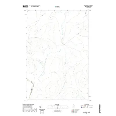
2021 Black Brook
Somerset County, ME
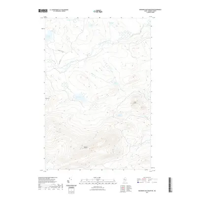
2021 Boundary Bald Mountain
Somerset County, ME
2021 Brassua Lake East
Somerset County, ME
2021 Brassua Lake West
Somerset County, ME
2021 Burntland Pond OE W
Somerset County, ME
2021 Campbell Brook
Somerset County, ME
2021 Canaan
Somerset County, ME
2021 Canada Falls Lake
Somerset County, ME
2021 Caratunk
Somerset County, ME
2021 Catheart Mountain
Somerset County, ME
2021 Churchill Stream
Somerset County, ME
2021 Daaquam
Somerset County, ME
2021 Dimmick Mountain
Somerset County, ME
2021 Doucie Brook
Somerset County, ME
2021 East Carry Pond
Somerset County, ME
2021 Eastman Brook
Somerset County, ME
2021 Embden Pond
Somerset County, ME
2021 Enchanted Pond
Somerset County, ME
2021 Fisher Ponds
Somerset County, ME
2021 Foley Pond
Somerset County, ME
2021 Foster Ridge
Somerset County, ME
2021 Hardwood Mountain OE W
Somerset County, ME
2021 Hardwood Mountain SE
Somerset County, ME
2021 Hardwood Mountain
Somerset County, ME
2021 Hardwood Mountain SW OE W
Somerset County, ME
2021 Hardwood Mountain SW
Somerset County, ME
2021 Harmony
Somerset County, ME
2021 Hartland
Somerset County, ME
2021 Heald Pond
Somerset County, ME
2021 Hinckley Hill
Somerset County, ME
2021 Hinckley
Somerset County, ME
2021 Holeb
Somerset County, ME
2021 Hurricane Hill
Somerset County, ME
2021 Hurricane Pond
Somerset County, ME
2021 Indian Pond North
Somerset County, ME
2021 Indian Pond South
Somerset County, ME
2021 Jackman
Somerset County, ME
2021 Johnson Mountain
Somerset County, ME
2021 King And Bartlett Lake
Somerset County, ME
2021 King And Bartlett Mountain
Somerset County, ME
2021 Kingsbury
Somerset County, ME
2021 Little Bigelow Mountain
Somerset County, ME
2021 Long Pond
Somerset County, ME
2021 Madison East
Somerset County, ME
2021 Madison West
Somerset County, ME
2021 Mahoney Hill
Somerset County, ME
2021 Mercer
Somerset County, ME
2021 Misery Knob
Somerset County, ME
2021 Moxie Pond
Somerset County, ME
2021 New Portland
Somerset County, ME
2021 Newport
Somerset County, ME
2021 Norridgewock
Somerset County, ME
2021 Norris Brook
Somerset County, ME
2021 Penobscot Lake
Somerset County, ME
2021 Pierce Pond
Somerset County, ME
2021 Pittsfield
Somerset County, ME
2021 Russell Mountain
Somerset County, ME
2021 Saint John Pond Depot
Somerset County, ME
2021 Saint John Ponds
Somerset County, ME
2021 Saint Zacharie North
Somerset County, ME
2021 Sandy Bay Mountain
Somerset County, ME
2021 Seboomook Lake East
Somerset County, ME
2021 Seboomook Lake West
Somerset County, ME
2021 Seboomook
Somerset County, ME
2021 Skinner NE
Somerset County, ME
2021 Skowhegan
Somerset County, ME
2021 Socatean Bay
Somerset County, ME
2021 Solon
Somerset County, ME
2021 Spencer Lake
Somerset County, ME
2021 Spruce Brook
Somerset County, ME
2021 Stony Brook
Somerset County, ME
2021 The Forks
Somerset County, ME
2021 The Horns
Somerset County, ME
2021 Tomhegan Pond
Somerset County, ME
2021 Tumbledown Mountain
Somerset County, ME
2021 Turner Pond
Somerset County, ME
2021 Witham Mountain
Somerset County, ME
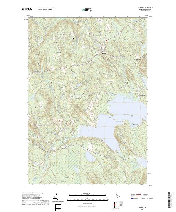
2024 Athens
Somerset County, ME
2024 Attean Pond
Somerset County, ME
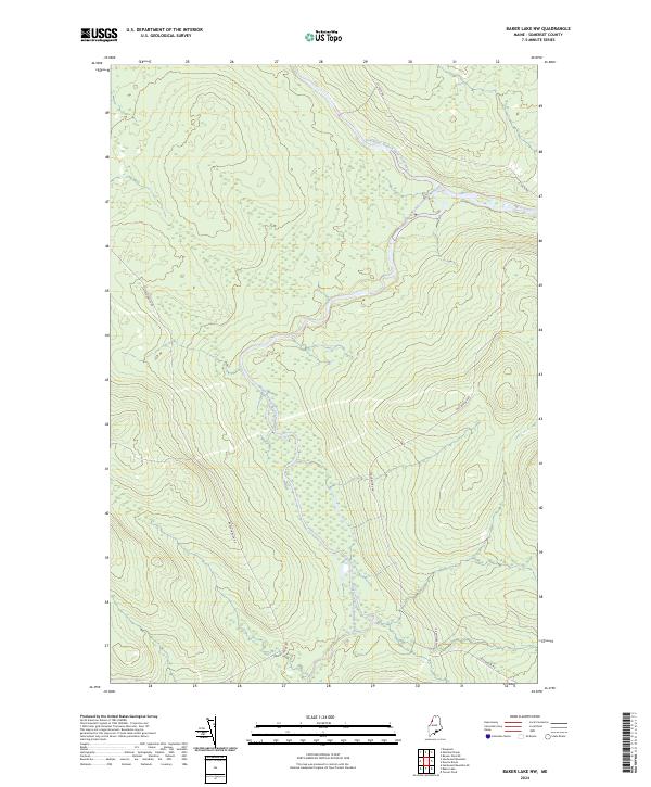
2024 Baker Lake NW
Somerset County, ME
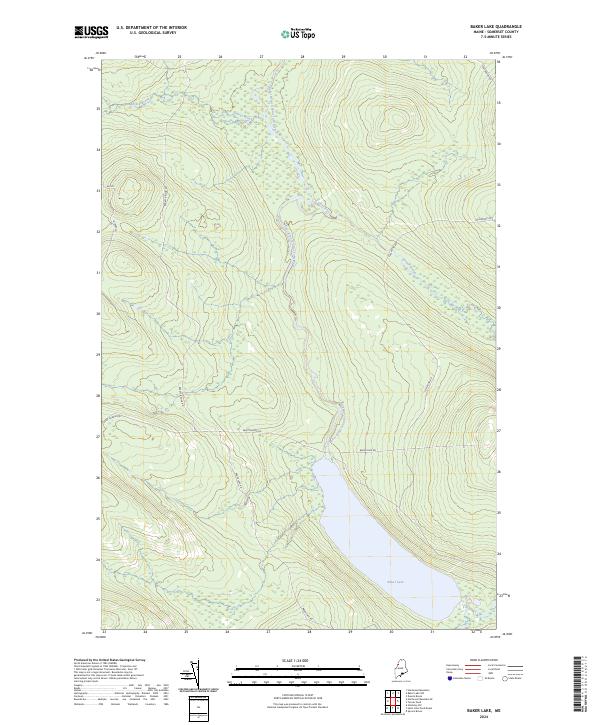
2024 Baker Lake
Somerset County, ME
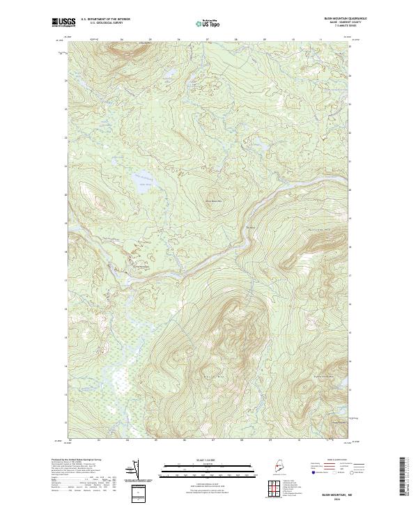
2024 Basin Mountain
Somerset County, ME
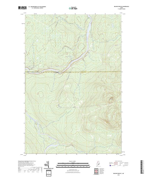
2024 Beaver Pond SE
Somerset County, ME
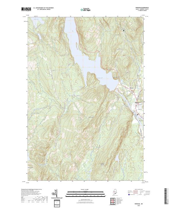
2024 Bingham
Somerset County, ME
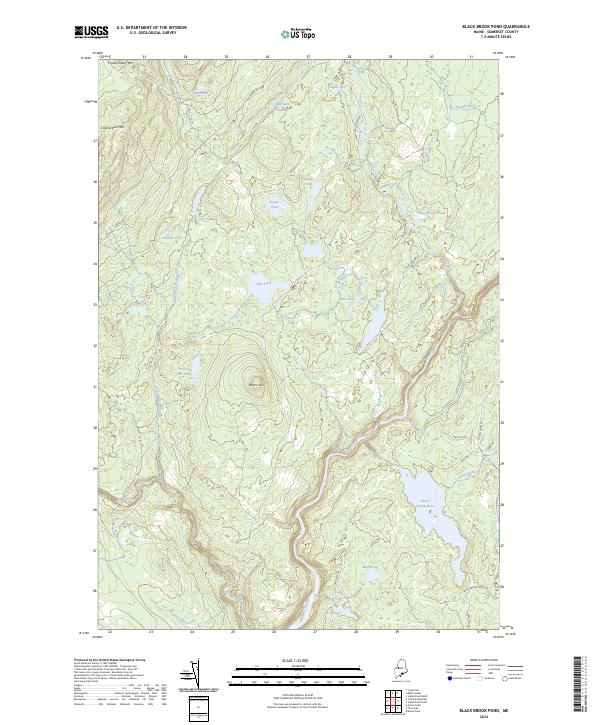
2024 Black Brook Pond
Somerset County, ME
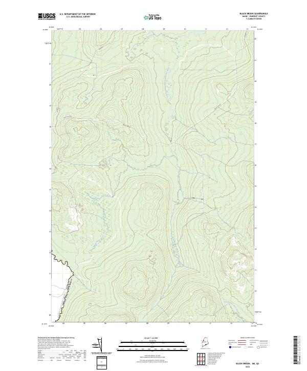
2024 Black Brook
Somerset County, ME
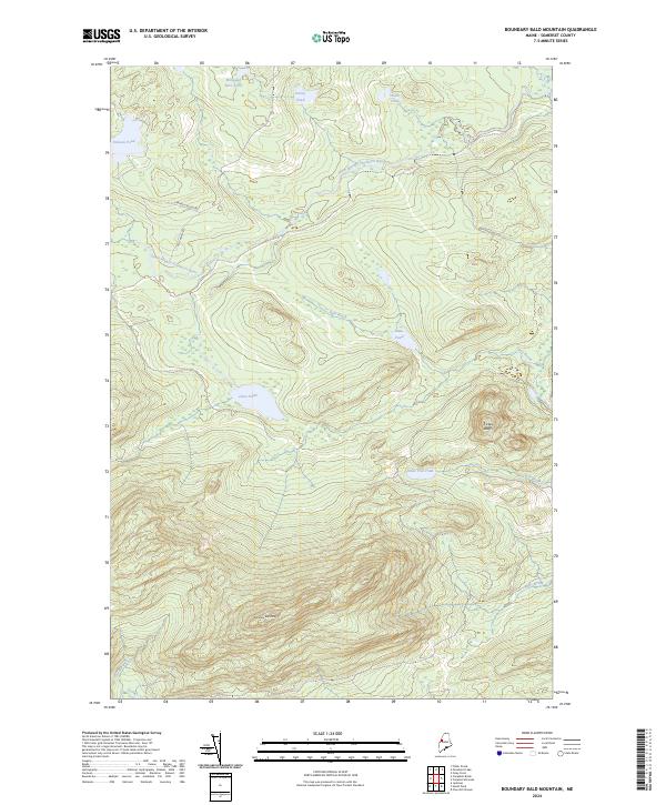
2024 Boundary Bald Mountain
Somerset County, ME
2024 Brassua Lake East
Somerset County, ME
2024 Brassua Lake West
Somerset County, ME
2024 Burntland Pond OE W
Somerset County, ME
2024 Campbell Brook
Somerset County, ME
2024 Canaan
Somerset County, ME
2024 Canada Falls Lake
Somerset County, ME
2024 Caratunk
Somerset County, ME
2024 Catheart Mountain
Somerset County, ME
2024 Churchill Stream
Somerset County, ME
2024 Daaquam
Somerset County, ME
2024 Dimmick Mountain
Somerset County, ME
2024 Doucie Brook
Somerset County, ME
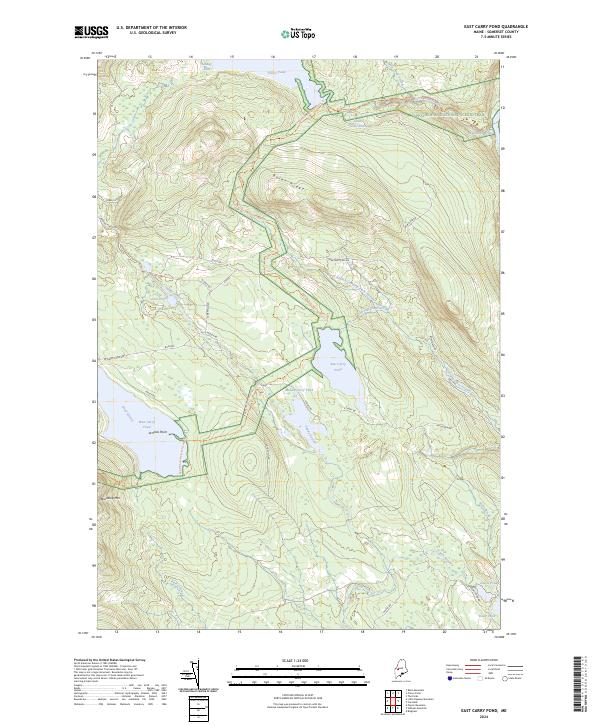
2024 East Carry Pond
Somerset County, ME
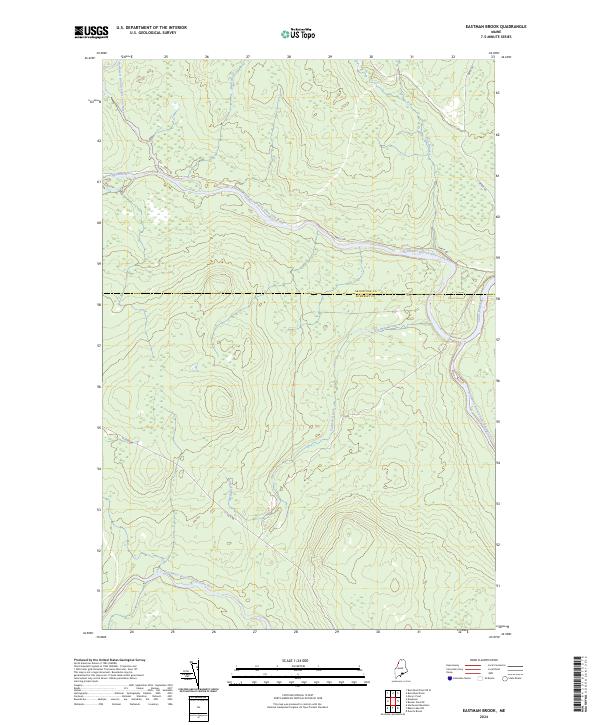
2024 Eastman Brook
Somerset County, ME
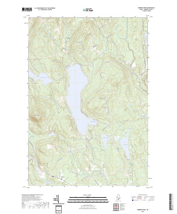
2024 Embden Pond
Somerset County, ME
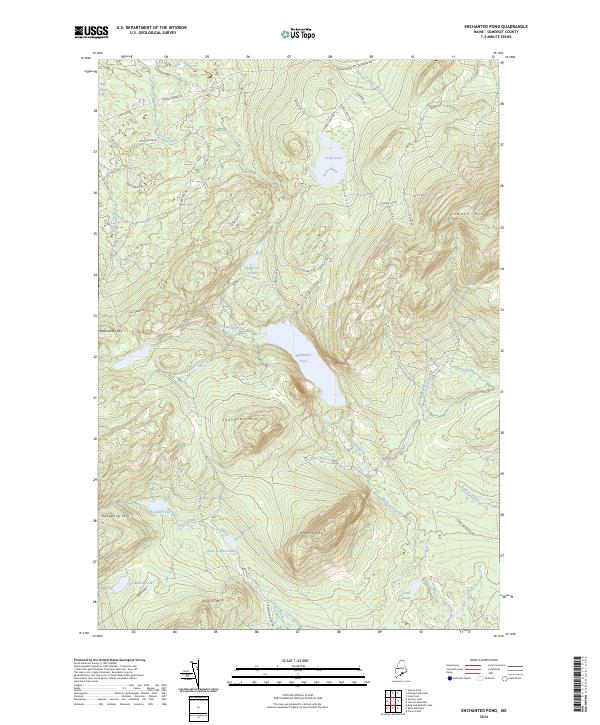
2024 Enchanted Pond
Somerset County, ME
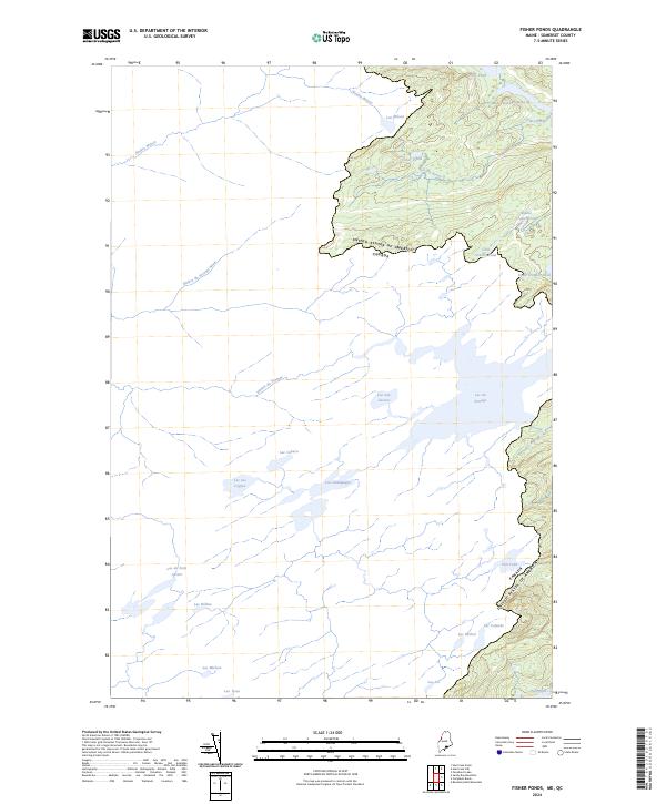
2024 Fisher Ponds
Somerset County, ME
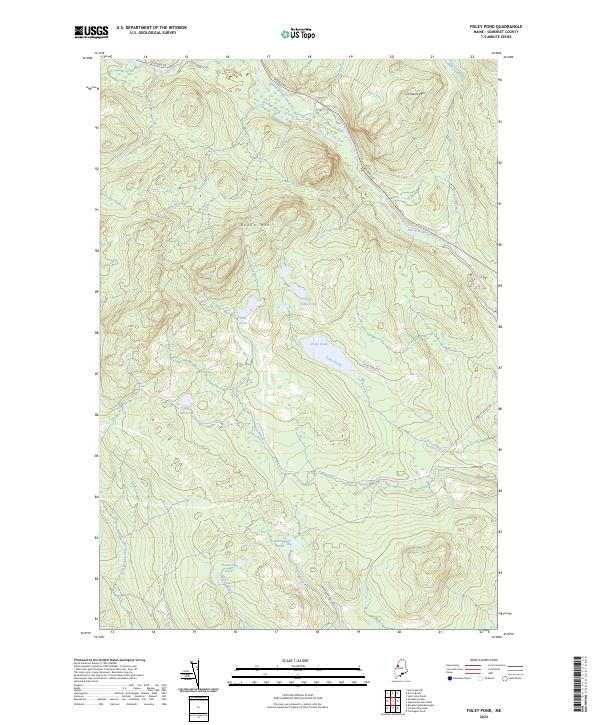
2024 Foley Pond
Somerset County, ME
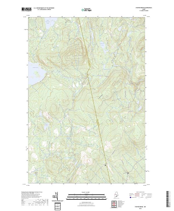
2024 Foster Ridge
Somerset County, ME
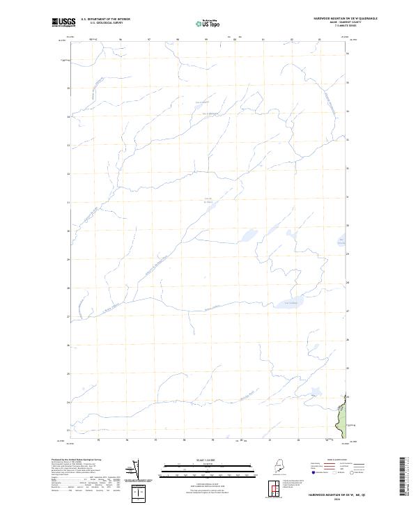
2024 Hardwood Mountain OE W
Somerset County, ME
2024 Hardwood Mountain SE
Somerset County, ME
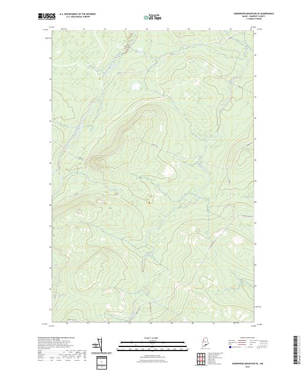
2024 Hardwood Mountain
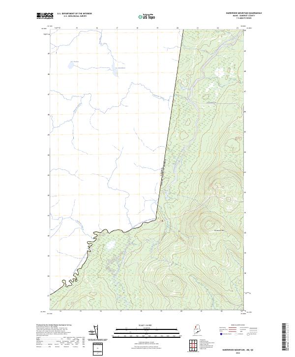
Somerset County, ME
2024 Hardwood Mountain SW OE W
Somerset County, ME
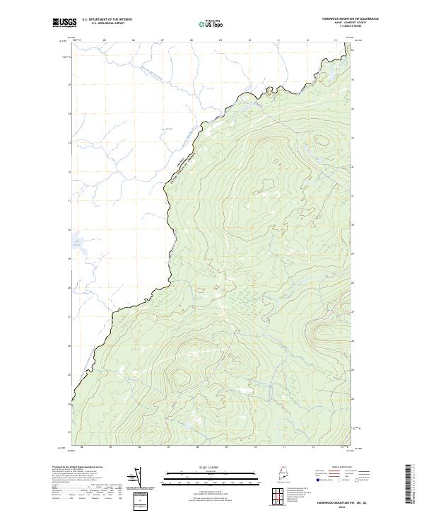
2024 Hardwood Mountain SW
Somerset County, ME
2024 Harmony
Somerset County, ME
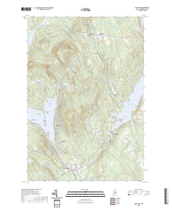
2024 Hartland
Somerset County, ME
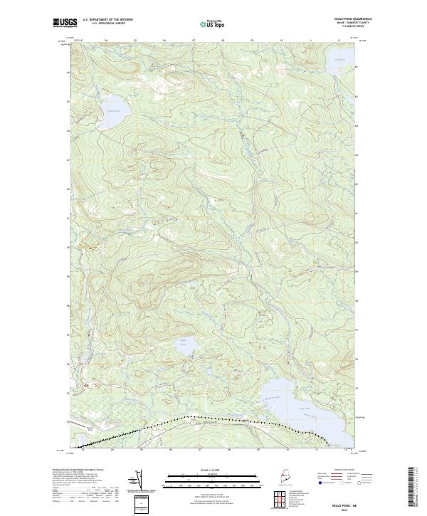
2024 Heald Pond
Somerset County, ME
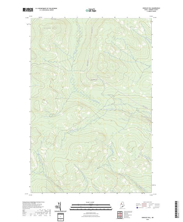
2024 Hinckley Hill
Somerset County, ME
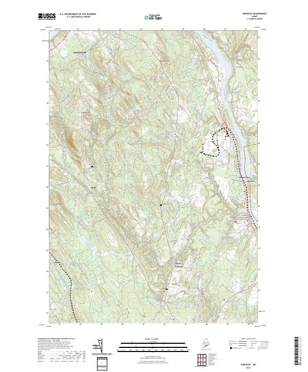
2024 Hinckley
Somerset County, ME
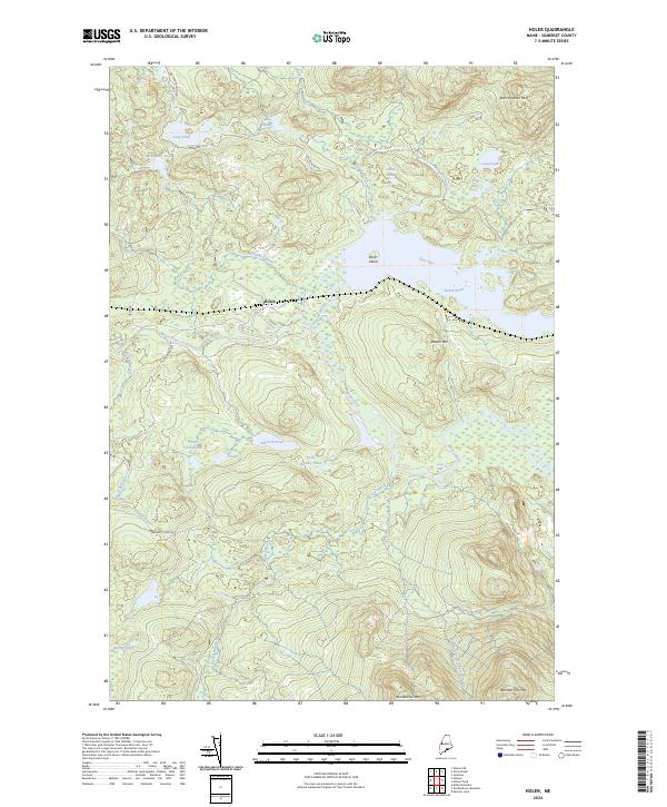
2024 Holeb
Somerset County, ME
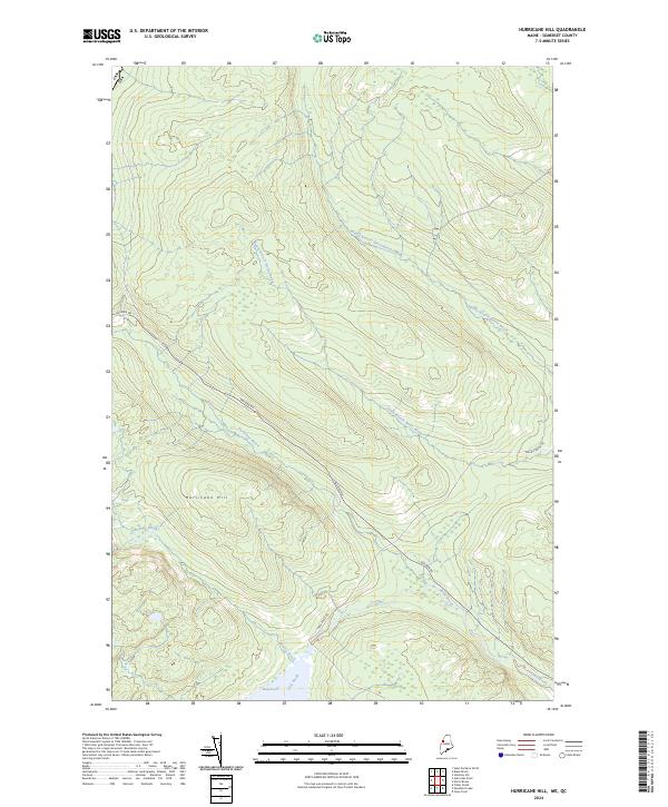
2024 Hurricane Hill
Somerset County, ME
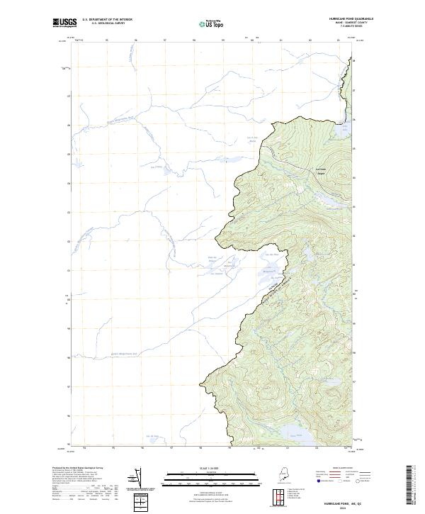
2024 Hurricane Pond
Somerset County, ME
2024 Indian Pond North
Somerset County, ME
2024 Indian Pond South
Somerset County, ME
2024 Jackman
Somerset County, ME
2024 Johnson Mountain
Somerset County, ME
2024 King And Bartlett Lake
Somerset County, ME
2024 King And Bartlett Mountain
Somerset County, ME
2024 Kingsbury
Somerset County, ME
2024 Little Bigelow Mountain
Somerset County, ME
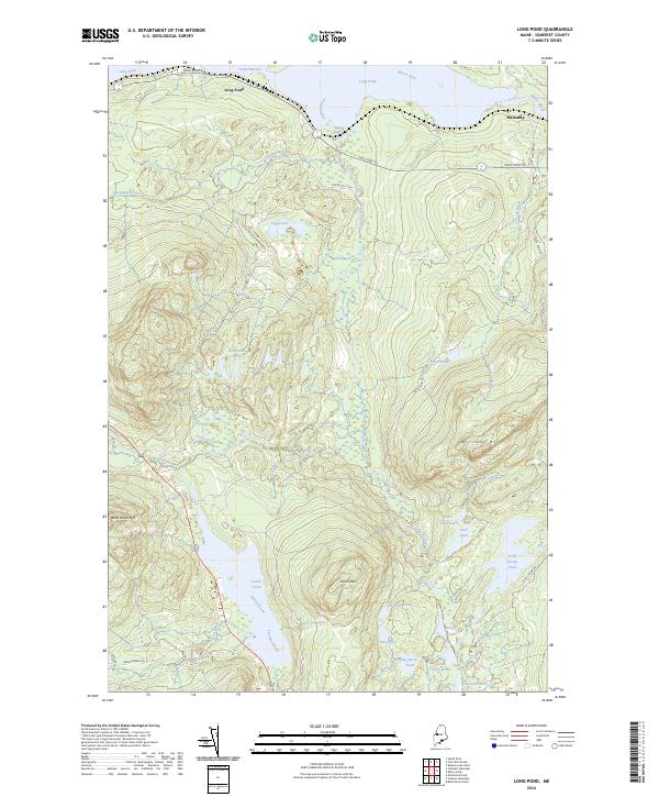
2024 Long Pond
Somerset County, ME
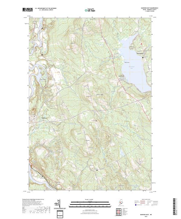
2024 Madison East
Somerset County, ME
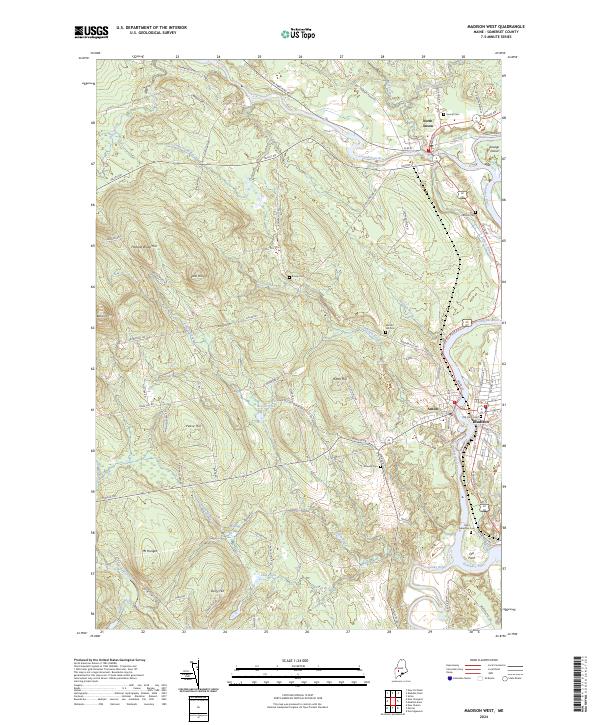
2024 Madison West
Somerset County, ME
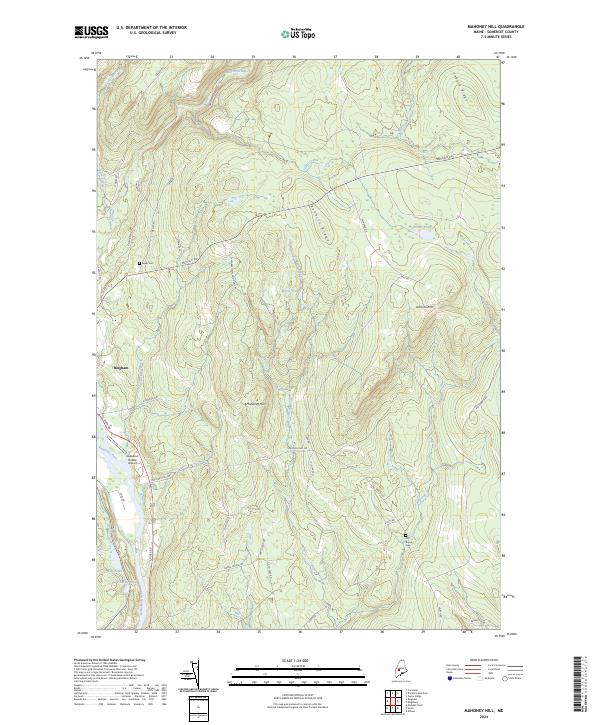
2024 Mahoney Hill
Somerset County, ME
2024 Mercer
Somerset County, ME
2024 Misery Knob
Somerset County, ME
2024 Moxie Pond
Somerset County, ME
2024 New Portland
Somerset County, ME
2024 Newport
Somerset County, ME
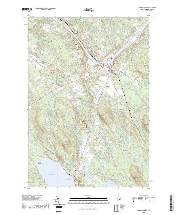
2024 Norridgewock
Somerset County, ME
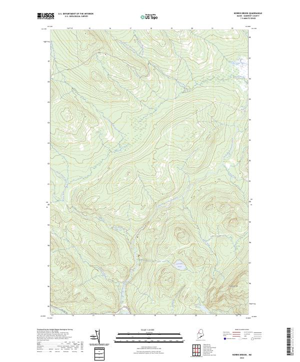
2024 Norris Brook
Somerset County, ME
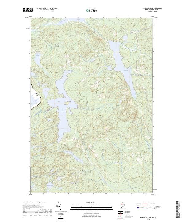
2024 Penobscot Lake
Somerset County, ME
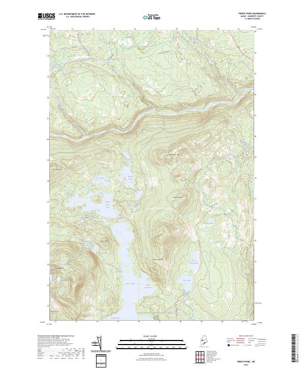
2024 Pierce Pond
Somerset County, ME
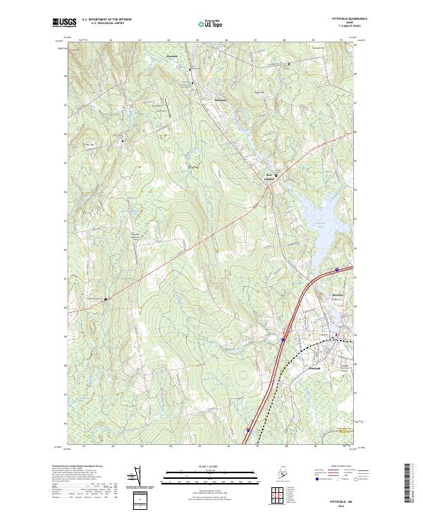
2024 Pittsfield
Somerset County, ME
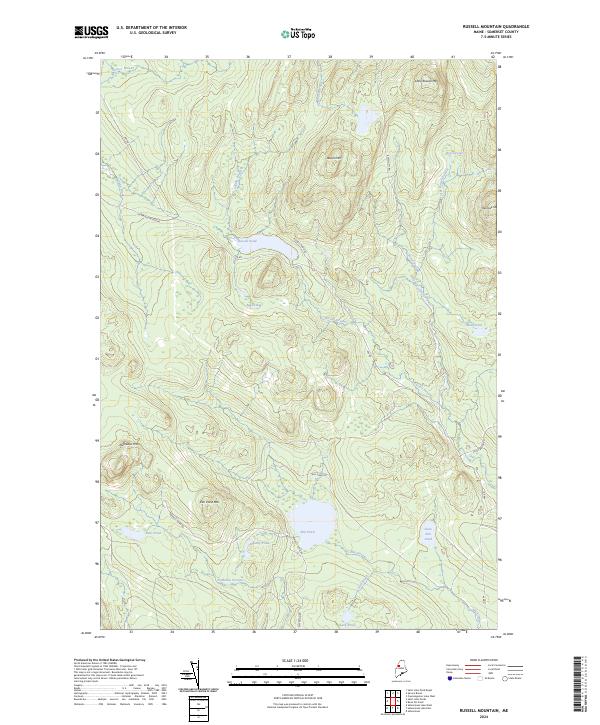
2024 Russell Mountain
Somerset County, ME
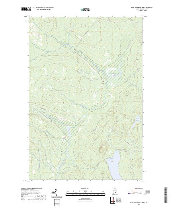
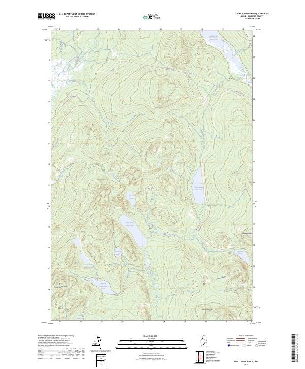
2024 Saint John Pond Depot
Somerset County, ME
2024 Saint John Ponds
Somerset County, ME
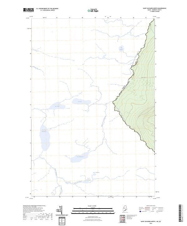
2024 Saint Zacharie North
Somerset County, ME
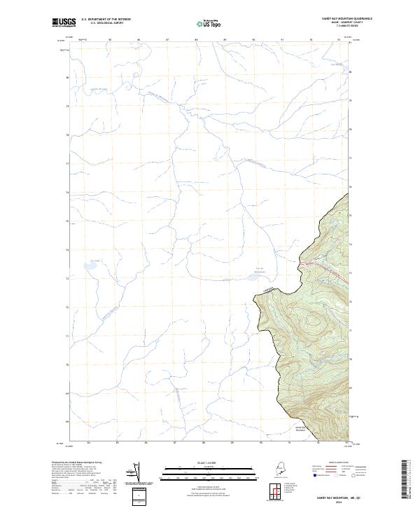
2024 Sandy Bay Mountain
Somerset County, ME
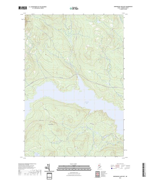
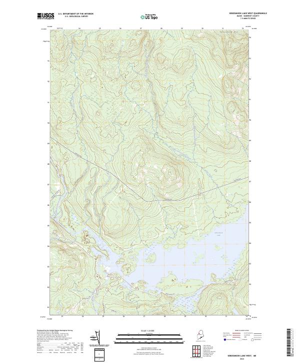
2024 Seboomook Lake East
Somerset County, ME
2024 Seboomook Lake West
Somerset County, ME
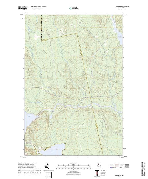
2024 Seboomook
Somerset County, ME
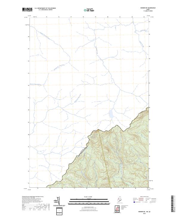
2024 Skinner NE
Somerset County, ME
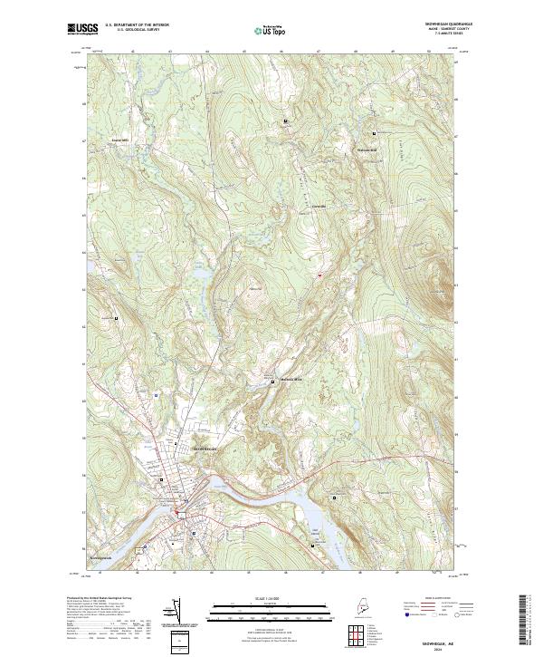
2024 Skowhegan
Somerset County, ME
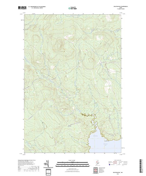
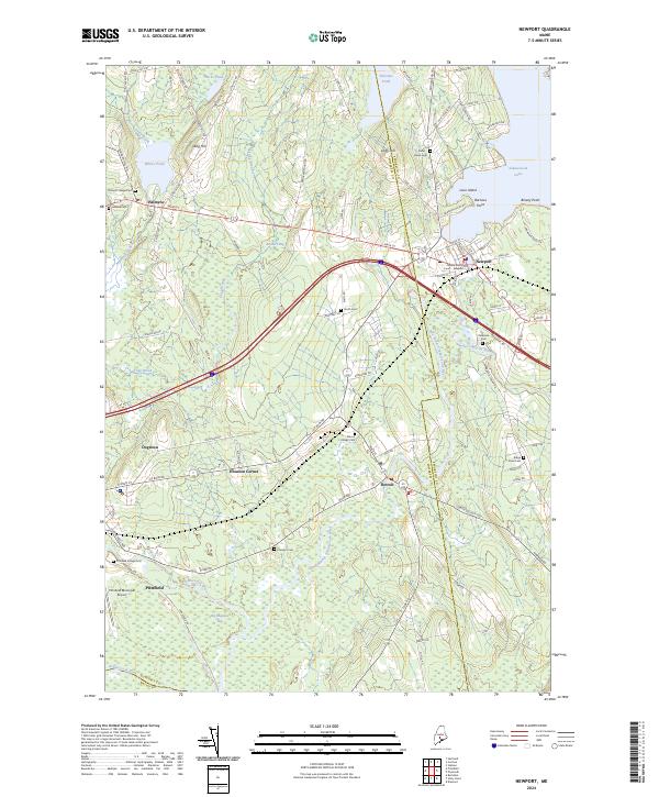
2024 Socatean Bay
Somerset County, ME
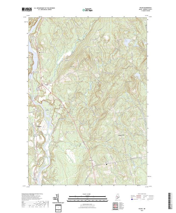
2024 Solon
Somerset County, ME
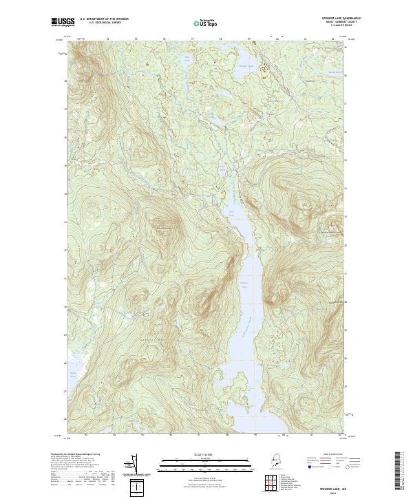
2024 Spencer Lake
Somerset County, ME
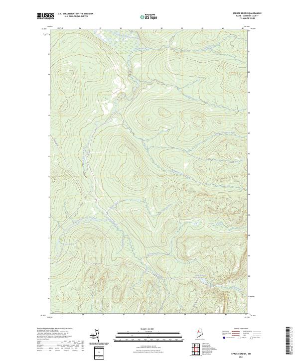
2024 Spruce Brook
Somerset County, ME
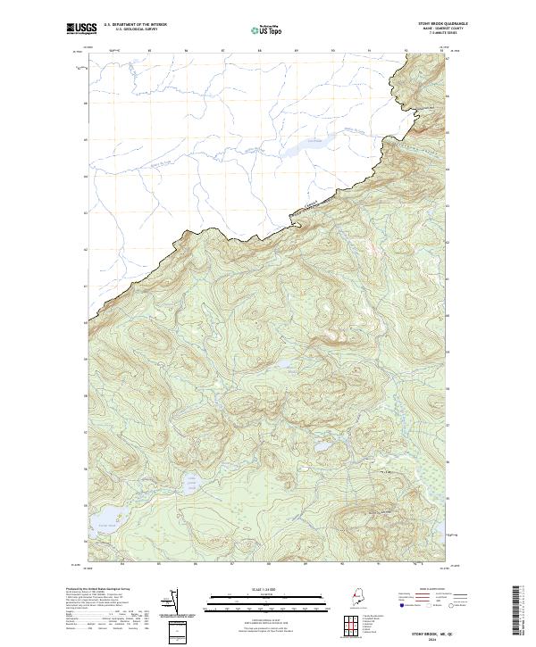
2024 Stony Brook
Somerset County, ME
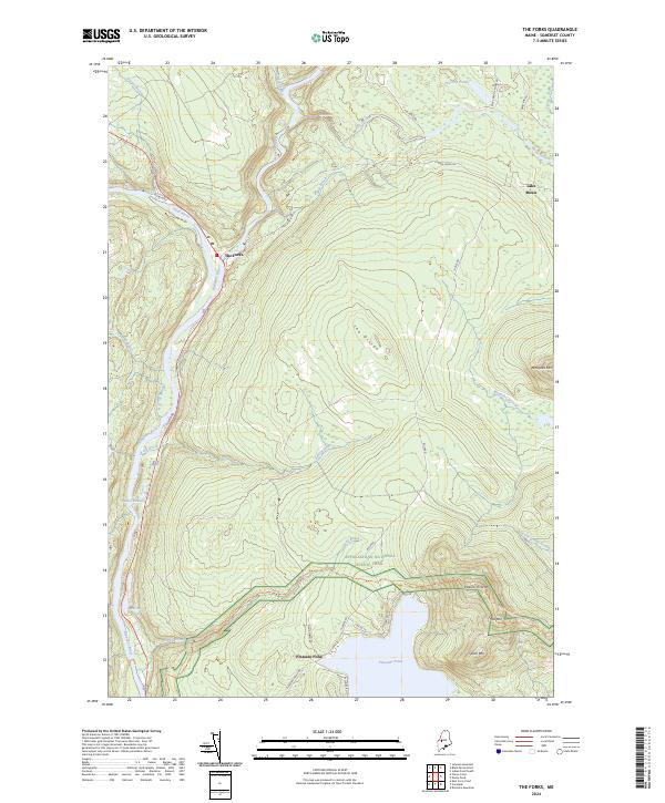
2024 The Forks
Somerset County, ME
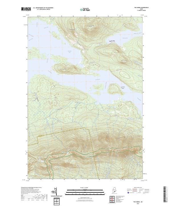
2024 The Horns
Somerset County, ME
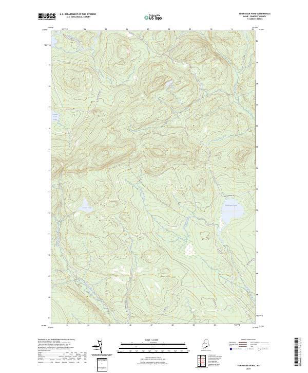
2024 Tomhegan Pond
Somerset County, ME
2024 Tumbledown Mountain
Somerset County, ME
2024 Turner Pond
Somerset County, ME
2024 Witham Mountain
Somerset County, ME