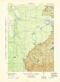
1944 Map of Sandy Bay
USGS Topo · Published 1944About this map
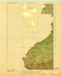
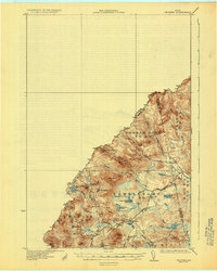
Customs Excise Land Immigration stations at Armstrong and St Theophile anchor this 1944 War Department survey of the international boundary between Maine and Quebec. This remote border region is defined by the headwaters of the Kennebec River and its major tributaries, including the Liniere River and Taschereau River. The map illustrates a landscape of high-elevation ponds and timber-focused settlements, featuring isolated outposts like South Branch Camp and upland agricultural clearings at Hilton Farm and Sandy Bay Farm. To the east, the topography rises sharply toward the summits of Bald Mountain and Sandy Bay Mountain. In an era of early forest management and fire prevention, the Fire Rangers Tower near Coburn Lake stood as a critical landmark for monitoring this vast watershed of the North Woods.
Find a feature on this map
57 named features on this map. Tap any name to fly to it.
Don’t see what you’re looking for? This feature index may not catch every label — zoom into the map to look around manually.
Map Details
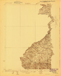
Editions of this 1944 Sandy Bay Map
This is the sole edition of this map. No revisions or reprints were ever made.
Other maps of this area

1922 · Long Pond
USGS Topo · 1:62,500

1923 · Attean
USGS Topo · 1:62,500

1924 · Long Pond
USGS Topo · 1:62,500

1925 · Attean
USGS Topo · 1:62,500
1927 · Sandy Bay
USGS Topo · 1:48,000
1928 · Skinner
USGS Topo · 1:48,000
1930 · Sandy Bay
USGS Topo · 1:62,500
1931 · Skinner
USGS Topo · 1:62,500

1944 · Long Pond
USGS Topo · 1:62,500

1949 · Jackman
USGS Topo · 1:250,000