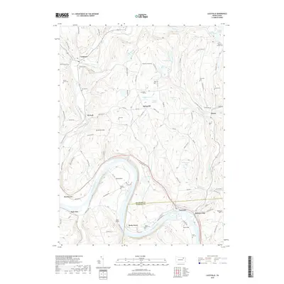
2019 Map of Laceyville
USGS Topo · Published 2019About this map
The Susquehanna River carves a dramatic oxbow at Quicks Bend as it flows through this section of Bradford and Wyoming Counties. The landscape is defined by the sharp transition from the river valley to high-elevation features like Browntown Mtn and Huff Hill. Settled pockets such as Laceyville and Skinners Eddy sit along the river's edge, while smaller rural communities like Spring Hill and Camptown occupy the surrounding ridges and creek valleys.
Find a feature on this map
104 named features on this map. Tap any name to fly to it.
Don’t see what you’re looking for? This feature index may not catch every label — zoom into the map to look around manually.
Map Details
Editions of this 2019 Laceyville Map
This is the sole edition of this map. No revisions or reprints were ever made.
Other maps of this area

1923 · Towanda
USGS Topo · 1:62,500

1926 · Towanda
USGS Topo · 1:62,500

1943 · Towanda
USGS Topo · 1:62,500

1943 · Monroeton
USGS Topo · 1:62,500

1943 · Le Raysville
USGS Topo · 1:62,500

1945 · Le Raysville
USGS Topo · 1:62,500

1945 · Meshoppen
USGS Topo · 1:62,500

1945 · Auburn Center
USGS Topo · 1:24,000

1945 · Jenningsville
USGS Topo · 1:24,000

1945 · Meshoppen
USGS Topo · 1:24,000
Featured Places
- Wilmot Township, PA
- Laceyville, PA
- Stevens Township, PA
- Spring Hill, Tuscarora Township
- Silvara, Tuscarora Township