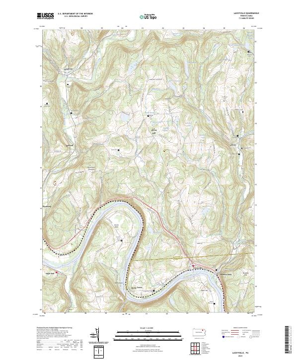
2023 Map of Laceyville
USGS Topo · Published 2023About this map
Laceyville and the surrounding river bends of the Susquehanna River anchor this topographic study along the Bradford and Wyoming county line. The landscape is defined by the heavy meanders of the river, which creates distinct geographic pockets such as Quicks Bend and the flatlands of North Flat and Dodd Island. Settlement patterns follow the high ground and creek valleys, with communities like Camptown, Merryall, and Silvara connected by a network of rural roads that climb toward heights such as Doolittle Hill and Browntown Mountain.
Find a feature on this map
114 named features on this map. Tap any name to fly to it.
Don’t see what you’re looking for? This feature index may not catch every label — zoom into the map to look around manually.
Map Details
Editions of this 2023 Laceyville Map
This is the sole edition of this map. No revisions or reprints were ever made.
Other maps of this area

1923 · Towanda
USGS Topo · 1:62,500

1926 · Towanda
USGS Topo · 1:62,500

1943 · Towanda
USGS Topo · 1:62,500

1943 · Monroeton
USGS Topo · 1:62,500

1943 · Le Raysville
USGS Topo · 1:62,500

1945 · Le Raysville
USGS Topo · 1:62,500

1945 · Meshoppen
USGS Topo · 1:62,500

1945 · Auburn Center
USGS Topo · 1:24,000

1945 · Jenningsville
USGS Topo · 1:24,000

1945 · Meshoppen
USGS Topo · 1:24,000