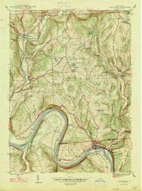
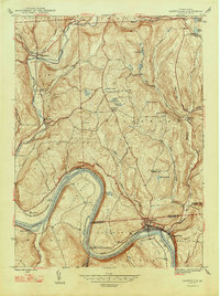
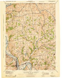
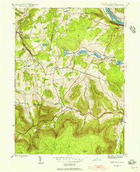
1947 Map of Laceyville
USGS Topo · Published 1947About this map
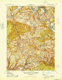
Laceyville and Skinners Eddy sit prominently along the northern bank of the Susquehanna River, where the Lehigh Valley Railroad and the Roosevelt Highway follow the water’s edge. This mid-century landscape is defined by the sharp meander of Quicks Bend, a dramatic horseshoe turn that frames Dodd Island and the elevated plateau of North Flat. The map documents a rural network of upland settlements and family-named landmarks, including Spring Hill and Silvara, connected by winding roads through the Tuscarora Mountain range.
Find a feature on this map
52 named features on this map. Tap any name to fly to it.
Don’t see what you’re looking for? This feature index may not catch every label — zoom into the map to look around manually.
Map Details
Editions of this 1947 Laceyville Map
2 editions found
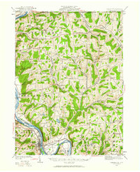
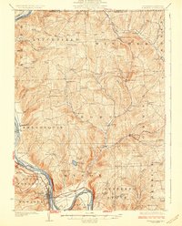
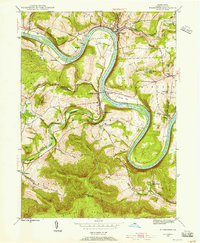
Other maps of this area
1923 · Towanda
USGS Topo · 1:62,500
1926 · Towanda
USGS Topo · 1:62,500
1943 · Towanda
USGS Topo · 1:62,500
1943 · Monroeton
USGS Topo · 1:62,500
1943 · Le Raysville
USGS Topo · 1:62,500

1945 · Le Raysville
USGS Topo · 1:62,500

1945 · Meshoppen
USGS Topo · 1:62,500
1945 · Auburn Center
USGS Topo · 1:24,000
1945 · Jenningsville
USGS Topo · 1:24,000
1945 · Meshoppen
USGS Topo · 1:24,000
Featured Places
- Wilmot Township, PA
- Laceyville, PA
- Herrick Township, PA
- Silvara, Tuscarora Township
- Browntown, Wyalusing Township