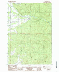
1984 Map of Lacomb
USGS Topo · Published 1985About this map
The community of Lacomb serves as the focal point for this Linn County landscape during the early 1980s. Defined by the fertile drainage of Crabtree Creek, the area shows a distinct transition from valley floor agriculture to the timbered foothills of the Cascades. Water management is a primary theme of the terrain, evidenced by the Irrigation Canal and the Roaring River State Fish Hatchery located near Roaring River Park.
Find a feature on this map
29 named features on this map. Tap any name to fly to it.
Don’t see what you’re looking for? This feature index may not catch every label — zoom into the map to look around manually.
Map Details
Editions of this 1984 Lacomb Map
This is the sole edition of this map. No revisions or reprints were ever made.
Other maps of this area

1921 · Brownsville
USGS Topo · 1:62,500

1921 · Lebanon
USGS Topo · 1:62,500

1922 · Lebanon
USGS Topo · 1:48,000

1924 · Lebanon
USGS Topo · 1:62,500

1940 · Lebanon
USGS Topo · 1:62,500

1944 · Lebanon
USGS Topo · 1:62,500

1950 · Brownsville
USGS Topo · 1:62,500

1951 · Sweet Home
USGS Topo · 1:62,500

1951 · Snow Peak
USGS Topo · 1:62,500

1952 · Brownsville
USGS Topo · 1:62,500