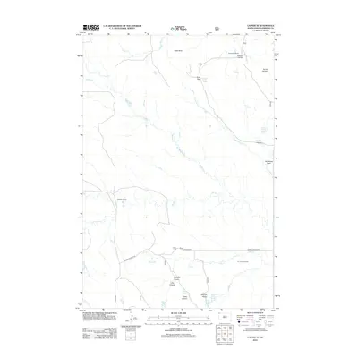
2012 Map of Ladner SE
USGS Topo · Published 2012About this map
The high plains of Harding County define this landscape, where the traditional ranching economy of northwestern South Dakota is evidenced by established properties like the M Clarkson Ranch and the W J Johnson Ranch. This 2012 USGS survey illustrates a region where water sources are vital to land use and navigation, specifically identifying Alice Spring and Craig Pass Spring as localized landmarks in an otherwise open terrain. These small-scale water features and private ranch holdings represent the essential anchor points for local history and genealogy in a sparsely populated corner of the state, preserving the specific family names associated with the land’s stewardship into the twenty-first century.
Find a feature on this map
4 named features on this map. Tap any name to fly to it.
Don’t see what you’re looking for? This feature index may not catch every label — zoom into the map to look around manually.
Map Details
Editions of this 2012 Ladner SE Map
This is the sole edition of this map. No revisions or reprints were ever made.
Other maps of this area

1935 · Reva
USGS Topo · 1:125,000

1935 · Buffalo
USGS Topo · 1:125,000

1954 · Lemmon
USGS Topo · 1:250,000

1957 · Lemmon
USGS Topo · 1:250,000

1968 · Eagles Nest Butte
USGS Topo · 1:24,000

1968 · Ludlow
USGS Topo · 1:24,000

1969 · Ladner NE
USGS Topo · 1:24,000

1969 · Table Mountain
USGS Topo · 1:24,000

1969 · Ladner
USGS Topo · 1:24,000

1969 · Ladner SE
USGS Topo · 1:24,000