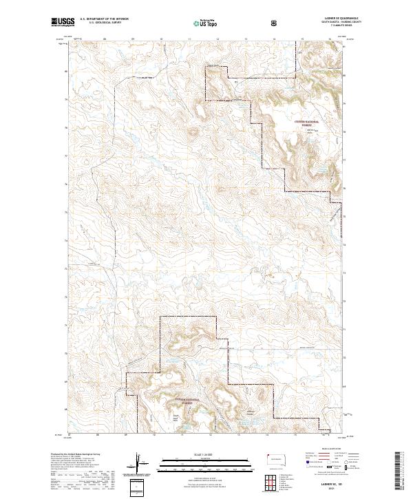
2021 Map of Ladner SE
USGS Topo · Published 2021About this map
Custer National Forest dominates this landscape in northwestern South Dakota, where the distinctive landforms of the North Cave Hills and South Cave Hills rise above the surrounding plains. The topography is defined by a network of drainage draws and deep incisions such as Devils Canyon, Icebox Canyon, and Timber Canyon. Water sources are critical landmarks in this arid environment, evidenced by numerous named points like Alice Spring, Travers Spring, and the uniquely titled Johnny Pocket Spring Number One.
Find a feature on this map
38 named features on this map. Tap any name to fly to it.
Don’t see what you’re looking for? This feature index may not catch every label — zoom into the map to look around manually.
Map Details
Editions of this 2021 Ladner SE Map
This is the sole edition of this map. No revisions or reprints were ever made.
Other maps of this area

1935 · Reva
USGS Topo · 1:125,000

1935 · Buffalo
USGS Topo · 1:125,000

1954 · Lemmon
USGS Topo · 1:250,000

1957 · Lemmon
USGS Topo · 1:250,000

1968 · Eagles Nest Butte
USGS Topo · 1:24,000

1968 · Ludlow
USGS Topo · 1:24,000

1969 · Ladner NE
USGS Topo · 1:24,000

1969 · Table Mountain
USGS Topo · 1:24,000

1969 · Ladner
USGS Topo · 1:24,000

1969 · Ladner SE
USGS Topo · 1:24,000