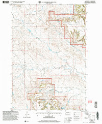
2005 Map of Ladner SE
USGS Topo · Published 2007About this map
Custer National Forest lands dominate this Harding County landscape, where the plateaus of Table Mountain and the Cave Hills rise above the surrounding plains. The map illustrates a ranching and resource-based economy, detailing scattered private holdings such as the J Clarkson Ranch and the W Johnson Ranch. These settlements are sustained by a network of vital water sources, including the North Clarkson Well, Alice Spring, and Dry Creek Reservoir.
Find a feature on this map
49 named features on this map. Tap any name to fly to it.
Don’t see what you’re looking for? This feature index may not catch every label — zoom into the map to look around manually.
Map Details
Editions of this 2005 Ladner SE Map
This is the sole edition of this map. No revisions or reprints were ever made.
Other maps of this area

1935 · Reva
USGS Topo · 1:125,000

1935 · Buffalo
USGS Topo · 1:125,000

1954 · Lemmon
USGS Topo · 1:250,000

1957 · Lemmon
USGS Topo · 1:250,000

1968 · Eagles Nest Butte
USGS Topo · 1:24,000

1968 · Ludlow
USGS Topo · 1:24,000

1969 · Ladner NE
USGS Topo · 1:24,000

1969 · Table Mountain
USGS Topo · 1:24,000

1969 · Ladner
USGS Topo · 1:24,000

1969 · Ladner SE
USGS Topo · 1:24,000