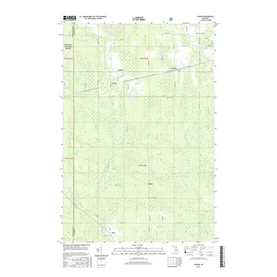
2017 Map of Ladoga
USGS Topo · Published 2017About this map
The eastern edges of the Hiawatha National Forest define this Upper Peninsula landscape, where the headwaters of several significant river systems converge. Small rural settlements including Sundell, Rumely, and Ladoga are linked by a grid of county roads and the Little Lake-Chatham Snowmobile Trail, which follows an established corridor across the northern half of the sheet. The terrain is characterized by a dense network of watercourses, with the Laughing Whitefish River flowing north while the West Branch Whitefish River and its tributaries like Dexter Cr and Scott Cr drain toward the south.
Find a feature on this map
39 named features on this map. Tap any name to fly to it.
Don’t see what you’re looking for? This feature index may not catch every label — zoom into the map to look around manually.
Map Details
Editions of this 2017 Ladoga Map
This is the sole edition of this map. No revisions or reprints were ever made.
Other maps of this area

1932 · Skandia SW
USGS Topo · 1:31,680

1932 · Rock NE
USGS Topo · 1:31,680

1932 · Skandia SE
USGS Topo · 1:31,680

1932 · Skandia NE
USGS Topo · 1:31,680

1932 · Rock NW
USGS Topo · 1:31,680

1950 · Skandia NW
USGS Topo · 1:31,680

1958 · Trenary
USGS Topo · 1:62,500

1958 · Au Train
USGS Topo · 1:62,500

1958 · Skandia
USGS Topo · 1:62,500
1958 · Rock
USGS Topo · 1:62,500