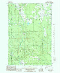
1985 Map of Ladoga
USGS Topo · Published 1985About this map
Sundell, Rumely, and Ladoga anchor this 1980s portrait of the Upper Peninsula’s wooded interior. The landscape is defined by the dense tracts of the Escanaba River State Forest and the Upper Peninsula Experimental Forest, where the terrain is carved by the Whitefish River and its numerous tributaries like Slapneck Creek and Dexter Creek.
Find a feature on this map
23 named features on this map. Tap any name to fly to it.
Don’t see what you’re looking for? This feature index may not catch every label — zoom into the map to look around manually.
Map Details
Editions of this 1985 Ladoga Map
This is the sole edition of this map. No revisions or reprints were ever made.
Other maps of this area

1932 · Skandia SW
USGS Topo · 1:31,680

1932 · Rock NE
USGS Topo · 1:31,680

1932 · Skandia SE
USGS Topo · 1:31,680

1932 · Skandia NE
USGS Topo · 1:31,680

1932 · Rock NW
USGS Topo · 1:31,680

1950 · Skandia NW
USGS Topo · 1:31,680

1958 · Trenary
USGS Topo · 1:62,500

1958 · Au Train
USGS Topo · 1:62,500

1958 · Skandia
USGS Topo · 1:62,500
1958 · Rock
USGS Topo · 1:62,500