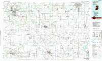
1984 Map of Lafayette
USGS Topo · Published 1985About this map
Lafayette and West Lafayette dominate the western portion of this mid-1980s landscape, anchored by the sprawling Purdue University campus and its associated Purdue University Airport. The region's transport network is defined by the Wabash River and the convergence of major rail lines, including the Norfolk and Western RR and the Seaboard System RR. To the east, Kokomo serves as a secondary industrial hub, while central towns like Frankfort and Lebanon illustrate the traditional county-seat model of the Indiana heartland.
Find a feature on this map
277 named features on this map. Tap any name to fly to it.
Don’t see what you’re looking for? This feature index may not catch every label — zoom into the map to look around manually.
Map Details
Editions of this 1984 Lafayette Map
2 editions found
Other maps of this area

1941 · Lafayette
USGS Topo · 1:24,000

1942 · Otterbein
USGS Topo · 1:24,000

1942 · Lafayette
USGS Topo · 1:24,000

1949 · Alamo
USGS Topo · 1:24,000

1950 · Lafayette
USGS Topo · 1:24,000

1951 · Otterbein
USGS Topo · 1:24,000

1952 · Fishers
USGS Topo · 1:24,000

1952 · Carmel
USGS Topo · 1:24,000

1952 · Mc Cordsville
USGS Topo · 1:24,000

1953 · Westfield
USGS Topo · 1:24,000