1984 Map of Lafayette
USGS Topo · Published 1994About this map
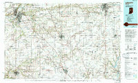
Purdue University and the surrounding campus of West Lafayette anchor the northwest corner of this 1980s regional landscape, where the Wabash River cuts through a dense network of county seats and agricultural centers. This survey captures the mid-century expansion of Lafayette, Frankfort, Lebanon, and Kokomo, showing the transition from traditional rail corridors like the Norfolk and Western RR to the modern interstate system of I-65. The map provides a detailed view of the civil geography of central Indiana, including the Tippecanoe County Courthouse and its counterparts in Clinton Co, Boone Co, and Tipton Co.
Find a feature on this map
168 named features on this map. Tap any name to fly to it.
Don’t see what you’re looking for? This feature index may not catch every label — zoom into the map to look around manually.
Map Details
Editions of this 1984 Lafayette Map
2 editions found

Historical Maps of Carmel Through Time
4 maps found