
1953 Map of Westfield
USGS Topo · Published 1954About this map
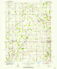
Westfield serves as the primary hub in this mid-century portrait of Hamilton County, situated at the intersection of the Central Indiana and the Chicago Indianapolis and Louisville railroads. The landscape is defined by its agricultural character and a network of rural community centers like Eagletown, Hortonville, and Jolietville. Educational and spiritual life are anchored by landmarks such as Washington High Sch and the Little Eagle Creek Ch, while numerous burial grounds including Union Grove Cem and Summit Lawn Cem offer significant touchpoints for genealogical research.
Find a feature on this map
26 named features on this map. Tap any name to fly to it.
Don’t see what you’re looking for? This feature index may not catch every label — zoom into the map to look around manually.
Map Details
Editions of this 1953 Westfield Map
2 editions found
Other maps of this area

1952 · Fishers
USGS Topo · 1:24,000

1952 · Carmel
USGS Topo · 1:24,000

1953 · Rosston
USGS Topo · 1:24,000

1953 · Zionsville
USGS Topo · 1:24,000

1953 · Noblesville
USGS Topo · 1:24,000

1953 · Danville
USGS Topo · 1:250,000

1953 · Indianapolis
USGS Topo · 1:250,000

1955 · Danville
USGS Topo · 1:250,000

1956 · Danville
USGS Topo · 1:250,000

1956 · Indianapolis
USGS Topo · 1:250,000