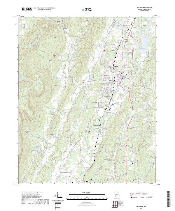
2024 Map of LaFayette
USGS Topo · Published 2024About this map
Pigeon Mountain dominates the western landscape of this Walker County region, characterized by deep natural depressions like Cornfield Sink and the steep descent of Waterfall Branch. In the valley below, the seat of LaFayette serves as the central hub, anchored by the Walker County Courthouse and surrounded by established neighborhoods like Linwood. The map reveals a legacy of local industry and agriculture, from the Estelle Mines in the northwest to the Blaylock Mill along Duck Creek.
Find a feature on this map
180 named features on this map. Tap any name to fly to it.
Don’t see what you’re looking for? This feature index may not catch every label — zoom into the map to look around manually.
Map Details
Editions of this 2024 LaFayette Map
This is the sole edition of this map. No revisions or reprints were ever made.
Other maps of this area

1886 · Ringgold
USGS Topo · 1:125,000

1892 · Ringgold
USGS Topo · 1:125,000

1935 · Catlett
USGS Topo · 1:24,000

1935 · Durham
USGS Topo · 1:24,000

1935 · Nickajack Gap
USGS Topo · 1:24,000

1936 · Kensington
USGS Topo · 1:24,000

1936 · Estelle
USGS Topo · 1:24,000

1936 · Dougherty Gap
USGS Topo · 1:24,000
1936 · Cedar Grove
USGS Topo · 1:24,000

1946 · Kensington
USGS Topo · 1:24,000