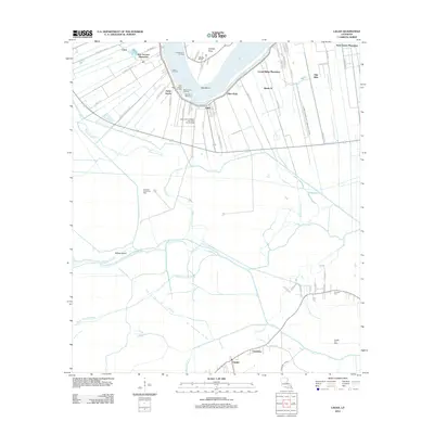
2012 Map of Lagan
USGS Topo · Published 2012About this map
The Mississippi River shapes the geography of St. James Parish, where river-oriented agriculture and modern industry occupy the same fertile strip of land. This detailed survey documents the enduring presence of several named riverside tracts, including Oak Alley, Bon Secours Plantation, and Laurel Ridge Plantation, which line the river's northern bend. These lands, situated near College Point and the Manresa Retreat, contrast with the extractive industrial infrastructure of the Saint James-College Point Gas and Oil Field. Further inland, the terrain transitions into a complex drainage network of bayous and canals. Communities like Lagan and Chackbay are connected by a web of local routes, while the Saint-James-Canal and Bayou-Citamon drain the low-lying reaches toward Willow Island. The map also identifies local landmarks such as Trosclair Cem and the Rich Bend Revetment, which protects the river's sharp curve.
Find a feature on this map
71 named features on this map. Tap any name to fly to it.
Don’t see what you’re looking for? This feature index may not catch every label — zoom into the map to look around manually.
Map Details
Editions of this 2012 Lagan Map
This is the sole edition of this map. No revisions or reprints were ever made.
Other maps of this area

1892 · Lac Des Allemands
USGS Topo · 1:62,500

1892 · Mount Airy
USGS Topo · 1:62,500

1892 · Donaldsonville
USGS Topo · 1:62,500

1892 · Thibodaux
USGS Topo · 1:62,500

1927 · Thibodaux NW
USGS Topo · 1:31,680

1932 · Lac Des Allemands NW
USGS Topo · 1:31,680

1932 · Lac Des Allemands SW
USGS Topo · 1:31,680

1932 · Thibodaux NE
USGS Topo · 1:31,680

1932 · Thibodaux SE
USGS Topo · 1:31,680

1932 · Thibodaux SW
USGS Topo · 1:31,680