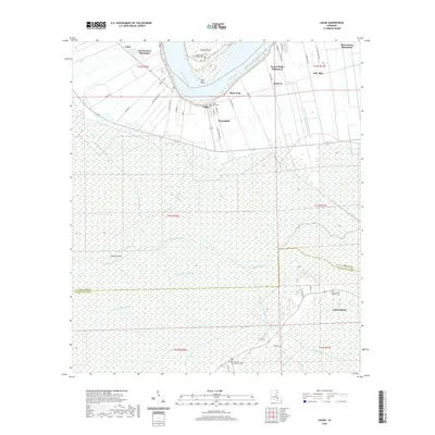
2020 Map of Lagan
USGS Topo · Published 2020About this map
The Mississippi River winds through the heart of St. James Parish, anchoring a landscape defined by the historic riverfront patterns of French colonial-era settlement. Here, the long-lot ribbon farms are punctuated by significant sites including Oak Alley, Bon Secours Plantation, and Saint James Plantation. The civic center of College Point is marked by the Saint James Parish Courthouse, while the surrounding communities of Lagan, Moonshine, and Rich Bend occupy the higher ground near the river's bend before the terrain descends into the expansive wetlands to the south.
Find a feature on this map
60 named features on this map. Tap any name to fly to it.
Don’t see what you’re looking for? This feature index may not catch every label — zoom into the map to look around manually.
Map Details
Editions of this 2020 Lagan Map
This is the sole edition of this map. No revisions or reprints were ever made.
Other maps of this area

1892 · Lac Des Allemands
USGS Topo · 1:62,500

1892 · Mount Airy
USGS Topo · 1:62,500

1892 · Donaldsonville
USGS Topo · 1:62,500

1892 · Thibodaux
USGS Topo · 1:62,500

1927 · Thibodaux NW
USGS Topo · 1:31,680

1932 · Lac Des Allemands NW
USGS Topo · 1:31,680

1932 · Lac Des Allemands SW
USGS Topo · 1:31,680

1932 · Thibodaux NE
USGS Topo · 1:31,680

1932 · Thibodaux SE
USGS Topo · 1:31,680

1932 · Thibodaux SW
USGS Topo · 1:31,680