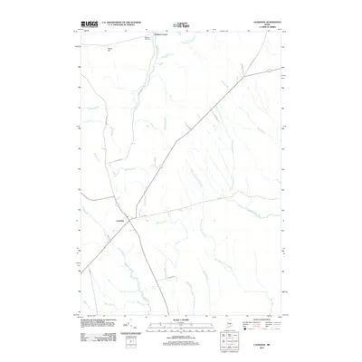
2011 Map of Lagrange
USGS Topo · Published 2011About this map
Lagrange and Medford Center anchor this Penobscot County landscape, illustrating a classic Maine pattern of small villages interspersed with an extensive network of waterways. The terrain is defined by the convergence of several significant drainage systems, most notably Cold Stream, Birch Stream, and the wandering course of Dead Stream. The presence of Paddy Hill provides a distinct topographic landmark in an area otherwise dominated by low-lying wetlands and riparian corridors. This 2011 survey documents the rural road network, including the evocative Brimstone Rd and Town Rd, which connect these small settlements. Genealogists and local historians can locate the Medford Cemetery situated near the northern border, while those studying the natural history of the region can trace the intricate paths of Hemlock Stream and the East Branch Birch Stream.
Find a feature on this map
25 named features on this map. Tap any name to fly to it.
Don’t see what you’re looking for? This feature index may not catch every label — zoom into the map to look around manually.
Map Details
Editions of this 2011 Lagrange Map
This is the sole edition of this map. No revisions or reprints were ever made.
Other maps of this area

1917 · Passadumkeag
USGS Topo · 1:62,500

1933 · Boyd Lake
USGS Topo · 1:62,500

1942 · Lincoln
USGS Topo · 1:62,500

1947 · Schoodic
USGS Topo · 1:62,500

1949 · Schoodic
USGS Topo · 1:62,500

1951 · Boyd Lake
USGS Topo · 1:50,000

1954 · Millinocket
USGS Topo · 1:250,000

1955 · Boyd Lake
USGS Topo · 1:62,500

1957 · Lincoln
USGS Topo · 1:62,500

1958 · Millinocket
USGS Topo · 1:250,000