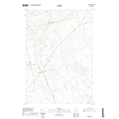
2021 Map of Lagrange
USGS Topo · Published 2021About this map
Lagrange serves as the primary settlement hub in this part of Penobscot County, where the local road network converges near the Hill Crest Cem. The landscape is defined by an intricate system of waterways, including the winding Dead Stream and Hemlock Stream, which drain a complex of wetlands. To the north, the terrain rises toward Paddy Hill, while the Piscataquis and Penobscot county line cuts across the northern woods near Medford Cem. The transition from the more developed area around Mill St to the dense stream networks of Birch Stream and Bear Brook illustrates the traditional Maine interior, where small-town centers give way quickly to managed timberlands and riparian corridors. This survey provides a clear view of the rural infrastructure, from old logging routes like Board Eddy Rd to established thoroughfares like Howland Rd.
Find a feature on this map
31 named features on this map. Tap any name to fly to it.
Don’t see what you’re looking for? This feature index may not catch every label — zoom into the map to look around manually.
Map Details
Editions of this 2021 Lagrange Map
This is the sole edition of this map. No revisions or reprints were ever made.
Other maps of this area

1917 · Passadumkeag
USGS Topo · 1:62,500

1933 · Boyd Lake
USGS Topo · 1:62,500

1942 · Lincoln
USGS Topo · 1:62,500

1947 · Schoodic
USGS Topo · 1:62,500

1949 · Schoodic
USGS Topo · 1:62,500

1951 · Boyd Lake
USGS Topo · 1:50,000

1954 · Millinocket
USGS Topo · 1:250,000

1955 · Boyd Lake
USGS Topo · 1:62,500

1957 · Lincoln
USGS Topo · 1:62,500

1958 · Millinocket
USGS Topo · 1:250,000