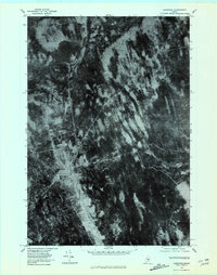
1978 Map of Lagrange
USGS Topo · Published 1981About this map
Lagrange and Medford Center appear as distinct clearings in the heavily forested interior of Penobscot County in the late 1970s. This orthophotograph, derived from aerial imagery, emphasizes the dense vegetation and drainage patterns typical of the Maine woods. Waterways such as Hemlock, Birch, and Dead cut through the terrain, while the East Branch Birch Stream winds through the southeastern portion of the quadrangle. The imagery highlights the contrast between the concentrated settlements and the expansive timberlands, showing the grid-like road structures around Lagrange alongside the natural meandering paths of Stream. For the researcher, the map captures a specific moment in the land-use history of these rural communities before modern developments changed the visible forest canopy.
Find a feature on this map
7 named features on this map. Tap any name to fly to it.
Don’t see what you’re looking for? This feature index may not catch every label — zoom into the map to look around manually.
Map Details
Editions of this 1978 Lagrange Map
This is the sole edition of this map. No revisions or reprints were ever made.
Other maps of this area

1917 · Passadumkeag
USGS Topo · 1:62,500

1933 · Boyd Lake
USGS Topo · 1:62,500

1942 · Lincoln
USGS Topo · 1:62,500

1947 · Schoodic
USGS Topo · 1:62,500

1949 · Schoodic
USGS Topo · 1:62,500

1951 · Boyd Lake
USGS Topo · 1:50,000

1954 · Millinocket
USGS Topo · 1:250,000

1955 · Boyd Lake
USGS Topo · 1:62,500

1957 · Lincoln
USGS Topo · 1:62,500

1958 · Millinocket
USGS Topo · 1:250,000