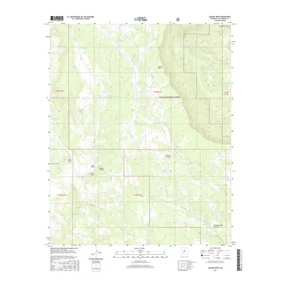
2017 Map of Laguna Ortiz
USGS Topo · Published 2017About this map
Laguna Ortiz sits at the center of this high-altitude landscape in San Miguel County, where ranching infrastructure and natural drainage patterns define the territory. The map details a complex system of water management essential for high-desert land use, featuring named catchments like Madrid Tank, Palmer Tank, and Hidden Tank. These features, combined with the presence of the Tierra de Dios Airport in the southwest, suggest a modern era of land management where aerial access and water security are paramount.
Find a feature on this map
31 named features on this map. Tap any name to fly to it.
Don’t see what you’re looking for? This feature index may not catch every label — zoom into the map to look around manually.
Map Details
Editions of this 2017 Laguna Ortiz Map
This is the sole edition of this map. No revisions or reprints were ever made.
Other maps of this area

1890 · Bernal
USGS Topo · 1:125,000

1891 · Bernal
USGS Topo · 1:125,000

1894 · Bernal
USGS Topo · 1:125,000

1894 · Lamy
USGS Topo · 1:125,000

1954 · Santa Fe
USGS Topo · 1:250,000

1958 · Santa Fe
USGS Topo · 1:250,000

1960 · Villanueva
USGS Topo · 1:62,500

1963 · Aurora
USGS Topo · 1:24,000
1966 · Mesa El Toro
USGS Topo · 1:24,000
1966 · Laguna Ortiz
USGS Topo · 1:24,000