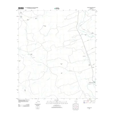
2012 Map of Laguna
USGS Topo · Published 2012About this map
The W Nueces River carves through the landscape of Uvalde County, creating a topography defined by steep bluffs and distinct peaks. This 2012 survey captures the settlement of Laguna and the surrounding ranching country, where landmarks like Housetop Mtn and Fence Mtn rise above the drainage basins of French Cr and Live Oak Cr. The map preserves the location of the Yancy Cem and historical river points such as Nineteen Mile Crossing and Edwards Waterhole, which represent critical water access in an arid region. The confluence of the west and main branches of the Nueces River is a primary geographical feature, anchored by local elevations including Whitecotton Peaks and the prominent Chimney Bluff in the northwest.
Find a feature on this map
30 named features on this map. Tap any name to fly to it.
Don’t see what you’re looking for? This feature index may not catch every label — zoom into the map to look around manually.
Map Details
Editions of this 2012 Laguna Map
This is the sole edition of this map. No revisions or reprints were ever made.
Other maps of this area

1893 · Nueces
USGS Topo · 1:125,000

1896 · Nueces
USGS Topo · 1:125,000

1896 · Brackett
USGS Topo · 1:125,000

1897 · Brackett
USGS Topo · 1:125,000

1898 · Uvalde
USGS Topo · 1:125,000

1899 · Uvalde
USGS Topo · 1:125,000

1938 · Turkey Mountain
USGS Topo · 1:48,000

1943 · Turkey Mountain
USGS Topo · 1:62,500

1944 · Barksdale
USGS Topo · 1:62,500

1954 · San Antonio
USGS Topo · 1:250,000