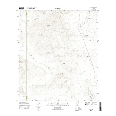
2016 Map of Laguna
USGS Topo · Published 2016About this map
The W Nueces River and Nueces River converge in this territory along the Kinney and Uvalde county line. The landscape is defined by distinct topographical formations such as Whitecotton Peaks, Housetop Mtn, and Double Mtn, illustrating the transition from river valleys to high bluff overlooks like Chimney Bluff. Local navigation is anchored by Ranch Rd 334 and the El Cerrito Airport near the settlement of Laguna. For those tracing family histories or land use, the presence of the Yancy Cem and named water sources like Edwards Waterhole and Bell Sow Bend provides specific points of interest. The area’s geography is further detailed by numerous hollows, including Negro Hollow and Long John Hollow, which segment the limestone-rich Edwards Plateau terrain.
Find a feature on this map
38 named features on this map. Tap any name to fly to it.
Don’t see what you’re looking for? This feature index may not catch every label — zoom into the map to look around manually.
Map Details
Editions of this 2016 Laguna Map
This is the sole edition of this map. No revisions or reprints were ever made.
Other maps of this area

1893 · Nueces
USGS Topo · 1:125,000

1896 · Nueces
USGS Topo · 1:125,000

1896 · Brackett
USGS Topo · 1:125,000

1897 · Brackett
USGS Topo · 1:125,000

1898 · Uvalde
USGS Topo · 1:125,000

1899 · Uvalde
USGS Topo · 1:125,000

1938 · Turkey Mountain
USGS Topo · 1:48,000

1943 · Turkey Mountain
USGS Topo · 1:62,500

1944 · Barksdale
USGS Topo · 1:62,500

1954 · San Antonio
USGS Topo · 1:250,000