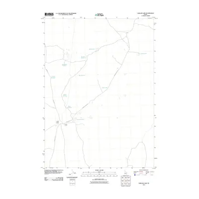
2010 Map of Laidlaw Lake
USGS Topo · Published 2010About this map
Laidlaw Corrals serves as a lonely landmark in this high desert basin of Minidoka County, an area defined by its reliance on water management for livestock and ranching. The landscape is dotted with small catchments and reservoirs, many bearing evocative names like Blackbird Reservoir, Bluebird Reservoir, and Wally Reservoir. These features, along with Steamboat Lake and Basco Lake, reveal a persistent effort to capture moisture in an arid environment where ranching operations are supported by a network of unimproved roads like Kimama to Carey Rd. The presence of the Laidlaw Corrals Airport adjacent to the corrals underscores the immense distances involved in managing this portion of Idaho, where aviation provides a vital link for remote agricultural outposts. Most water bodies here, such as Brokie Lake and Laidlaw Lake, appear as ephemeral or shallow features, illustrating the seasonal cycles of the Snake River Plain.
Find a feature on this map
17 named features on this map. Tap any name to fly to it.
Don’t see what you’re looking for? This feature index may not catch every label — zoom into the map to look around manually.
Map Details
Editions of this 2010 Laidlaw Lake Map
This is the sole edition of this map. No revisions or reprints were ever made.
Other maps of this area

1954 · Pocatello
USGS Topo · 1:250,000

1955 · Idaho Falls
USGS Topo · 1:250,000

1958 · Idaho Falls
USGS Topo · 1:250,000

1958 · Pocatello
USGS Topo · 1:250,000

1972 · Shale Butte
USGS Topo · 1:24,000

1972 · Community Lake
USGS Topo · 1:24,000

1972 · Laidlaw Lake
USGS Topo · 1:24,000

1972 · Bear Den Butte
USGS Topo · 1:24,000

1972 · Laidlaw Butte
USGS Topo · 1:24,000

1972 · Bottleneck Lake
USGS Topo · 1:24,000