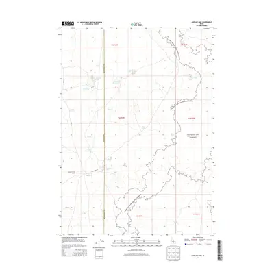
2013 Map of Laidlaw Lake
USGS Topo · Published 2013About this map
Craters of the Moon National Preserve dominates the eastern and southern reaches of this landscape, marking the transition from the high desert plains of the Snake River Valley into volcanic terrain. The area is defined by a complex network of seasonal water sources and managed catchments, essential for supporting the agricultural and ranching operations at Laidlaw Corrals. These water features range from natural pools like Laidlaw Lake and Mac Rae Lake to man-made structures including Bluebird Reservoir and Bugler Reservoir. The presence of the Laidlaw Corrals Airport and the boundary between Lincoln and Minidoka counties underscores the remote but organized nature of the land. Roadways like Laidlaw Park Rd and Shale Butte Rd provide the primary access through this dry, high-elevation environment.
Find a feature on this map
25 named features on this map. Tap any name to fly to it.
Don’t see what you’re looking for? This feature index may not catch every label — zoom into the map to look around manually.
Map Details
Editions of this 2013 Laidlaw Lake Map
This is the sole edition of this map. No revisions or reprints were ever made.
Other maps of this area

1954 · Pocatello
USGS Topo · 1:250,000

1955 · Idaho Falls
USGS Topo · 1:250,000

1958 · Idaho Falls
USGS Topo · 1:250,000

1958 · Pocatello
USGS Topo · 1:250,000

1972 · Shale Butte
USGS Topo · 1:24,000

1972 · Community Lake
USGS Topo · 1:24,000

1972 · Laidlaw Lake
USGS Topo · 1:24,000

1972 · Bear Den Butte
USGS Topo · 1:24,000

1972 · Laidlaw Butte
USGS Topo · 1:24,000

1972 · Bottleneck Lake
USGS Topo · 1:24,000