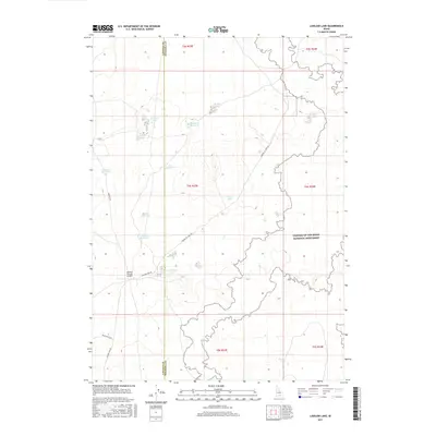
2017 Map of Laidlaw Lake
USGS Topo · Published 2017About this map
Craters of the Moon National Monument dominates the eastern expanse of this Idaho landscape, where the jagged limits of the lava fields meet the high desert plains. This 2017 survey reveals an environment defined by seasonal water management and isolated infrastructure along the Lincoln Co and Minidoka Co line. A network of small reservoirs and ephemeral lakes, including Bluebird Reservoir, MacRae Lake, and Steamboat Lake, suggests a landscape managed for livestock or local water needs despite its arid character.
Find a feature on this map
19 named features on this map. Tap any name to fly to it.
Don’t see what you’re looking for? This feature index may not catch every label — zoom into the map to look around manually.
Map Details
Editions of this 2017 Laidlaw Lake Map
This is the sole edition of this map. No revisions or reprints were ever made.
Other maps of this area

1954 · Pocatello
USGS Topo · 1:250,000

1955 · Idaho Falls
USGS Topo · 1:250,000

1958 · Idaho Falls
USGS Topo · 1:250,000

1958 · Pocatello
USGS Topo · 1:250,000

1972 · Shale Butte
USGS Topo · 1:24,000

1972 · Community Lake
USGS Topo · 1:24,000

1972 · Laidlaw Lake
USGS Topo · 1:24,000

1972 · Bear Den Butte
USGS Topo · 1:24,000

1972 · Laidlaw Butte
USGS Topo · 1:24,000

1972 · Bottleneck Lake
USGS Topo · 1:24,000