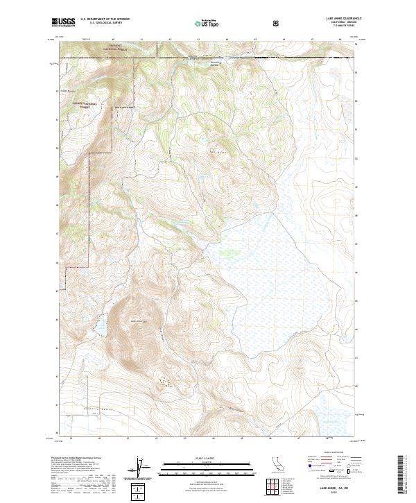
2022 Map of Lake Annie
USGS Topo · Published 2022About this map
Lake Annie and its namesake Lake Annie Mtn dominate this high-altitude landscape along the border of the Modoc National Forest and Fremont National Forest. The geography here is defined by a complex network of seasonal drainages and managed water storage, including Ninemile Reservoir and Schadler Reservoir, which feed into Cow Head Slough. These water features highlight the importance of high-desert water management for the surrounding grazing lands and meadows such as Indian Meadow and Twelvemile Meadow. The terrain descends from the Two Buttes into the northern reaches of the Surprise Valley, where deep incisions like Long Canyon and Briggs Canyon carve through the volcanic landscape toward Big Mud Lake.
Find a feature on this map
31 named features on this map. Tap any name to fly to it.
Don’t see what you’re looking for? This feature index may not catch every label — zoom into the map to look around manually.
Map Details
Editions of this 2022 Lake Annie Map
This is the sole edition of this map. No revisions or reprints were ever made.
Other maps of this area

1886 · Alturas
USGS Topo · 1:250,000

1889 · Long Valley
USGS Topo · 1:250,000

1892 · Alturas
USGS Topo · 1:250,000

1954 · Vya
USGS Topo · 1:250,000

1954 · Alturas
USGS Topo · 1:250,000

1955 · Klamath Falls
USGS Topo · 1:250,000

1955 · Adel
USGS Topo · 1:250,000

1957 · Adel
USGS Topo · 1:250,000

1958 · Alturas
USGS Topo · 1:250,000

1958 · Klamath Falls
USGS Topo · 1:250,000