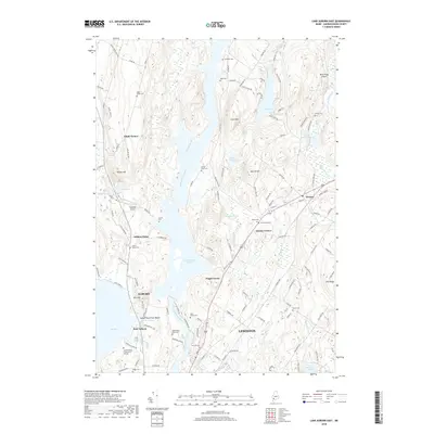
2018 Map of Lake Auburn East
USGS Topo · Published 2018About this map
Gulf Island Pond and the winding Androscoggin River anchor this late-2010s survey of the river valley between Auburn and Lewiston. The landscape is a mix of urban edge and rural upland, where numerous family cemeteries like Sylvester Cem and Mower Cem are preserved among the hills. The map highlights the area's continued reliance on local infrastructure, from the Twitchell Airport and Rocky Ridge Airport to the educational grounds of Central Maine Community College. Small settlements such as Greene Corner and Foggs Corner dot the intersections of historic transit routes, while water bodies like Lake Auburn and Allen Pond define the recreational and natural boundaries of these Maine communities.
Find a feature on this map
129 named features on this map. Tap any name to fly to it.
Don’t see what you’re looking for? This feature index may not catch every label — zoom into the map to look around manually.
Map Details
Editions of this 2018 Lake Auburn East Map
This is the sole edition of this map. No revisions or reprints were ever made.
Other maps of this area

1908 · Poland
USGS Topo · 1:62,500

1908 · Lewiston
USGS Topo · 1:62,500

1910 · Livermore
USGS Topo · 1:62,500

1911 · Buckfield
USGS Topo · 1:62,500

1912 · Livermore
USGS Topo · 1:62,500

1913 · Buckfield
USGS Topo · 1:62,500

1940 · Poland
USGS Topo · 1:62,500

1941 · Livermore
USGS Topo · 1:62,500

1942 · Lewiston
USGS Topo · 1:62,500

1942 · Buckfield
USGS Topo · 1:62,500