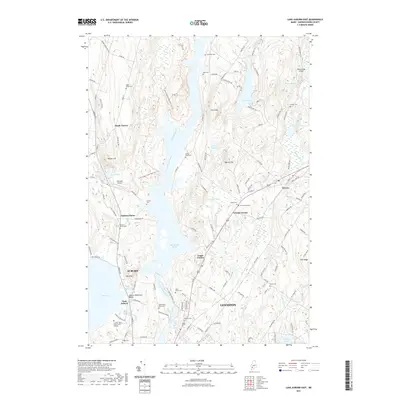
2021 Map of Lake Auburn East
USGS Topo · Published 2021About this map
The Androscoggin River carves a central path through this Maine landscape, defining the boundaries and industrial character of Lewiston and Auburn. The river expands into Gulf Island Pond at the heart of the map, a significant impoundment that sits between the rising terrain of Merrill Hill and Poplar Hill. This area is characterized by a dense network of local cemeteries, such as Saint Peters Cem and Auburn Plains Cem, which serve as vital markers for genealogical research in the region.
Find a feature on this map
137 named features on this map. Tap any name to fly to it.
Don’t see what you’re looking for? This feature index may not catch every label — zoom into the map to look around manually.
Map Details
Editions of this 2021 Lake Auburn East Map
This is the sole edition of this map. No revisions or reprints were ever made.
Other maps of this area

1908 · Poland
USGS Topo · 1:62,500

1908 · Lewiston
USGS Topo · 1:62,500

1910 · Livermore
USGS Topo · 1:62,500

1911 · Buckfield
USGS Topo · 1:62,500

1912 · Livermore
USGS Topo · 1:62,500

1913 · Buckfield
USGS Topo · 1:62,500

1940 · Poland
USGS Topo · 1:62,500

1941 · Livermore
USGS Topo · 1:62,500

1942 · Lewiston
USGS Topo · 1:62,500

1942 · Buckfield
USGS Topo · 1:62,500