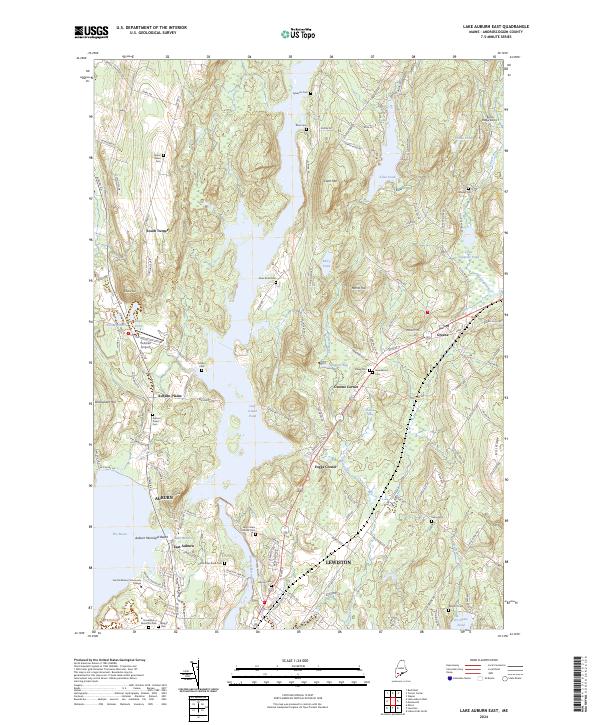
2024 Map of Lake Auburn East
USGS Topo · Published 2024About this map
The Androscoggin River flows centrally through this region, forming the expansive Gulf Island Pond and separating the urban centers of Auburn and Lewiston to the south. In the north, the landscape transitions into a network of smaller water bodies such as Allen Pond and Berry Pond, interspersed with family-named landmarks like Clark Mtn and Merrill Hill. The map reveals a high density of historical burial grounds, including the Saint Peters Catholic Cem and Gracelawn Memorial Park, which provide significant data points for genealogists tracking local lineages in South Turner or Auburn Plains.
Find a feature on this map
136 named features on this map. Tap any name to fly to it.
Don’t see what you’re looking for? This feature index may not catch every label — zoom into the map to look around manually.
Map Details
Editions of this 2024 Lake Auburn East Map
This is the sole edition of this map. No revisions or reprints were ever made.
Other maps of this area

1908 · Poland
USGS Topo · 1:62,500

1908 · Lewiston
USGS Topo · 1:62,500

1910 · Livermore
USGS Topo · 1:62,500

1911 · Buckfield
USGS Topo · 1:62,500

1912 · Livermore
USGS Topo · 1:62,500

1913 · Buckfield
USGS Topo · 1:62,500

1940 · Poland
USGS Topo · 1:62,500

1941 · Livermore
USGS Topo · 1:62,500

1942 · Lewiston
USGS Topo · 1:62,500

1942 · Buckfield
USGS Topo · 1:62,500