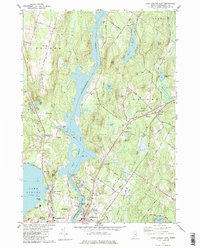
1979 Map of Lake Auburn East
USGS Topo · Published 1979About this map
The Androscoggin River carves through the heart of this landscape, its waters slowed by the Gulf Island Dam to form the expansive Gulf Island Pond. Along its banks and the surrounding hills, small settlements like Greene Corner and Auburn Plains mark the rural character of Androscoggin County in the late 1970s. The map illustrates a region in transition, where established towns like Greene and the northern outskirts of Lewiston and Auburn coexist with active agricultural and industrial features. Local history is deeply etched into the land through numerous small burial grounds, including the River Road Cem and the Herrick Cem, alongside more modern landmarks like Twitchell Airport and the State Fairground. The presence of the Maine Central Railroad and the concentration of gravel pits near the river suggest an economy historically tied to both extraction and efficient transport.
Find a feature on this map
81 named features on this map. Tap any name to fly to it.
Don’t see what you’re looking for? This feature index may not catch every label — zoom into the map to look around manually.
Map Details
Editions of this 1979 Lake Auburn East Map
This is the sole edition of this map. No revisions or reprints were ever made.
Other maps of this area

1908 · Poland
USGS Topo · 1:62,500

1908 · Lewiston
USGS Topo · 1:62,500

1910 · Livermore
USGS Topo · 1:62,500

1911 · Buckfield
USGS Topo · 1:62,500

1912 · Livermore
USGS Topo · 1:62,500

1913 · Buckfield
USGS Topo · 1:62,500

1940 · Poland
USGS Topo · 1:62,500

1941 · Livermore
USGS Topo · 1:62,500

1942 · Lewiston
USGS Topo · 1:62,500

1942 · Buckfield
USGS Topo · 1:62,500