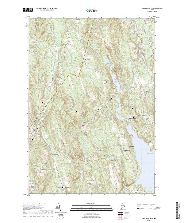
2024 Map of Lake Auburn West
USGS Topo · Published 2024About this map
East Hebron and North Auburn anchor a landscape defined by the hills and ridges of Androscoggin County. The region is densely populated with historical burial grounds, including the Scott Family Graveyard, Olde French Cem, and Bog Brook Cem, providing a significant record of early local families. To the east, the waters of The Basin and Little Wilson Pond are surrounded by prominent terrain like Dillingham Hill and Perkins Ridge.
Find a feature on this map
134 named features on this map. Tap any name to fly to it.
Don’t see what you’re looking for? This feature index may not catch every label — zoom into the map to look around manually.
Map Details
Editions of this 2024 Lake Auburn West Map
This is the sole edition of this map. No revisions or reprints were ever made.
Other maps of this area

1908 · Poland
USGS Topo · 1:62,500

1908 · Lewiston
USGS Topo · 1:62,500

1910 · Livermore
USGS Topo · 1:62,500

1911 · Buckfield
USGS Topo · 1:62,500

1912 · Livermore
USGS Topo · 1:62,500

1913 · Buckfield
USGS Topo · 1:62,500

1940 · Poland
USGS Topo · 1:62,500

1941 · Livermore
USGS Topo · 1:62,500

1942 · Lewiston
USGS Topo · 1:62,500

1942 · Buckfield
USGS Topo · 1:62,500