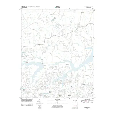
2010 Map of Lake Brandt
USGS Topo · Published 2010About this map
Lake Brandt and the surrounding residential expansions north of Greensboro define this era of suburban development. The landscape is characterized by numerous artificial impoundments and water management features, including the Greensboro Waterworks and the Lake Brandt Dam. These reservoirs, along with Richland Lake and smaller private water bodies like Foster Lake and Britt-Fishman Lake, have shaped the layout of modern neighborhoods such as Battle Forest, The Orchard, and White Oak Heights.
Find a feature on this map
81 named features on this map. Tap any name to fly to it.
Don’t see what you’re looking for? This feature index may not catch every label — zoom into the map to look around manually.
Map Details
Editions of this 2010 Lake Brandt Map
This is the sole edition of this map. No revisions or reprints were ever made.
Other maps of this area

1951 · Guilford
USGS Topo · 1:24,000

1951 · Lake Brandt
USGS Topo · 1:24,000

1951 · Browns Summit
USGS Topo · 1:24,000

1951 · Greensboro
USGS Topo · 1:24,000

1952 · Mc Leansville
USGS Topo · 1:24,000

1953 · Greensboro
USGS Topo · 1:250,000

1954 · Greensboro
USGS Topo · 1:250,000

1962 · Greensboro
USGS Topo · 1:250,000

1966 · Greensboro
USGS Topo · 1:250,000

1969 · Summerfield
USGS Topo · 1:24,000